Equestrian Trails and Campgrounds

Author: Kelly Hurd (Page 3 of 12)

Mineola Nature Preserve, Mineola TX

Sign Main


Website: Mineola Nature Preserve

Facebook Page: Mineola Nature Preserve Facebook Page

Location: East Texas just on the southern outskirts of Mineola, TX


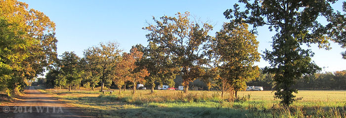
The Equestrian Campsite / Trailhead entrance.  This point of view is coming from US HWY 69, turning east (right) on Loop 564, then look for the Mineola Wastewater Treatment Plant sign.

The Equestrian Campsite / Trailhead entrance. This point of view is coming from US HWY 69, turning east (right) on Loop 564, then look for the Mineola Wastewater Treatment Plant sign.


Directions: From U.S. 69, turn east on Loop 564. To go to the Equestrian Trailhead/Campsite also known as The Derby, take your first right (this is not the main entrance to the park). Look for a sign that says Wastewater Treatment Plant. This road goes up a hill and you will see a small building where the fees are paid on the left and the pens and electric hook ups to the right of the road.


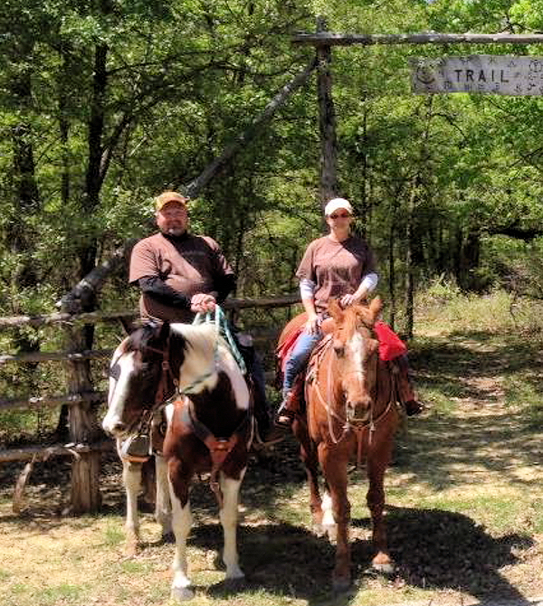
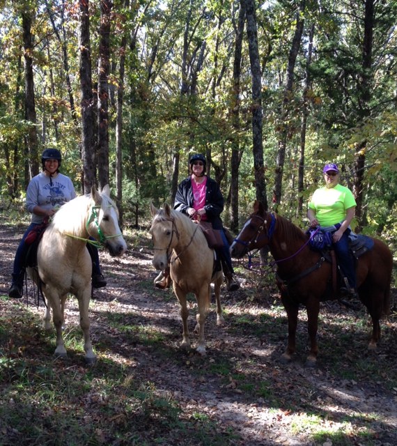
Kelly Hurd, Curtis George, and Patricia Leopold ready to enjoy a day at Mineola Nature Preserve.

Kelly Hurd, Curtis George, and Patricia Leopold ready to enjoy a day at Mineola Nature Preserve.


Reservations:

To reserve a campsite please call Lori at 903.569.6183

Contacts:

For information about the trails, trail condition, facilities, etc… call the trail boss, George “Buster” Green at 903.780.1942


Trail boss and managers, Buster and Jenny keep the trails running and in good condition.  They kindly gave Chris and Kelly Hurd and their dog LB a tour of the park via their mule.

Trail boss and managers, Buster and Ginny keep the trails running and in good condition. They kindly gave Chris and Kelly Hurd and their dog LB a tour of the park via their mule. Left to right; Jenny, Buster, Kelly, and LB.


Equestrian Camping: Allowed!

photo 2Fees: Use the door slot to the small building at the entrance of the Equestrian Campsite to deposit  your fees.  Fees are subject to change so please get confirmation on the most current fee requirements from the park.

$5.00 for day riders

$5.00 for primitive camping

$5.00 for use of a pen

$30.00 for a water/electric campsite (the $5.00 day use riding fee is included in this)

$75.00 for daily rental of the Derby Pavillion ($50.00 deposit required)


Equestrian electric/water campsites with pens.

Equestrian electric/water campsites with pens.


Facilities: 14 electric & water hook up sites with fire rings, picnic tables, and two side by side 12 x 12 metal panel pens per each site are provided at the Equestrian Trailhead/campsite.  There is no shade in the electric/water campsites. These sites are separated by wooden posts and ropes. The parking pads are gravel.  At this time none of the pens are covered, but the park is hoping to raise funds through ACTHA and TETRA rides to eventually get the pens covered.  A water trough and two horse stocks, handy for bathing your horse, are also provided.  The horse stocks were funded by TETRA. There is a large covered pavilion (The Derby Pavilion) with picnic tables, a bar, gas grill (bring your own propane tank), and a men’s and women’s bathroom which includes one toilet and shower each.  The Derby Pavilion can be used at any time free of charge, or for a fee it can be reserved for a special occasion or event.  The men’s & women’s restroom/shower can be used by day riders or campers.  On the side of the pavilion is a large and sturdy wheelchair ramp to be used for mounting. Mineola Nature Preserve is one of the very few places we’ve visited that has a wheelchair ramp for physically challenged riders. Bravo!


The Derby Pavilion.

The Derby Pavilion.


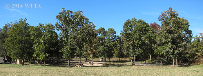
Between the primitive camping area and the electric/water hook up sites is a large open gravel open parking space.  The primitive side of this area has several trees and is more scenic.  There is a round pen in this area made of metal panels.  There are a few pens which are constructed differently than the pens in the LQ/RV campsites.  The  couple of pens in the primitive campsites are made of wooden posts, guard rails, and rope.

Pets/Dogs: Allowed, just keep them on a leash.

Cell Phone Service: Fair to good.

Hunting: The Mineola Nature Preserve trails close a few times a year for organized youth hunts. Outside of that hunting is not allowed.

Trail Users: Trails are shared by equestrians, hikers, Boy Scouts, bicycles, and of course wildlife.  No motorized vehicles are allowed on the trails, however, the trail boss does check and work on the trails via an ATV. Equestrians are instructed to stay off of the railroad bed path (gravel walkway).Tthey may cross over it, but not ride along on top of it.

Mileage: Approximately 24 miles of equestrian/multiuse trails.

Map: Available on the parks’ website: Mineola Nature Preserve Maps Link

Be sure to print out the map before leaving for your trip, as they may not be available at the park.


Map2

Mineola Nature Preserve trail map – Click to enlarge


East Map

West Map


Terrain: Mostly sandy with only a few rocky areas; most horses will not require shoes/boots. Most of the trails are flat with some hills on the northeast side of the park.

Water on Trail: Several creek crossings allow for multiple opportunities to water your horse while on the trail.


bridge 2

Patti and Dakota crossing Grisham’s bridge at Mineola Nature Preserve.


Description:

Consisting of 2,911 acres in Wood County and along the Sabine River, Mineola Nature Preserve (owned and managed by the City of Mineola, TX) has over 20 miles of riding trails and is a great place for overnight equine camping.  When arriving to the equestrian campsite at The Derby we were greeted by the park’s trail boss, Buster and his wife Ginny Green. They kindly introduced us to the preserve by taking us for a ride on their mule.  When they asked if we wanted to ride on their mule my equine mind was thinking the four legged kind of course, but it was the four wheeled kind.  Thanks to the Greens I was able to see some parts of the park where equestrians can’t go, like along the Railbed walking trail and the really muddy lower south trails that we opted not to ride on for this trip.  Buster and Ginny shared a wealth of history and tales about the area, unfortunately I could not hear every word due to the loud purr of their mule’s engine.  Remnants of the I&GN (International and Great Northern) and T&P (Texas and Pacific) railways which emerged in the 1870s are still evident today. Remaining metal and wood railway support beams spurred on my curiosity of what it must have been like to travel these railways in the late 19th century. The preserve has also installed educational signs detailing information about the land’s history along the trails. The Greens were excited to show off the beauty of the Preserve and highlighted how important the equestrian users are to the park. One of my highlights on this mule ride was seeing a resident alligator just before sunset, not a sight this south Texas gal often sees.  Buster also took us up to Greer Hill which we later rode to on horseback as well.  This  area along with a few other spots in the Preserve have rest stops with a porta-potty, picnic table, and hitching post, which came in handy.


SCK running

Kyle, Scott, and Curtis enjoying a fun gallop on the road to Greer Hill at Mineola Nature Preserve. A false pear tree is blooming in the background.


Our early April trip to the Preserve was perfect timing to see the dogwoods and pear trees just beginning to bud. We met up with one of our favorite trail riding groups, NETASA, to explore the park in the company of friends who especially enjoy riding Spanish Mustangs / Indian Horses. Due to lots of rain this year, the lower south trails were just too muddy to be safe.  We still ran into some pretty boggy areas but the north trails were usable.   The Preserve trails wind in and out of East Texas forests, over bridges, through creeks, beside beautiful ponds, and into wide open fields.  Part of the Appaloosa Trail travels beside a fenced pasture containing a few buffalo and longhorns. If you ride to the main park pavilion (not the Derby Pavilion) then you have a great view of the luscious grass filled senderos and beautiful ponds.  I was curious as to what is a sendero and why were they created.  So I just had to Google it.


Ahead on the left and directly behind the pond are two senderos.

Ahead on the left and directly behind the pond are two senderos.


Here is the best definition of sendero I found by Arturo Longoria, “A sendero is a cleared pathway (always a straight line) through the woods or brushlands of south Texas and Mexico, often several miles long. Not until bulldozers were used for oil and gas exploration did senderos become common place.  Most senderos are from twenty to fifty feet wide, though some are as much as fifty yards across.  Hunters often set up blinds along senderos to harvest deer as the animals cross.”  Then Arturo goes on to note a quote from A Vaquero of the Brush Country by John D. Young and Frank Dobie, who said a sendero is “a clearing that will allow people to behold some of the secrets that the brush has hidden.”  Oh how I love Google, now I know what a sendero is!  Even if you don’t ride, be sure to visit the park just to look down on the beautiful ponds and senderos from the backside of the main pavilion.


Plenty of Bridge crossing can be found at the preserve.

Patti and Dakota crossing Big Foot Bridge.


There are several bridges along the trails which are sturdy for crossing on horseback. Trails in the thick forest provide lots of shade, a welcomed respite from the hot Texas sun.  Most of the trails are flat and sandy with some hills towards the northeast side of the park. Along the trails are great spots to stop and rest that have picnic tables and a port-a-potty. One of these spots is at the top of Greer Hill which is a lovely well-shaded area with picnic tables, hitching posts, and a portable restroom on the north side of the park.


NoMyth

Kyle Germany’s flashy Spanish Mustang, No Myth, waits patiently at the Greer Hill Hitching post.


The trails are shared by equestrians, hikers, bicyclists, and wildlife of course.  We did run into a pack of feral hogs on trail, which was interesting.  They sounded like gorillas. Our horses did not think highly of the situation but we managed well.   The only motorized vehicle allowed is Buster’s mule as he uses it along with his horses to check and maintain the trials. Equestrians can ride just about everywhere except on the gravel Railbed Walking trail. You can ride next to this trail when it is dry enough and you can cross it if you need to.


Judy, Kyle, and Scott enjoying the Mineola trails.

Judy, Kyle, and Scott enjoying the Mineola trails.


The facilities are really nice and the pavilion at the Derby (equestrian campsite) is perfect for gatherings.  We enjoyed several tasty meals and a few games of Chicken Foot under the covered pavilion.  The large men’s and women’s bathroom/showers are amenites not often found when camping.  The only down side for me is the lack of trees and shade for the electric/water campsites.  However, there are plans to put shelters over the pens to give the horses some shade.  I also was not crazy about the water treatment plant being just down the road from the campsite.  Currently there is some construction going on near the camping area as well, but this is temporary.  These are minor issues when looking at the whole picture.  All and all, the Mineola Nature Preserve is a great place to enjoy and camp at with your horses and friends.  I am thankful to have such a resource available for trail-riding equestrians.


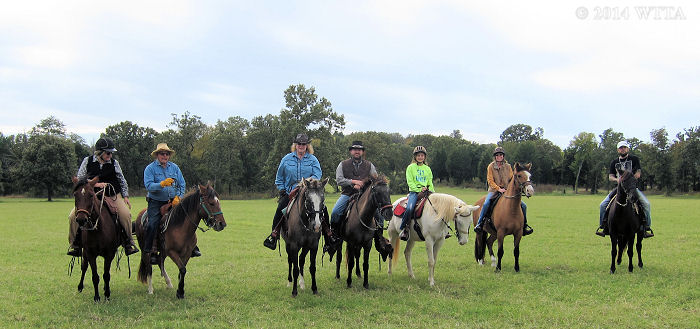
N.E.T.S.A American Indian Horsing riding club getting a group photo at Mineola Nature Preserve.

N.E.T.A.S.A American Indian Horsing riding club getting a group photo at Mineola Nature Preserve.


Mineola Nature Preserve visitor, Dorene Scanlon-Gable wrote, “We’ve been to Mineola Nature Preserve many times in the past two years. We belong to N.E.T.A.S.A., a horseback riding club and find it to be a great place to bring our horses for a 3 or 4 hour ride, even on Texas summer days. After rains it can be less fun because of the mud! They have many trails which are very well marked and are well maintained. The facilities include corrals, clean rest rooms with showers, hoses for washing the sweat off the horses, water spigots for drinking water, a handicap mounting area, picnic tables and all for $5/horse! We heartily recommend the Preserve for riding.”

Additional Pictures:

Facilities:

camp rv sites

Equestrian electric/water with pens camping sites.


Electric / water camping sites.

Electric / water camping sites.


Overhead view of electric / water campsite.

Overhead view of electric / water campsite.


camp hookups

30 and 50 AMP electric hookups


Two pens for each electric/water hookup site.

Two pens for each electric/water hookup site.


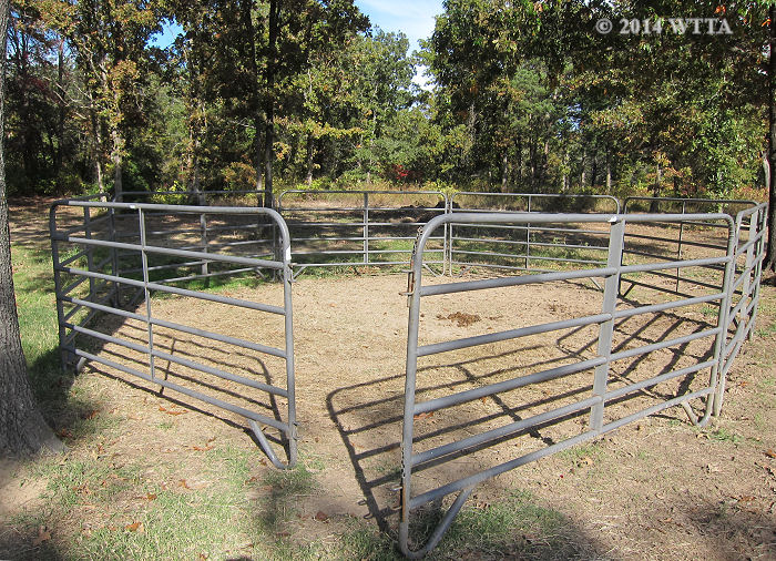
The round pen is across the gravel parking lot in the primitive camping area.

The round pen is across the gravel parking lot in the primitive camping area.


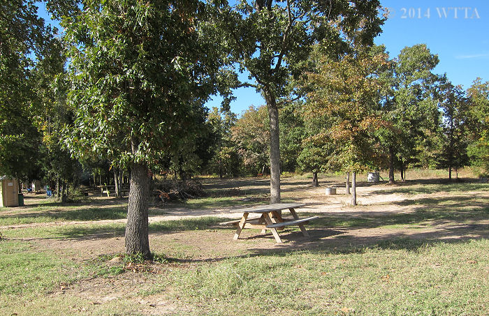
Primitive camping sites, some are on grass and are on gravel.  Only a few have pens.

Primitive camping sites, some are on grass and a few are on gravel.


Primitive Campsites

Primitive Campsites


There are a few pens in the primitive camping area, however, they are constructed differently from what looks like guard rails, rope and wood posts.  I'm not sure I'd use one of these pens.

There are a few pens in the primitive camping area; they are constructed differently from what looks like guard rails, rope and wood posts.


Wash rack / stocks provided by TETRA.

Wash rack / stocks provided by TETRA.


Campsite water trough.

Campsite water trough.


Derby Pavilion handicap ramp.

Derby Pavilion wheelchair ramp.


Under the Derby Pavilion.

Under the Derby Pavilion.


The Derby Pavilion has a men's and women's restroom with showers.

The Derby Pavilion has a men’s and women’s restroom with showers.

Along the Trail:


pond

Mineola Nature Preserve – April 2015


Patti and Curtis on Appaloosa Trail.

Patti and Curtis on Appaloosa Trail.


Buffalo and longhorn seen from Appaloosa Trail.

Buffalo and longhorn seen from Appaloosa Trail.

Longhorn at Mineola Nature Preserve.

Longhorn at Mineola Nature Preserve.


Greer Hill road.

Greer Hill road.


On the Trail.

Trail Marker


On the road at Mineola Nature Preserve.

On the road at Mineola Nature Preserve.


Trail marker

Trail Markers


Totum Poll

Totem Poll


Old Railroad support beams.

Old Railroad support beams. The trails here are gravely.


Old metal railroad support beams at Mineola Nature Preserve.

Old metal railroad support beams at Mineola Nature Preserve.


Thanks to Buster and Ginny we got to see the resident alligator.

Thanks to Buster and Ginny we got to see the resident alligator.

Cooper Lake State Park, Sulphur Springs TX

Cooper Lake State Park, South Sulphur Unit – Sulphur Springs, TX

Contributor: Trail review and pictures provided by contributor Ann Sides. Thank you Ann!

Website: http://tpwd.texas.gov/state-parks/cooper-lake

Contacts: Reservations for camping: 512-389-8900. Ranger Station: 903-945-5256 (open 8-5 daily). Reservations can also be made on-line at http://texas.reserveworld.com/

Directions: Two separate units comprise Cooper Lake: South Sulphur Unit and Doctors Creek. The South Sulphur Unit is closer to Sulphur Springs, and has the equestrian campground, Buggy Whip Equestrian Area. The address is 1690 FM 3505, Sulphur Springs, TX 75482. Latitude: 33.28772   Longitude: -95.65792

Cooper Lake Ranger Station.

Cooper Lake Ranger Station.

From Greenville, take I30 East toward Sulphur Springs. Take the Hwy 19 exit (Exit 122) and cross over I30 and go north. This is also called Loop 301. You will loop around Sulphur Springs, and will go through several stop signs. When you come to the intersection of Loop 301 and Hwy 19, go to the left (north). At Birthright, turn left on FM 71 and go 4 miles, then turn right on FM 3505. You’ll see signs that say Cooper Lake when you’re back on Hwy 19. After you go past the Rangers’ station, take the first left. This is a long winding road that will take you to Buggy Whip Equestrian Camping Area. The last sign for Buggy Whip Equestrian Camping is on the left side of the road. If you miss it you can keep going straight and easily turn around. The camping area is laid out in a large loop, with camp sites all around the loop. There is day parking along the center of the loop. You can also access the South Sulphur Unit from Commerce but the road is more narrow and twisty.

Equestrian Camping: There are 15 concrete camp sites with water and electricity. Two of the sites are made for double trailers, which is really nice if you’re traveling with someone. The sites are spaced out with trees and bushes between the sites making them feel more private. Each site has a metal post picket system in the shape of an H with 20 ft cable across the top to tether horses. This camp doesn’t appear to be as busy as it was in past years, but reservations for camping are recommended.

Cooper Campsite

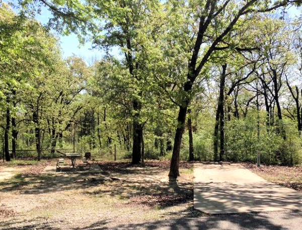
A typical camp site; very shady with nice concrete pads.

Fees: $5.00 for day use. $20 per night plus day use fee for equestrian campsites with water and electricity.

Coggins: You will be asked to present a current Coggins at the Ranger Station prior to entering the park. They will inspect your horse to insure the papers match the horse.

Facilities: The road in camp is asphalt and is in the shape of a long oval. It’s also very flat, which makes it a great place for kid’s to ride bikes. The equestrian camp has a very nice bath house with men’s and women’s facilities with multiple showers, sinks, flushing toilets, and is heated in cold weather. It is always clean and well cared for. There are picnic tables and fire rings at each campsite.   The park has many separate camp sites, some with shelters and others for camping or RVs. There are many hiking trails and nature talks are also offered at times. Check with the ranger station for non-horse related activities.
Facility Map Link to the South Sulphur Unit

Dogs: Welcome!

Cell Phone Service: ATT has good service.

Buggy Whip Trail Users: Equines only

Cooper Trailhead

Mileage: The Buggy Whip Equestrian only trail is 10.55 miles.

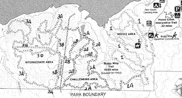
Trail Map: The current trail map you receive at the front gate doesn’t have trail numbers marked on it. I’ve written them in on the new map using info from a previous map.

Cooper Map

Link to Cooper Lake South Sulphur Unit Park Trail Map

Terrain: Sandy clay with some rocks. Most horses are fine without shoes. The soil erodes very badly so when there is rain the trails are closed. If in doubt, call the ranger station before you haul.

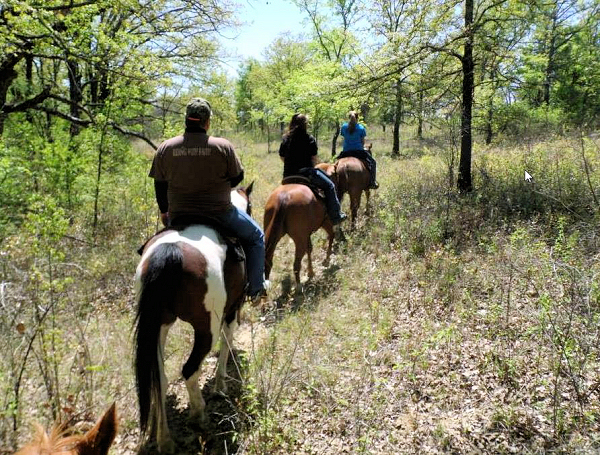
Description: The Buggy Whip Equestrian trail is primarily in hard wood forest with some ups and downs. There is access to the lake on one portion of the trail. Be prepared to see deer and possibly wild hogs. There is no hunting in the park and the deer certainly seem to know that!   The park has really worked hard in the recent years to alleviate erosion by rerouting trails and adding supports in the trails.

Buggy Whip Equestrian Trail: There are basically 3 areas of trails. On the new map the area closest to the camp is called “Novice area”. These are easy trails and are comprised of 3 large long loops. From these trails there is a single crossing over into the next area. This crossing is a low bridge in a creek, but it is good footing with mild slopes on either side. Some inexperienced horses/riders may have problems with this crossing. This creek crossing was very dangerous for many years with an open bridge and steep slopes. Hats off to the park for changing this crossing and making it very safe.

The 2nd area is called “Challenging” on the new map. After you cross the bridge the trail will fork and the trail to the right has some steep inclines. If you have small children or inexperienced riders, I’d definitely recommend avoiding this section of trail. On the map the trails that fork are BOTH called 2A so if you want mild riding go to the left. The pond near the north end of Trail 2A is very boggy.

The 3rd area is across a white rock road. The majority of these trails are relatively flat and wind through trees.

Please note, the numbering on the trails can be somewhat confusing. The far trail is called 3A on both the north, west and south loops. If you’re one of those folks who like to know where they are, it’s a good idea to orient yourself with the sun before you take off.

Cooper Trail two


Cooper Trail

FullSizeRender (3)Ann Sides

Ann Sides, WTTA’s newest contributor, lives near Greenville, TX with husband, J.Paul, who is head of security and composting, 5 horses, and 3 dogs. Ann works at L-3 in Greenville and hopes to retire in a couple of years. But until then she’ll keep riding and camping every weekend she gets the chance. She and J.Paul have one daughter, Lauren, son-in-law Clint, and one adorable grandchild, Ryan Moore, who live close by in Royse City. It doesn’t get any better than this!!!

Photo shot by Donna Taker. Ann and Scout, her long time, much loved, trail companion.

Ann has contributed posts on the following locations:
Trace Trails in Athens, TX, Caddo National Grasslands near Telephone, TX, and Cooper Lake State Park in Sulphur Springs, TX.

Heyne Ranch, Glen Flora TX

Photo provided by Lin Sutherland.

Photo provided by Lin Sutherland.

Contributed by Lin Sutherland

Mr. Peter Heyne, owner of Heyne Ranch.  Photo provided by Lin Sutherland.

Mr. Peter Heyne, owner of Heyne Ranch. Photo provided by Lin Sutherland.

Heyne Ranch Location: Southeast Texas, slightly south and west of Houston.

Website: None at this time.

FaceBook Link FB page Heyne Ranch Link

Contact/Owner: Peter Heyne #713/504-3141 Email: writer@peterheyne.com

Address: 10010 FM 960, Glen Flora, Texas 77443

Directions: Look for a Big sign on front of the drive. Please note, the ranch address is not exact on Google Maps. The best thing to do is Google Glen Flora. The ranch is one mile south on 960, just over the Colorado bridge, on the left. Call Peter Heyne if you have any questions or problems: 713-504-3141.

Hours:  By appointment only. This is a private ranch, you need to make arrangements before showing up.

Cell Phone Service: Good.

Dogs: Dogs are allowed if well behaved and under control.

Lin's puppies, having a blast at Heyne Ranch.  Photo provided by Lin Sutherland.

Lin’s puppies, having a blast at Heyne Ranch. Photo provided by Lin Sutherland.

Equestrian Camping: Allowed!

Fees: Fees are subject to change, please ask the owner, Mr. Heyne, for current rates.

Day Riders: $20 per person for day riding (when not camping but only riding for the day) or $15 for day riding that is 4 hours or less.

Camping Fee: $20 per night per rig. (there are no electric hook ups yet)

Pens: $15 per horse.

Farm House Rental: $125 a night.

Guest ranch house for rent when available.

Guest ranch house for rent when available. Photo provided by Lin Sutherland.

Facilities: 

Ranch House: The ranch house has electricity, running water, central heat/air. This home is located in a Beautiful setting. Big cottonwood and sycamore trees overlook the 1920’s farmhouse, surrounded by a large, trimmed yard.  An old barn sits nearby.  The house is a two bedroom one bath facility.  It can sleep five (two full sized beds and a fold out couch).  A new refrigerator and stove is provided.   Centrally heated and air-conditioned, the house is comfortable and pleasant, with old ranch photos and books. The front porch, complete with rocking chairs, is a perfect spot for wine and conversations.  Cost: $125 a night.  The ranch house is rented on a limited basis when Mr. Hayne is not using it.

Bathhouse: There is a nice newly built bathhouse with running water, showers, toilets, and heat/air.

Bathhouse with air & heat! Photo provided by Lin Sutherland.

Bathhouse with air & heat! Photo provided by Lin Sutherland.

Pens –  Good pipe pens (full of spring grass), two water troughs in the camping area.  A hose and faucet are available for washing up.   Owner requests you muck out your own area if needed.

Camping: I saw no trailer electrical hookups but understand Mr. Heyne is working on that.  For now it appears to be “dry camping,” but it’s under a large set of deep-shade trees near the pens. You are welcome to run your generator.

Heyne Ranch barn.

Heyne Ranch barn. Photo provided by Lin Sutherland.

Mileage: Approximately 10 miles of trail.

Map: Provided by the Ranch.

Trails/Terrain: This is a 400 acre ranch with 10 miles of trails.  The 10 mile estimate is word from the owner. It seems about right.   There are few gates to go through.  Existing gates have horseback friendly openers. The  trails were mowed when I was there. Shoes are not required. The soil is basically sandy.  It’s solid, soft and mostly grassy footing. There is cattle/longhorn on the property.

The River: Two river trails are gorgeous with winding trails through the trees. Big plus: Large sandy beach on the river.  Owner suggests not entering the river by horseback as certain spots seem to have quick sand.

Enjoying the Colorado River at Heyne Ranch.  Photo provided by Lin Sutherland.

Enjoying the Colorado River at Heyne Ranch. Photo provided by Lin Sutherland.

Coggins:  A current Coggins is required.

Pests: BUG SPRAY HIGHLY RECOMMENDED.  There can be sudden gnat invasions so DO NOT FORGET your bug spray both for you and your horse.  It’s southeast Texas and on a river.  A fly mask is also a good idea.

Ranch Lin

Lin Sutherland at Heyne Ranch, April 2015. Photo provided by Lin.


Description: HEYNE RANCH © 2015 Lin Sutherland

Heyne Ranch is an old private ranch in Southeast Texas that offers 10 miles of grassy, no-rock trails through scenic woods, farmland and rolling pastures. The land lies along the Colorado River and includes shaded parking, water troughs and pens.  Peter Heyne, the owner, has opened the ranch to trail riders and overnight campers.  He’s recently built a nice new bathroom/shower house that’s heated and air conditioned.  The old farmhouse on the place is available for rent on a limited basis. Check with the owner for availability.

We took our two gaited horses to Heyne Ranch and it was perfect for them. The trails at the ranch are maintained by frequent mowing.  We liked the trails that wind through the woods along the Colorado River and the open cantering trails through the fields where we could really move out.  I also loved cantering on the smooth, long dirt road through the cultivated corn and cotton fields. Our horses are barefoot and never had a problem since rocks and tough terrain is virtually nonexistent on the ranch.

At Heyne Ranch.  Photo provided by Lin Sutherland.

At Heyne Ranch. Photo provided by Lin Sutherland.

Nearby Towns: Close to two towns: the small community of Glen Flora with its Antique Emporium, and Wharton, which is loaded with trash and treasure stores, as well as a Wal-Mart and Buc-ees and a terrific Mexican food restaurant called Los Cucos Café

In Summary: I loved riding this ranch. I found I could really get up and go or just plod along and enjoy the scenery. For endurance riders, the trails do form a loop so you could do two loops with only two gates to open. There is one gas pipeline bridge you have to go under, but the owner has put in a go-around if your horse is wary of it. Our horses had no problem with it.

Caddo National Grasslands

This trail post is courtesy of WTTA contributor
Ann Sides – Thank you Ann!

logo

Websites:

Texas Parks and Wildlife Caddo National Grasslands website link

Caddo Trail Riders Association link

Caddo Trail Riders Association Facebook page link

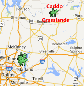
Location:  Caddo Grasslands is about an hour and a half northeast of Dallas. When you come to Caddo Grasslands, plan on getting away from it all and enjoying some of nature’s beautiful scenery and great horseback riding.

Just FYI, in case of emergency Paris, TX is the nearest large city with emergency facilities.

Latitude:  33.7372   Longitude 95.9738   If you are using Mapquest etc. type in Telephone, TX (closest town)

Contacts:

Ranger station at Caddo:  903-378-2103 (is NOT answered 24 hours)

Ranger headquarters of Caddo & LBJ Grasslands:  940-627-5475

Caddo Trail Riders Association: President Phil Haley 903-583-3902 and Mike Durbin 903-664-2618 CTRA@K5MJD.US


Caddo Grassland map

Directions:

Through Bonham:   (Ann’s favorite route)

Go out North Hwy 69 to Leonard.

Turn right at Hwy 78.  Stay on 78 through Bonham to FM 1396.

Turn right on FM 1396 and go 9.6 miles

Turn left on FM 2029 approx 3-4 miles.

Turn right on FM 409 and go approx 2 miles.  You’ll see a brown sign that says Bois d’Arc Trailhead.  Entrance is on the right side of the road, with a cattle guard crossing.

Note: 

Mapquest will show some little FM roads that skirt around Ladonia and one after Bonham, especially on the FM around Ladonia (twisty and narrow). It is a much better drive pulling horses to stay on the bigger roads.


Equestrian Camping: 

Overnight equestrian camping is allowed.

Fees: 

$2.00 for day riders or day visitors

$6.00 for overnight camping

*There is free day use area which has no water or bathroom

Coggins: 

Current Coggins is required but is not usually checked.  There is no ranger station at front gate.


Caddo 4 edit

Photo provided by Ann Sides.

Facilities: 

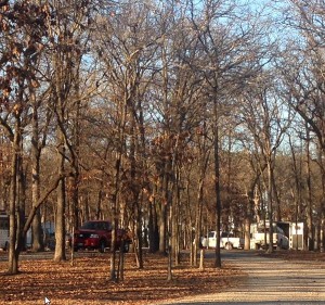
The road in the camp is gravel and all campsites are shaded. There are approximately 20 pull through sites and 10 pull in sites. Each campsite on the outer side of the loop has a large picnic table, and either a single pole to tie horses to or a steel highline with a cross piece. The single poles are being replaced with highlines. Other amenities at the campsite include a large covered pavilion with picnic tables, a composting pit toilet, a large water trough, a horse wash rack and a mounting block for handicap riders. All campsites have frost free faucets with water available year round; however there are no showers or electrical hookups. You can tell this camp was designed by horse people, for horse people, as all facets of the campsite are horse friendly. There is day use parking down the road from the main trailhead. It is primarily used when there are large group meetings. The work on the campsite began in 2000 by a volunteer riding club, Caddo Trail Riders Association, who still maintain and improve the trails and campsites today. Their website (Caddo Trail Riders Association link) contains up-to-date maps and phone numbers of members you can check with about weather and controlled burns (more on this later).

Dogs:

Dogs are allowed but must remain on a leash. 

Cell Phone Service: 

Cell phone service is fair.

Trail Users:

This is a multi-use trail for Equestrians, hikers, hunters, and bicycles.  However, due to the sandy trails there are rarely if ever bicycles on trail. Hunters typically hunt. in areas away from the trails.  Trail users are required to wear orange during dear season. No motorized vehicles are allowed on the trails..

Mileage: 

There is approximately 30 miles of trails.

Trail Map:

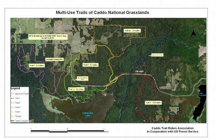
Click the map to enlarge it.  According to Caddo Trail Riders Association, trail maps are available at the campgrounds.  CTRA also reports that the trails are well marked. Caddo trail map

Photo provided by Ann Sides.

Photo provided by Ann Sides.

Terrain: 

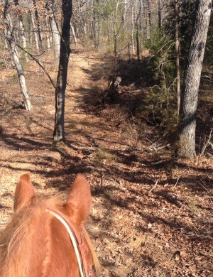
The terrain is sandy, heavily wooded, and hilly to flat. These are barefoot friendly trails.

Description:

When most equestrian folks hear “grasslands” in Texas they think of the Grasslands in Decatur. However, there is another grasslands area that together with the Decatur area comprises the Caddo-Lyndon B. Johnson National Grasslands. It is located near Honey Grove and called Caddo Grasslands. Caddo Grasslands has nearly 18,000 heavily wooded acres and three pristine lakes. It is open for hunting and fishing (following TX Parks & Wildlife seasons), camping, hiking, picnicking and horseback riding. Equestrian riders will find 30 miles of shady, sandy trails and a comfortable campsite at Bois D’ Arc Trailhead. There is additional acreage near Ladonia but it has not been developed for recreational use.

Trails:

Trail 1 is 11.0 miles and for years I was warned this trail was very rough. I finally rode it with some friends who had ridden it before and found it’s a wonderful trail!! It had lots of up and downs which I really like. To access Trail 1, go out Trail 2 and take Trail 4. You’ll cross a small road into a camping area with horse gates on both sides of the road. After about a quarter mile you’ll come to another horse gate that goes out toward the road. Go out this gate and ride by the fence to the right. You’ll need to cross the bridge on the highway and go a short distance to another horse gate on your right. This is not a busy highway and has good visibility. This is a long trail and it is ideal to bring along a lunch and stop at the lake overview to eat, where there is a picnic table. The 11.0 miles includes the portion of Trail 2 and Trail 4. If you desire to shorten your ride back a little, you can ride along the highway all the way back. It’s pretty boring and is not maintained for horses, so be wary of holes or other hazards.

Trail 2 is the shortest trail at 3.6 miles.  However, it is very scenic with a stop by the lake and a trek through a large stand of pine trees.  This is a very nice trail and is relatively flat.

Caddo Bridge 2

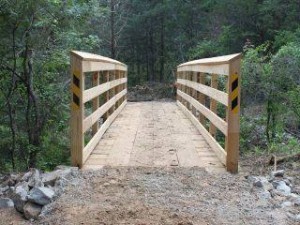
Trail 3 is the next longest at 6.2 miles. It is similar to Trail 1 but has more up and downs. There is a cut through on the trail to use if there’s been a lot of rain and is shown on the map. There is a very sturdily made bridge on this trail that is good training for your horses.

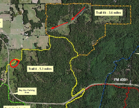
Trail 4 is 8.9 miles. This trail is located across the highway from camp but there is good visibility at the crossings. The west side of the trail has some areas that are not shaded. On the north end of the trail is a new trail that’s been recently opened, called 4b. I’ve been told it’s the best trail there.  With the weather bumping the 70s a group of us went up to Caddo Grasslands and decided to ride Trail 4 and 4b.  We didn’t have any trouble closing gates as we had a pro side passer ride with us, who not only side passed with ease but did so while ponying another horse!!!   The road crossing went well with gates on both sides of the road.  The terrain is gently rolling hills, with moderate ups and downs and most of it was through lovely forests with sandy trails.  One of the really nice things about Trail 4 is if you have a group that some riders want to do a short ride and some want to do a longer ride, it’s easy to split up and one group do the inner circle and the other group do the outer circle.  Our group stayed together but we found some of us getting a little tired so we cut off part of Trail 4b by riding a gravel driveway, shown by the red arrows.  From there it was an easy 1 mile back to camp.  The trails were VERY well marked and maintained.   The area shown in the red circle is across an open field and if there had been a recent rain it would have been very boggy.  The trail itself was dry but one horse got off the trail and it was boggy even though there has not been rain in several weeks.

Trail 4

Trail 4

Note on controlled burns. Occasionally the National Forrest Service determines the forest is getting too dense with underbrush and they’ll do a controlled burn. In a controlled burn the flames are only about a foot tall and they basically cut through small trees and bushes and clear out the undergrowth. Sometimes the trees are supported by other trees’ branches and do not fall. This can be a hazard immediately after a burn; especially if it’s windy. Also, as you can imagine its not real pretty after the burn. If you’re planning a long stay and/or a long drive, be sure and check dates for controlled burns with the Forrest Service at Decatur (940-627-5475) or with the Caddo Riders Association.

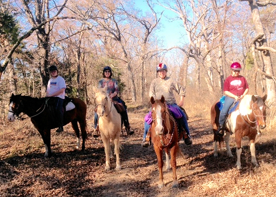
Andrew, Ann, Julie and Judi on Trail 4.

Andrew, Ann, Julie and Judi on Trail 4.


Photo provided by Ann Sides.

Photo provided by Ann Sides.

About the contributor: 

Ann Sides, WTTA’s newest contributor, lives near Greenville, TX with husband, J.Paul, who is head of security and composting, 5 horses, and 3 dogs.  Ann works at L-3 in Greenville and hopes to retire in a couple of years.  But until then she’ll keep riding and camping every weekend she gets the chance.  She and J.Paul have one daughter, Lauren, son-in-law Clint, and one adorable grandchild, Ryan Moore, who live close by in Royse City.  It doesn’t get any better than this!!!

Trace Trails, Athens TX

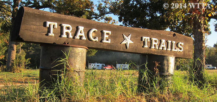
Trace Trails entrance sign.

Trace Trails entrance sign.


Website: Unknown

Face Book Page: https://www.facebook.com/TraceTrails

Location: 7960 County Road 3914, Athens, TX  75752 (North East Texas)

Mailing Address: Trace Trails, 8543 County Road 3914, Athens, TX 75752

Contact: (903) 258-0054, owner Billy Beeson

Email: Unknown

Trace Trails entrance is on the right off of County Road 3914 in Athens, TX.

Trace Trails entrance is on the right off of County Road 3914 in Athens, TX.

Directions: From the intersection of Texas Loop 7 and US 175 head northwest towards Mabank on US 175 for approximately two miles.  Turn right on Co. Rd. 3918.  Follow this road around a 90 degree curve to the right, then take the first left, which is Co. Rd. 3914 (you will also see signs for Tara Winery).  Co. Rd. 3914 is narrow and curvy. Pass the winery on your left (it’s a two story white house with large pillars and a vineyard — you can’t miss it). Continue on 3914.  After a curve in the road you will see a silver gate on your left — pass this gate and continue on Co. Rd. 3914.  Trace Trails will be on your right and easily seen from the road.  From Co. Rd. 3914 it is approximately 1.7 miles. The campground is in a large tree lined meadow.  There is a wooden sign placed on two metal barrels.
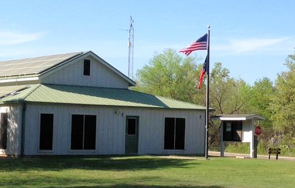
Open field parking offers lots of room and maneuverability for large rings at Trace Trails in Athens.

Open field parking offers lots of room and maneuverability for large rigs at Trace Trails in Athens.

Fee drop box is done by the honor system at Trace Trails.

Fee drop box is done by the honor system at Trace Trails.

Overnight Equestrian Camping: Allowed!

Fees: Fees are paid by way of the honor system.  There is a metal drop box located to the left of the entrance road under some shade trees.  Just drop in your payment and enjoy the trails.

$8.00 per person per day

$7.00 per person to camp overnight

Operating Hours: These trails are normally open 24/7 with some exceptions.  On occasion for large events like an endurance race in which 100 or more riders will participate, the trails might be closed to those not participating in the event.  So it is always best to call before you haul.


Shady camping / parking areas at Trace Trails in Athens, TX.

Shady camping / parking areas at Trace Trails in Athens, TX.

 Facilities: Primitive camping grounds are located in a large tree lined meadow.  There is no electricity and there are no designated campsites, so you can pick where you want to park or camp.  There is one porta-potty, a few picnic tables, a fire ring, and two water faucets with metal water troughs. Water hoses were attached to the faucets but I do not know if they belonged to another visitor or were provided by the ranch.  I’d suggest you bring your own water hose. There is one horse pen constructed out of 8 metal panels.  The pen is not covered but is located under some shade trees. You may high tie to trees so long as you use tree savers or something like a girth to protect the trees. You may also bring portable or electric pens.  On the north side of the camping area (to the left as you drive in) there are some shady places to park, otherwise you can park along the tree line or out in the open field.  It is first come, first served with regard to parking and/or camping locations.  The water faucets, pen, picnic tables, fire ring, and porta-potty are located to the left (or north) side of the campground under the trees.

There is a single horse pen at Trace Trails which has eight metal panels and is under shade trees.

Water faucet and trough.

Water faucet and trough.

Campground at Trace Trails in Athens, TX.

Dogs: Dogs are allowed and may be loose so long as they are well behaved… otherwise please keep your dog on a leash. Be aware that some of the trails go near residences who have dogs, and we had two dogs try to chase after our horses.  However, as soon as we turned our horses around facing the dogs they backed off.

Dog & group

During one of our rides at the ranch a fellow equestrian had her well behaved dog tag along down the trails with us and he was having a blast.

Cell Phone Service: Cell phone service was strong and I had no problems using my Verizon cell phone.

Trail Users: Trail users consists of mostly equestrians and maybe an occasional hiker.  There are no motorized vehicles or bikes on these trails.

Mileage: According to the owner, Mr. Beeson, there are more than 50 miles of trails on the 1,000 acre property. The trails are color coded.

Red Trail = 7.5 miles

White Trail = 6.5 miles

Orange Trail = 9.2 miles

Blue Trail = 11 miles

Pink Trail = 16 miles

There are multiple cut-through trails  marked by yellow and green ribbons for which the mileage is unknown.

Maps: Go to the Trace Trails FaceBook page to see additional maps.

Trace Trails Map and Campstie

The green asterisk is where the campgrounds are located (this map is on the Trace Trails Facebook page).

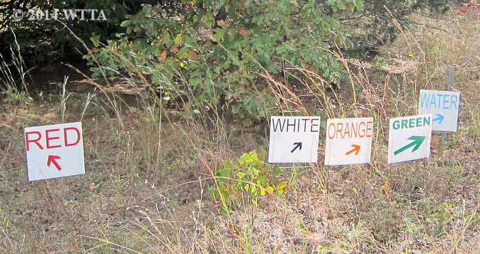
Trail Markers: The trails are well marked with colored ribbons (some colors are faded), white signs with colored arrows, and pie plates.  The property fence line, telephone poles, gas line, blacktop road, and dirt road make great guides to also help you find your way around. The trails heading out of camp are fairly easy to find.  Several of the trails start out north of the water troughs and others start out on the edges of the tree line.  You can also go to the very south of the campground meadow to pick up the trails as well.

Additional information on trail markers provided by Ann Sides (Thanks!):
Trail marking:  the ribbons are on the right side of the trail as you’re leaving camp on the start of the trail as indicated on the maps.   Turns are shown by three markers on the side to make the turn or by an arrow.    Several competitions are held here each year including endurance rides, trail competitions with NATRAC and ACTHA and all of these folks put in LOTS of hours to keep the trails maintained and marked.  Thank you all!!!  Additional thanks to the Beeson family for allowing us to ride on their lovely ranch!!!  And thanks to GOD for creating this lovely place and allowing us to care for it and our horses.

Trail signs at Trace Trails in Athens, TX.

Trail signs at Trace Trails in Athens, TX.

Terrain: The soil is sandy and mostly free of rocks; shoes/boots are not required for your horse. The sand can be deep in some areas.  This is a great place to ride if there has been rain, as the sandy soil drains quickly and therefore the mud and bog dries up fast. The trails can be dusty if there has been no rain.  The trails take you through wide open grassy meadows and thick forests. The terrain is mostly level or gentle rolling slopes.  The Green and Yellow cut-through trails usually cut across thick woods and wind in and out of creeks and gullies providing more challenging terrain.  There are more ups and downs, creek crossings, and deadfall on these cut-through trails.

This stock tank is not far from the campground at Trace Trails.

This stock tank is not far from the campground at Trace Trails.

Water: There are two water faucets with troughs at the campground.  On the trail I saw one stock tank and a few creeks from which the horses were able to drink.

Open meadow group

Trace Trails Description:

Trace Trails in Athens, Texas is a privately owned 1,000 acre working cattle ranch in northeast Texas.  This ranch offers over 50 miles of sandy and scenic trails to enjoy with your friends, family, and horses. Dogs are allowed and may be loose so long as they are well behaved, otherwise please keep your dog on a leash. During one of our rides at the ranch a fellow equestrian had her well behaved dog tag along down the trails with us and he was having a blast.  The ranch often hosts trail competitions, benefit rides, and endurance races.  You are welcome to bring your own horse anytime to ride at Trace Trails, but you might want to call first to find out if there is an organized event also going on. Some of the endurance races held there can have as many as 100 riders. Ranch use fees are very affordable and everyone pays by the honor system by depositing their fees in the drop box. Overnight equestrian camping is primitive in that there are no electrical hook ups or designated camping pads.

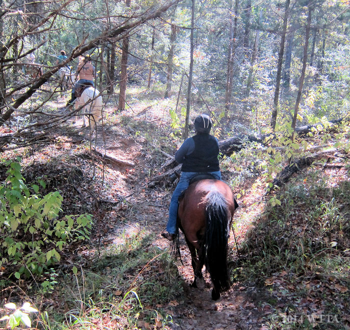
Patti terrain

Patti is riding Dakota through the thick woods at Trace Trails.

This is a great place to camp and ride, especially since there are numerous miles of trails.  The trails are diverse with flat to rolling sandy terrain, open grassy meadows, and thick forests.  The yellow and green cut-through trails wind through thick forests and in and out of gullies and creeks; these were my favorite trails.  The trails are well marked with colored ribbons — although some colors are faded — and white signs with colored arrows, and pie plates.  The property fence line, telephone poles, gas line, blacktop road, and dirt road make great guides to also help you find your way around.

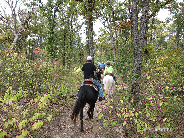
Heading out on the trails at Trace Trails in Athens.  The purple beauty-berries were everywhere.

Heading out on the trails at Trace Trails in Athens. The purple beauty-berries were everywhere.

Trail Tale & Review:


Photo shot by Donna Taker. Ann and Scout, her long time, much loved, trail companion.

Photo shot by Donna Taker. Ann and Scout, her long time, much loved, trail companion.

Trace Trails Review, Nov 7-9, 2014 – By Contributor Ann Sides (Thanks so much Ann!)

I’ve probably ridden at Trace Trails in Athens 7-8 times, but I haven’t ridden there for a couple of years prior to this trip and have never been brave enough to camp out without electricity!!  So this trip was a welcome return back to a place where I’ve had some great rides.  In the past we had jumped from trail to trail, never going from start to finish, and I always thought I was probably missing a lot of good trails.  I was so RIGHT!!

My friend Jackie and I arrived Friday mid-day and got busy setting up camp; stringing the highline and setting up the generator.  We decided to ride a portion of the red trail.  It leaves out of camp on the north end, crosses a county road that is not paved, and through a gate into a large pasture.  It took a team effort to open and close the gate but at least we didn’t have to dismount!  The trail went through an open pasture and then into the woods.  The trails are sandy, wide, shady and well marked.  We rode the north loop of the trail, probably about 4 miles and it was beautiful; gently rolling hills through heavy forest.  There were some gentle ups and downs, and we passed by a deer stand (no one home).  We stopped by a pond about halfway into the ride for the horses to rest and get a drink.  We took the “scenic loop” and it was a little higher with some very nice views.  The entire trail is through woods, and it was truly a delight.  We were joined in the camp by a local cowboy church, Living for the Brand, and they were great campers!!  They cut up a fallen tree and stacked firewood, started a fire, and invited us for supper, breakfast, and lunch!!!  They were real nice folks and we enjoyed getting to know them.  There were two girls with the cowboy church that were horse crazy and loved on the horses.


Photo provided by Ann Sides.

Jax on the right is saying “What about me?” Photo provided by Ann Sides.

The 2nd day we were joined by Brenda and Henry McNair, who are some great folks that helped me start trail riding and camping.   They brought their wonderful horses CJ & Sunny.  CJ is a gray Appaloosa and Walker combination and Sunny is a Palomino QH.  CJ is one of the steadiest trail horses I’ve ever been around.  His only problem is that he sometimes falls asleep while he’s walking!!  After a wonderful breakfast of pancakes and sausage provided by the Cowboy Church we rode out on the Pink Trail from the north end.  We planned to ride 2 hours so we only rode the inside loop of the Pink Trail, which is in the same area as the loop of the Red Trail that we rode on Friday.  This portion of the pink Trail has very heavy woods and sandy, shaded trails.  The south portion of the pink trail includes 3 miles of road riding on very lightly traveled dirt roads.


Brenda and CJ in front, Jacki and Frisco, and Henry and Sunny. Photo provided by Ann Sides.

Brenda and CJ in front, Jacki and Frisco, and Henry and Sunny. Photo provided by Ann Sides.

After a big lunch of hamburgers, again provided by the Cowboy Church, and lots of good visiting around the campfire, Henry & Brenda left for their home in nearby Wills Point.  We decided on a short ride and left out on the south end of the Red Trail.  We planned to just hop around on whatever trail took our fancy.  This end of the trails has a lot of ups and downs and is very heavily wooded, but as usual well trimmed and marked.  Jacki spotted a deer not far out of camp.

Trail marking:  the ribbons are on the right side of the trail as you’re leaving camp on the start of the trail as indicated on the maps.   Turns are shown by three markers on the side to make the turn or by an arrow.    Several competitions are held here each year including endurance rides, trail competitions with NATRAC and ACTHA and all of these folks put in LOTS of hours to keep the trails maintained and marked.  Thank you all!!!  Additional thanks to the Beeson family for allowing us to ride on their lovely ranch!!!  And thanks to GOD for creating this lovely place and allowing us to care for it and our horses.

Saturday evening we were joined by Annette Griffin and her two horses, Tally, a Paint and Percheron combination, and Mister Man Griffin, (Mister for short) a Haflinger and POA combination.  Annette competes in NATRAC on Tally and recently won Sweepstakes in their first year of competing together!!  We were joined on Sunday morning by Julie Whitaker and a Paint horse she was trying out named Laredo; a really pretty horse with one blue eye.

We rode the Orange Trail, which starts in the south end of the meadow.  It was spectacular with some good ups and downs; lovely, lovely ride.  This took us way back on the ranch to places I’ve never been.  We went through several large pastures and stopped by a nice sized pond for the horses to drink.   I finally rode one trail start to finish!!!!

IMG_7906

Julie and Laredo in front, and Annette and Mister. Photo provided by Ann Sides.

Saturday evening we were joined by Annette Griffin and her two horses, Tally, a Paint and Percheron combination, and Mister Man Griffin, (Mister for short) a Haflinger and POA combination.  Annette competes in NATRAC on Tally and recently won Sweepstakes in their first year of competing together!!  We were joined on Sunday morning by Julie Whitaker and a Paint horse she was trying out named Laredo; a really pretty horse with one blue eye.

We rode the Orange Trail, which starts in the south end of the meadow.  It was spectacular with some good ups and downs; lovely, lovely ride.  This took us way back on the ranch to places I’ve never been.  We went through several large pastures and stopped by a nice sized pond for the horses to drink.   I finally rode one trail start to finish!!!!

We rode the Orange Trail, which starts in the south end of the meadow.  It was spectacular with some good ups and downs; lovely, lovely ride.  This took us way back on the ranch to places I’ve never been.  We went through several large pastures and stopped by a nice sized pond for the horses to drink.   I finally rode one trail start to finish!!!!


IMG_7903

Julie in front, Jacki and Frisco in middle and Annette and Mister, accompanied by our shadow horses!  Photo taken by Julie Whitaker.


FullSizeRender (2)

Annette and Mister on left, myself and Jax in middle and Jacki and Frisco on the right. Photo provided by Ann Sides.


Trail Tale & Review:

November 8-9th, 2014, provided by contributor Kelly Hurd

I had the opportunity to visit Trace Trails due to last minute changes in our camping plans on account of the weather. Our original destination was a muddy mess, but since Trace Trails is sandy, the water drains through the soil quickly and that means little to no mud after several days of rain. I joined my American Indian Horse riding club, NETASA, to enjoy Trace Trails during a fall weekend in November.

NETASA, American Indian Horse trail riding club, enjoys Trace Trails in November.

NETASA, an American Indian Horse trail riding club, enjoys Trace Trails in November.

The leaves were starting to turn and the bright purple beauty berries were everywhere. This is a working cattle ranch so there are roaming cattle throughout and gates to open and closed as you ride through the property. During our short weekend visit to Trace Trails I ran into some old friends (Shirley & Vern) by chance, which was a pleasant surprise.

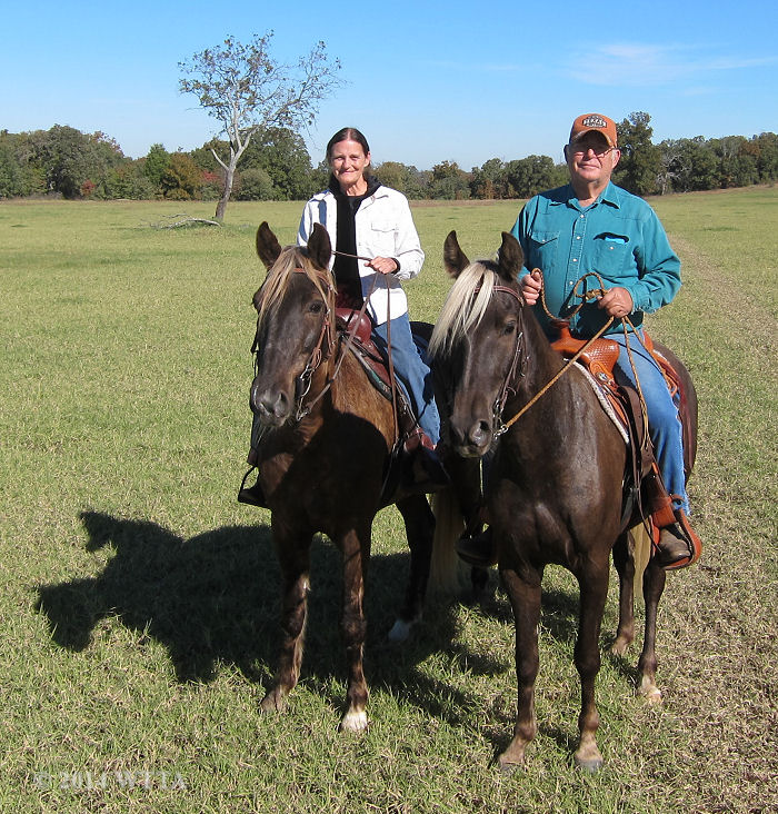
Vern and Shirely live nearby and enjoy riding their Rocky Mountain horses with their riding club, Trail Gaiters and Friends, at Trace Trails.

Vern and Shirley live nearby and enjoy riding their Rocky Mountain horses with their riding club, Trail Gaiters and Friends, at Trace Trails.

Vern and Shirley had brought their Rocky Mountain horses to the ranch and were meeting up with their riding club “Trail Gaiters and Friends.”  Our two clubs met together to ride some of the trails and we had a fun time. Overall it was a great weekend with cool weather for a campfire, good friends and family, good horses, super trails, and good food!  I’m looking forward to riding at Trace Trails again. It is definitely worthy of a return trip.

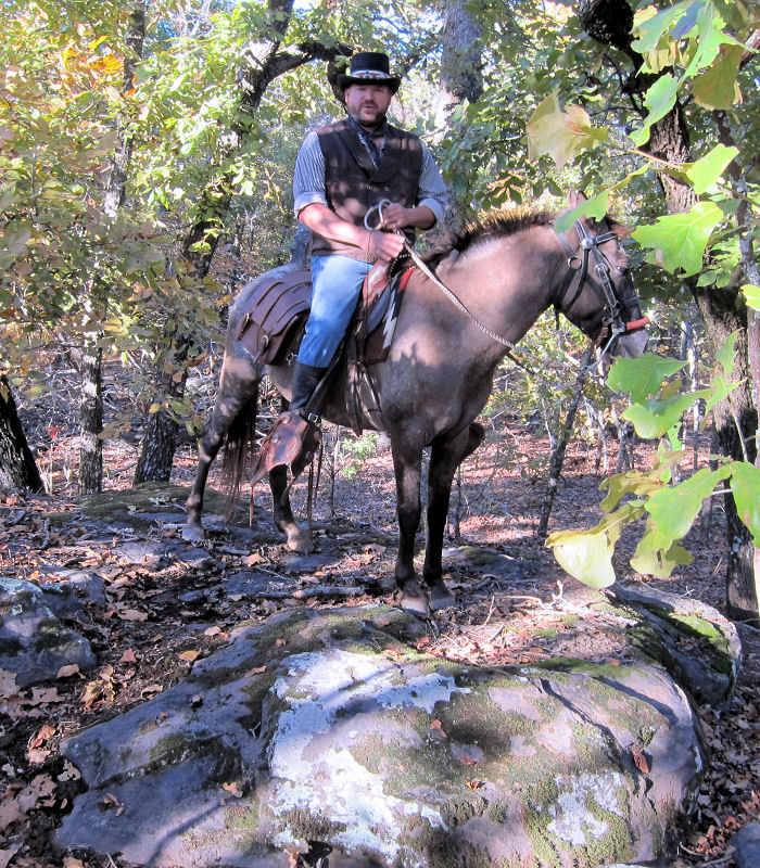
Curtis George riding Dragonfly, shows me rock formations which are hiding in the shadows of the forest just off the trail.

Curtis George, riding Dragonfly, shows me rock formations which are hiding in the shadows of the forest just off the trail.  This terrain is unusual for the ranch as most of the ground is sandy with little to no rocks.

During this trip Curtis with NETASA showed me all sides of the ranch.  Since this was my first trip to Trace Trails and because we didn’t always stick to one trail in particular (as it was fun to ride the cut through trails and jump around to different trails), I don’t have a good description of each individual trail.  If you know these trails well and can give a good description of each of the colored trails then please email the info to me and I’ll add it on this page.  I also invite others to share their reviews of the trails as well and I will share the information here.

Additional Pictures: 

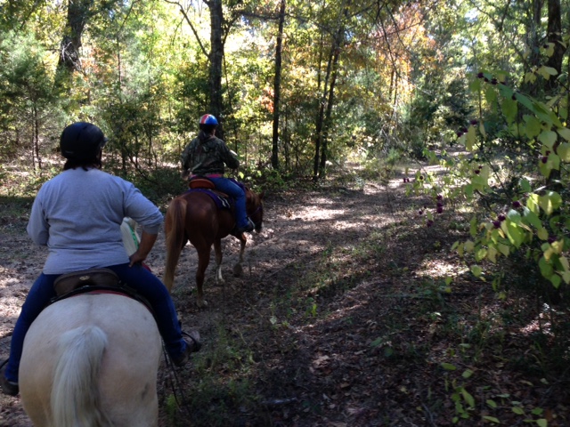
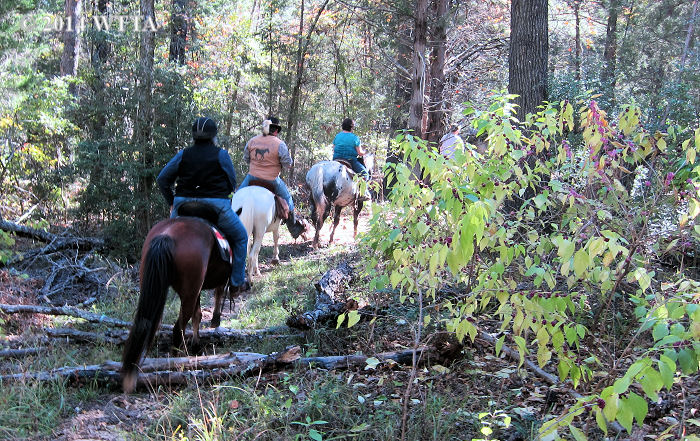
Riding clubs NETASA and Trail Gaiters and Friends ride through a forest trail in Athens, TX.

Riding clubs NETASA and Trail Gaiters and Friends ride through a forest trail in Athens, TX.


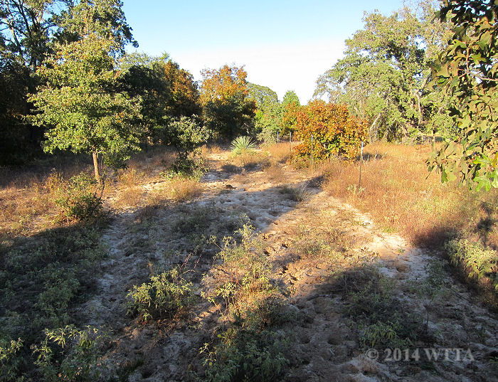
There are several deep sandy trails at Trace Trails.

There are several deep sandy trails at Trace Trails.

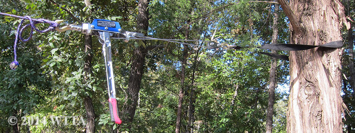
A new friend made at Trace Trails, Ann Sides, shows me a neat trick she learned from other trail riders to get your high tie nice and tight.  Thanks Ann!

A new friend made at Trace Trails, Ann Sides, showed me a neat trick she learned from other trail riders to get your high tie nice and tight – use a come along hoist.  Thanks Ann!

A post oak tree is highlighted by the early morning sun at Trace Trails.

A post oak tree is highlighted by the early morning sun at Trace Trails.


Scott & Curtis meadow

Curtis and Scott enjoying the open meadow trails in Athens, TX.

Emily kindly opens the gate for us at Trace Trails.  Due to cattle on the ranch it is important to always close the gate once everyone is through.

Emily kindly opens the gate for us at Trace Trails. Due to cattle on the ranch it is important to always close the gate once everyone is through.


Paul and Doreen enjoy their American Indian Horses, Who Are You and Sing, with NETASA at Trace Trails.

Paul and Doreen enjoy their American Indian Horses, Who Are You and Sing, with NETASA at Trace Trails.

A wide sandy path at Trace Trails.

A wide sandy path at Trace Trails.


« Older posts Newer posts »