Equestrian Trails and Campgrounds

Category: Texas Trails (Page 8 of 11)

Six O Ranch, Cleburne, TX

View from the hills at the Six O Ranch, 12/2010.

Entrance, photo by Jim Edmondson with Optical Harmonics, 12/2010.

Website: None at this time

FaceBook Page:

http://www.facebook.com/profile.php?id=100003311998687

Contact:

Ted and Kim Reeeves #817/558-7146,

e-mail: Kimreeves87@yahoo.com

Location:

11404 FM 200, Cleburne, TX 76033

Directions:

Click on the address above for the Google Map Link. From 35W south of Fort Worth, take 67 west past Cleburne towards Glen Rose and turn south (left) on Park Road 21. Go  approximately 7 miles, pass the State Park and Lime Co on the right, and take the first right onto FM 200.  Six O Ranch will be on your right, there will be a sign and white pipe gate entrance.

Ranch Hours:

Use of the trails is by appointment only.

Wow, what a view!

Cost:

$10.00 per rider a day.

Overnight Camping is allowed by permission only.

Dogs:

No dogs allowed.

Facilities:

Running water is available for use at the ranch. Chemical toilets are available when there is an organized competitive trail ride event, but when there is not an event there are no restroom facilities.  Trailer parking is spacious and is located in front of the house.  There are no electrical hook ups or pens.

Mileage:

Six O Ranch offers 35 miles of riding trails.

Map:

Trail Maps are available upon request. Below is a copy of the map provided by the ranch:

Terrain:

The ranch consists of varied terrain from open fields with soft easy footing, rocky hills, and shaded wooded trails.  There are watering opportunities at the ranch by way of tanks, creeks, and water troughs. A large lake, at least fifty acres in size, is also located on the southwest side of the ranch.

Water stop with a view of the hills in the background. The trough is deeper than the ground surface so don't allow your horse to step in.

Continue reading

Pedernales Falls, Johnson City TX

Website:

http://www.tpwd.state.tx.us/spdest/findadest/parks/pedernales_falls/

Location:

2585 Park Road 6026, Johnson City, TX 78636

Contact:

830/868-7304 or 1-800/792-1112

Directions to Pedernales Falls:

Pedernales Falls State Park is located in Blanco County about 35 miles west of Austin and nine miles east of Johnson City.

From 290 head north on Ranch Road 3232, turn right on County Road 201 (Pedernales Falls Rd.), then take an immediate left on Park Road 6026, you will see the park sign.  Park Road 6026 will take you to the park entrance.

From Johnson City off of 281 head east on Ranch Road 2766 ((Robinson Road), this will turn into County Road 201 (Pedernales Falls Rd.), pass Ranch Road 3232 on your right, then take an immediate left on Park Road 6026 where you will see the park sign.  This road leads to the park entrance.

Directions to the equestrian parking/ trail head:

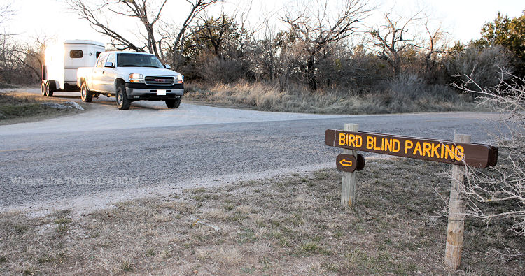
Once entering the park headquarters gate/pay booth continue down the main park road and look for a sign to your right labeled “Bird Blind Parking”.  At this sign turn left into the Bird Blind Parking area and pass it.  Continue down the road into the equestrian parking area.  There is no sign marking the equestrian trail head parking.

This sign leads to the equestrian trail head / parking area which is not labled.  The truck is exiting the equestrian parking area.

Continue reading

Parrie Haynes, Killeen TX

Photo provided by Karen Boone and Boomer.

Parrie Haynes Equestrian Center

Parrie Haynes Equestrian Center remains open to horseback riders!

Website: www.parriehaynesequestriancenter.com


Sign NewLocation:

13816 N. Maxdale Rd. (East Unit- Equestrian Center)

Killeen, TX 76549

(Please note when you Google this address it does not take you to the correct location)

Contact: Ona Trubee spottedhorselivery@gmail.com 254-394-0330

Directions: Parrie Haynes Equestrian Center is centrally located within 3-4 hours of the Houston, Dallas, and San Antonio metropolitan areas, one hour north of Austin, and 13 miles south of Killeen.
Step 1:
-Traveling from Waco I-35S, take Hwy 190 west at Belton. In Killeen turn south on Hwy 195 for about 13 miles, then turn right on FM 2670. If you cross the Lampasas River Bridge you have gone too far. Go 3.7 miles and take right on North Maxdale Road.
-Traveling from Austin I-35N, take Hwy 195 north (exit 266) & drive for 24 miles, traveling through Florence and crossing the Lampasas River, then turn left on FM 2670. Go 3.7 miles and take right on North Maxdale Road.
Step 2:
-The East Unit is located at 13816 North Maxdale Road – The multi use entrance is 2.2 miles straight on North Maxdale Road, on the left past the main ranch entrance. The entrance to the camp is through the second set of double silver gates. Proceed down the paved road until you come to the iron ranger. Payment is required before parking.

Entrance to Parrie Haynes Equestrian Center.

Entrance to Parrie Haynes Equestrian Center.


Overnight Equestrian Camping: allowed!

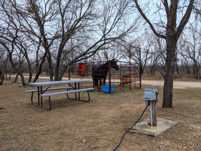
Electrical & Water hook up camping with pens. Photo by Karen Boone.

Continue reading

Slaughter Creek Trail, Austin TX

SCT 1/2/2011

Slaughter Creek Trail, Austin TX

Website: None, but there is a Twitter page which post information about the trail and possible trail closure due to rain and or maintenance.

Contact: slaughtercreek@yahoo.com

Location: 9901 FM 1826, Austin, TX 78737 MAP

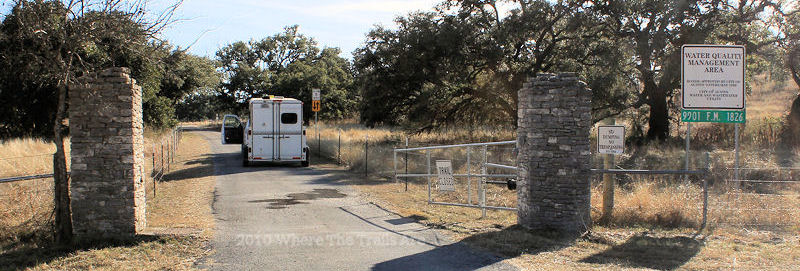
Directions: SCT is off FM1826 not far from HWY 290.  From IH 35 exit Slaughter Lane going west approximately eight miles, then turn left on 1826, pass over a small creek with a dam on the right, then SCT will be immediately on the left.  It can be easy to miss. There is a metal gate with gray brick  pillars at each end and a white sign which states Water Quality Management Area above a green address sign.  From 290 go south on 1826 and pass W. Slaughter Lane then follow the directions listed above.

SCT entrance located on FM 1826

Continue reading

Land Heritage Institute, San Antonio TX

 Website: https://www.landheritageinstitute.com/

 Land Heritage FaceBook page

Contact:

Peggy Oppelt

email: moppelt@ocoarchitects.com

phone:  210.846.9403

Location: 1349 Neal Rd (main gate address), San Antonio, TX .
 

LHI Headquarters


Multipurpose barn and pigeon cote at LHI, possibly built in the early 1900s.


Hours of Operation: Land Heritage Institute is normally open on the 2nd Saturday of the month, but it will also be open the 2nd & 3rd Saturday’s from January through May 2021. Gates will open at 8 am and close at 4 pm. COVID 19 protocols including wearing masks at headquarters check in, maintaining physical distance and no groups larger than ten people are requested. Open dates from now through May 2021 are:

January 9th & 16th

February 13th & 20th

March 13th & 20th

April 10th & 17th

May 8th & 15th

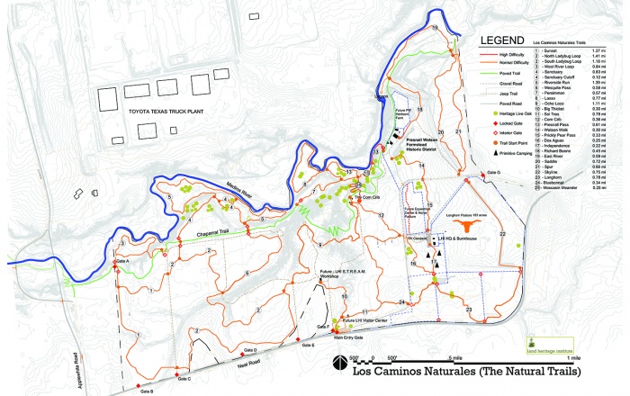
Upon entry, please sign in, provide your donation/fee at headquarters and email your Coggins to  (210) 846-9403. Maps if available, will also be located at HQs.  The map is also on line and below.

Contact Peggy Oppelt for scheduling an appointment outside of LHI’s open days or to inquire of events or special programs such as LHI Trail Masters.


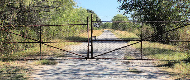
Entrance Gate to LHI off of Neal Road.


Directions:

In San Antonio on the South side, from HWY 410 and S. Zarzamora St., travel south on S. Zarzamora.  Pass  Texas A&M University SA, pass Zarzamora Ranch, turn left at the light onto Applewhite. Pass the Toyota Plant, cross the Medina River, pass the Medina River Greenway Trailhead, and then turn left on Neal Road. The main entrance gate will be about a mile on the left with a stone sign to the right of the gate.  Once in the gate continue down the paved road, maybe about a little less than a mile, you will see a sign and orange barrel in the middle of the road directing you to the right gravel road.  Camps sites and horse pens are on the right and straight ahead is a large field, then the headquarters and bunk house.

LHI Trail Map


Fees:  $10.00  donation per rider and $3 per non rider for the day and $25 a night for water/electric camping sites. Fees are subject to change; always check with LHI for the most up-to-date rates.


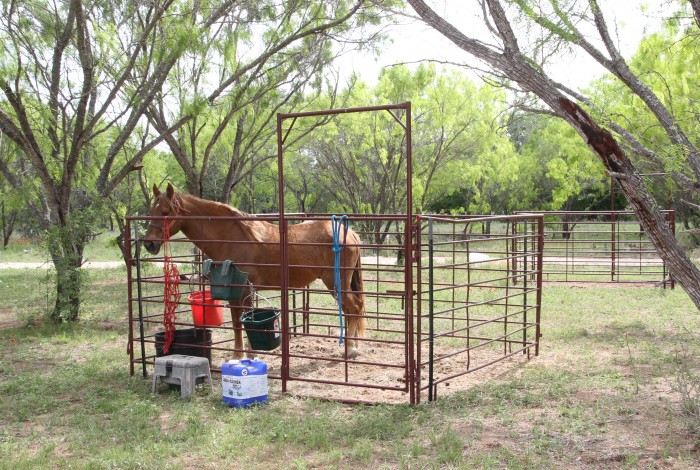
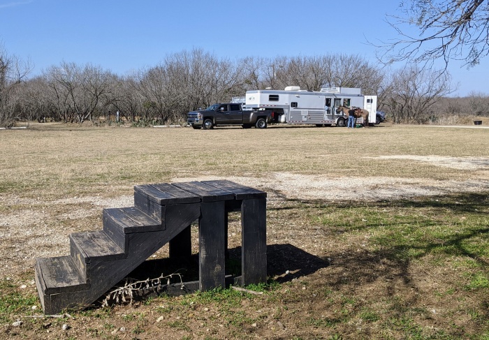
Facilities: LHI has a designated equestrian center for day riders and campers with electric hook ups, water, pens, and also a restroom / shower in the headquarters building.  Between the bunk house and the headquarters building is a shared water trough, a tall wooden mounting block, additional picnic tables and a water fountain.    A restroom and shower is located at the back of the headquarters building.  Be sure to admire the magnificent Long Horn cattle located in the pen/pastures behind the bunkhouse and headquarters.

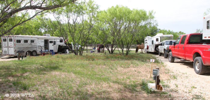
Overnight Camping: Ten RV / living quarter trailer hook ups  with electricity and water, horse pens and picnic tables.  Camping for small groups is by reservation only or  at organized events.

Bunkhouse Rental: $250 a day, call for details.  Fees are subject to change; always check with LHI for the most up-to-date rates.

Cell Phone Service:  Good


Restrictions/Rules:  A few of the rules to follow (check LHI website for a full list):

  • No open flame fires
  • No smoking
  • No alcohol
  • No firearms
  • Pets must be kept on a leash no more than six feet long
  • Clean up after yourself

 Manure Management: Please clean up manure in stalls and day area use.  Deposit manure in the designated area.  Wheel barrels, muck buckets, and shovels are provided.  Bring your own rake.


  Continue reading

« Older posts Newer posts »