Equestrian Trails and Campgrounds

Category: Texas Trails (Page 1 of 11)

Onion Creek Metropolitan Park, Austin TX

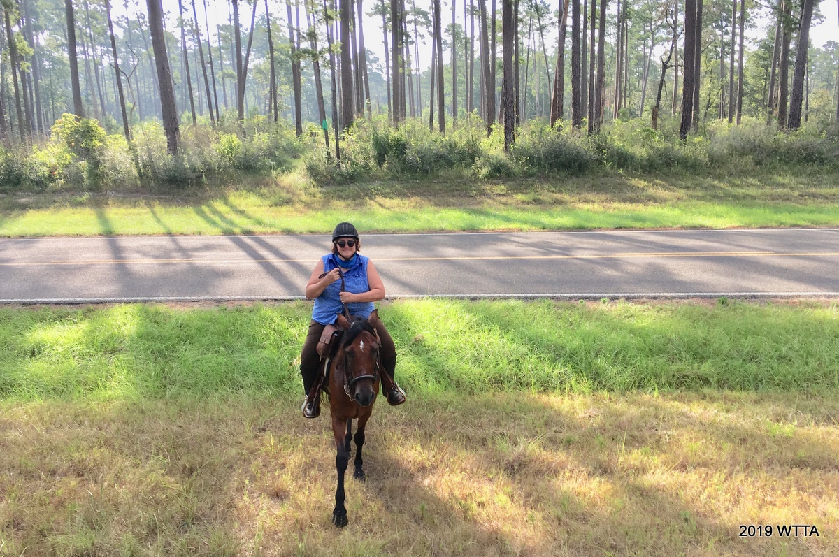
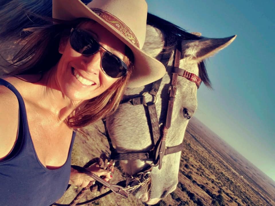
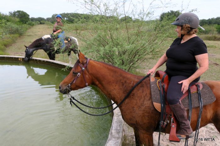
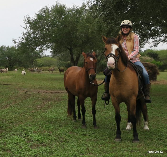
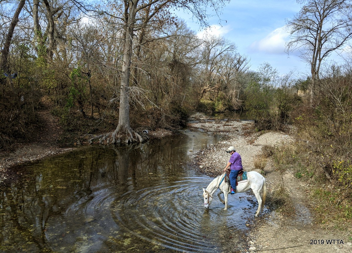
Deb Demers, contributor of this Onion Creek update is riding Maya at creek crossing #2. Maya is enjoying a nice drink of water from the creek.

Updated Review Provided by contributor Deb Demers.  Thank you Deb!

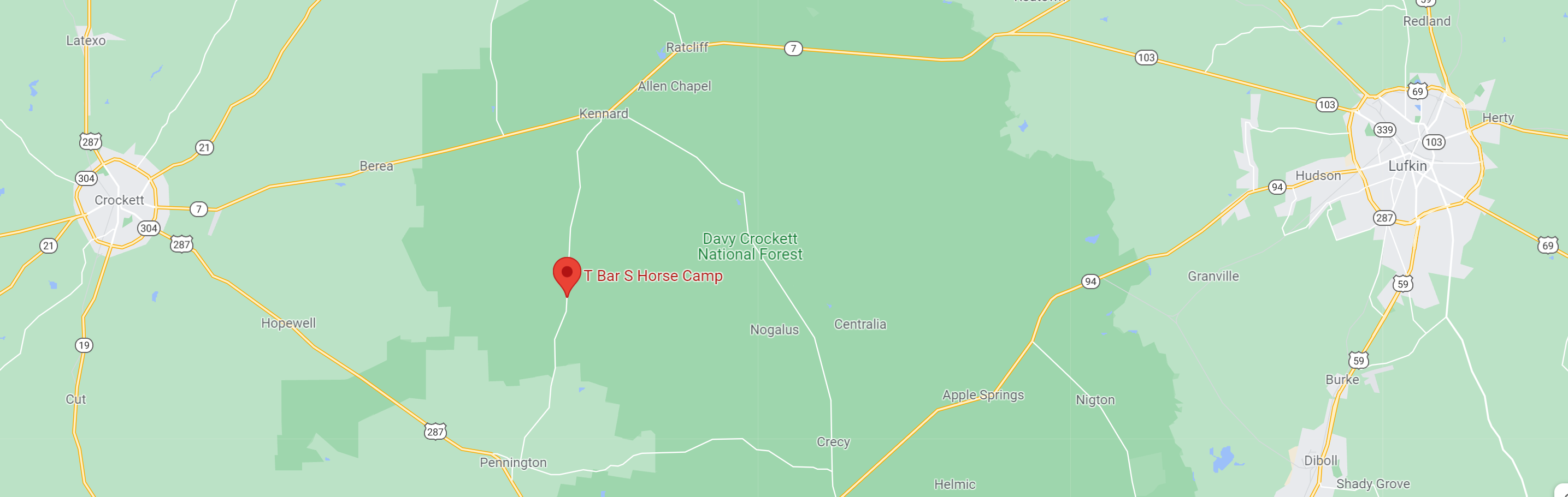
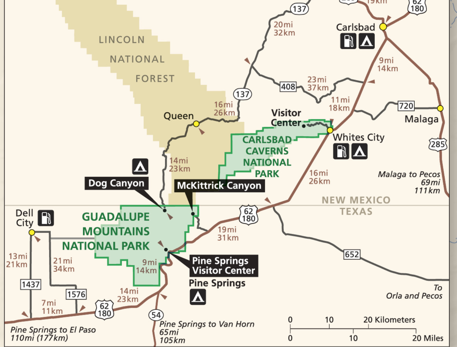
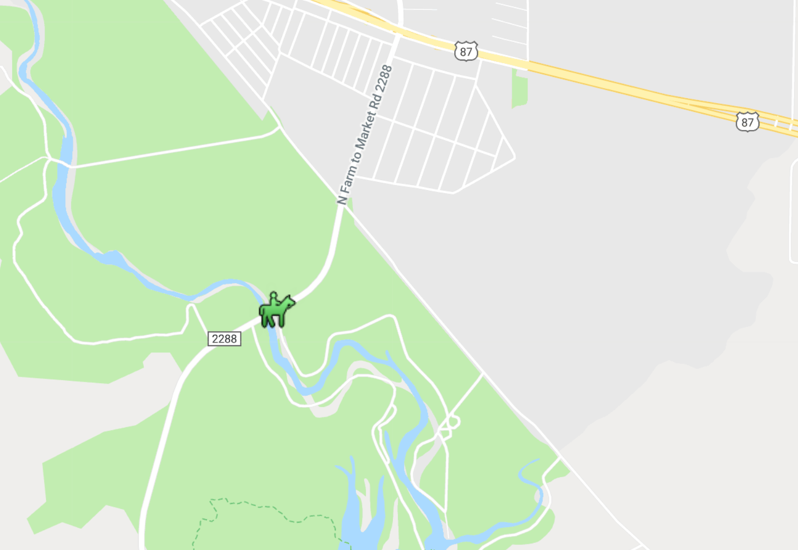
Location: Location: Onion Creek Metropolitan Park, 7409 Wild Onion Dr., Austin, TX

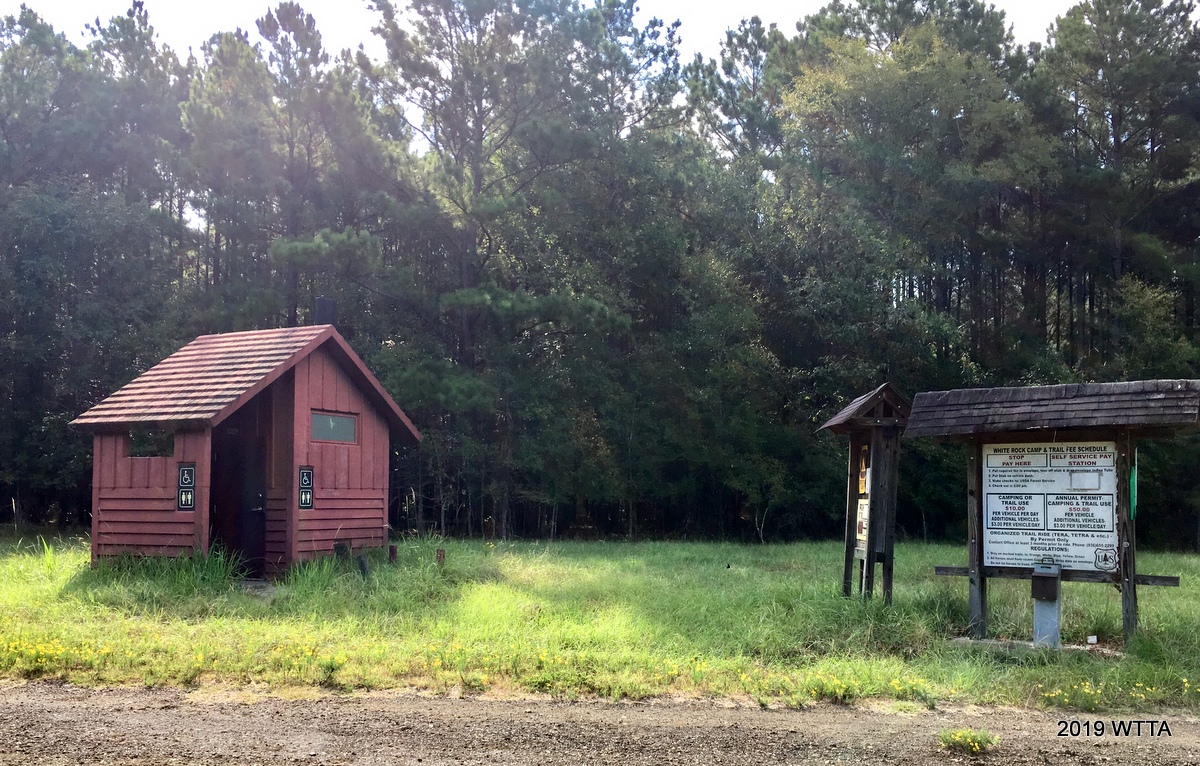
Parking and access area.
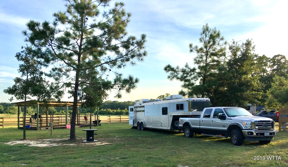
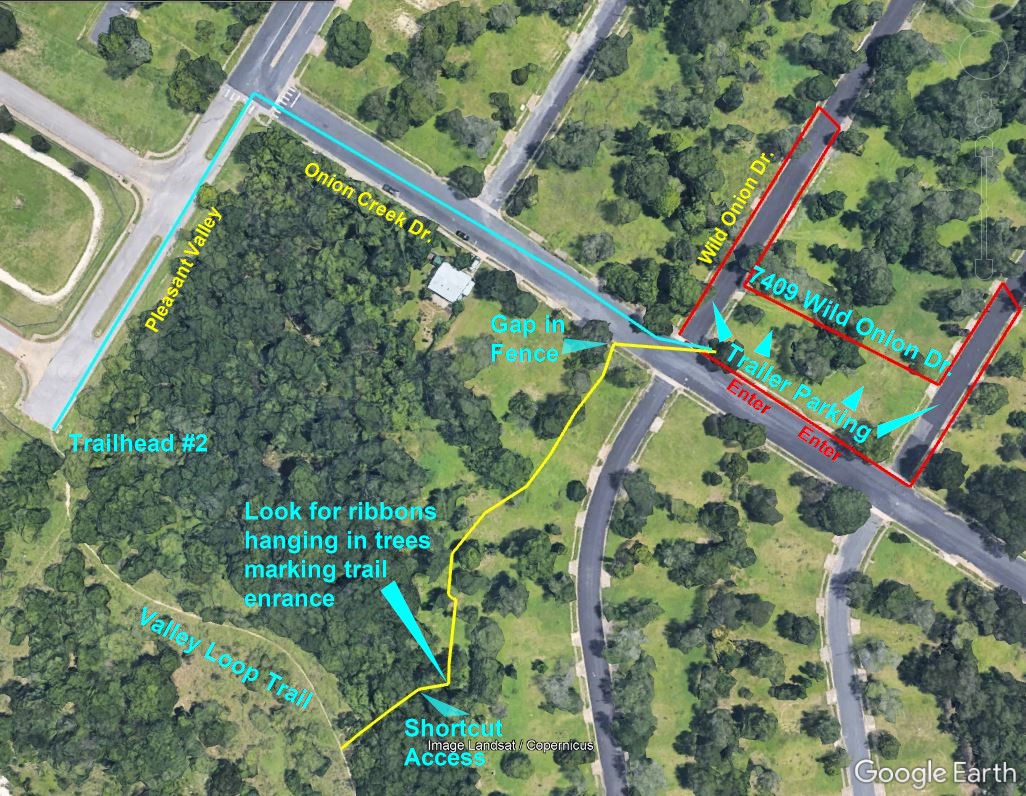
DirectionsDo not follow GPS directions to Onion Creek Metropolitan Park. Doing that will either take you to Trailhead #1 (Dog Park) or to the other side of the park which has no equestrian entrances.  To get the Equestrian access to the park, exit IH-35 onto William Cannon Dr. and head east passing the HEB on your right. Turn right on Pleasant Valley (you will see a Citco gas station on the corner).  Do not turn at the first left onto Onion Creek Drive (GPS will tell you to go there). That is Onion Creek North Metropolitan Park and has the Dog Park and Dog Park Path.  Continue down Pleasant Valley almost to the end.  You will see a dead end ahead of you. Turn left at the last street junction onto Onion Creek Drive.  Proceed two blocks to Wild Onion Dr.  The grassy area on the left between Wild Onion Dr. And Ladybug St. is where horse trailers park. Pull into the grass area using the driveway cutouts.  This parking area is the “unofficial” equestrian parking area.  You can also park curbside on Wild Onion and Ladybug to unload horses there. 


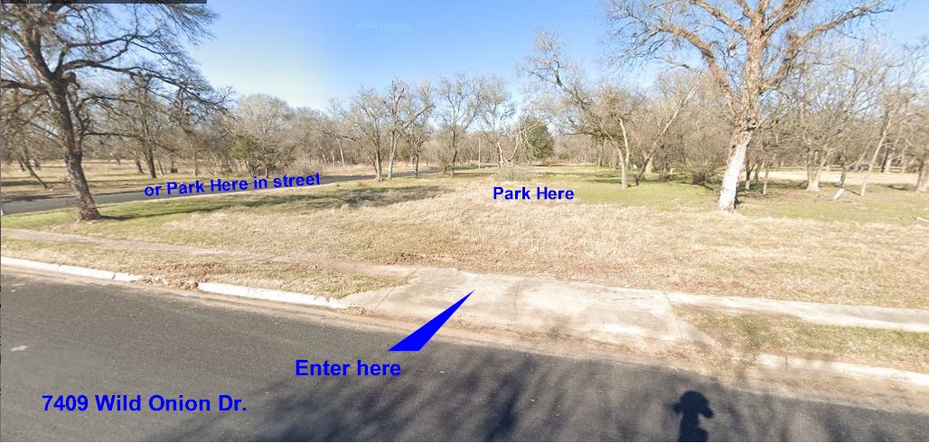
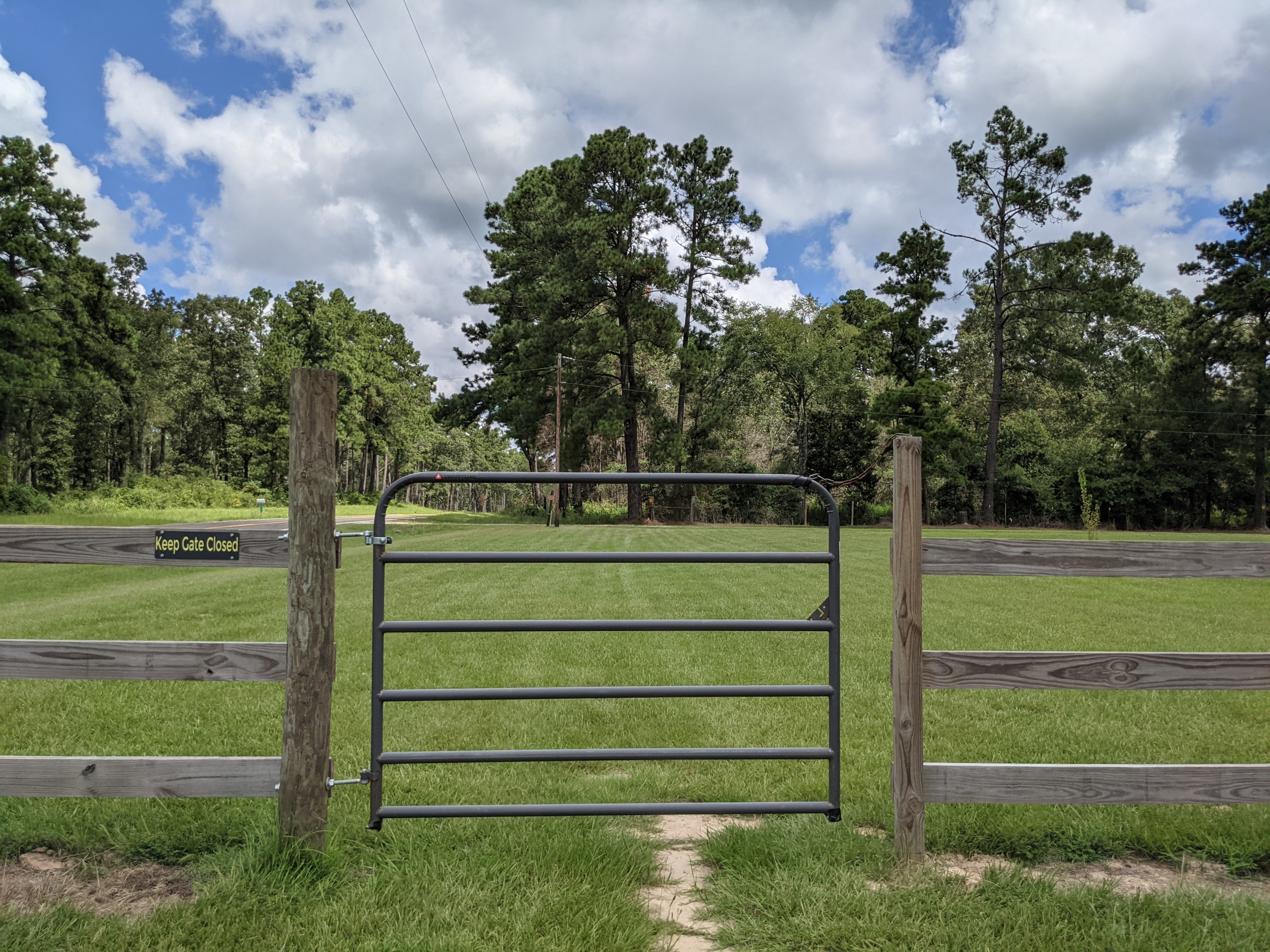
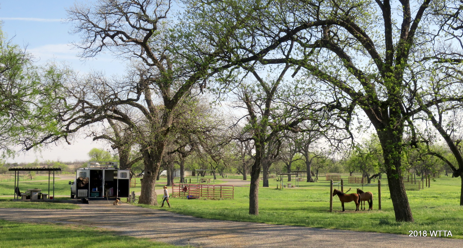
Equestrian Parking Area.


Trail Head #2:

Trail Head #2 From the Equestrian Parking area: 7409 Wild Onion Dr. (See Parking and Trail Access Photo):

There are two ways to access the horse trails:

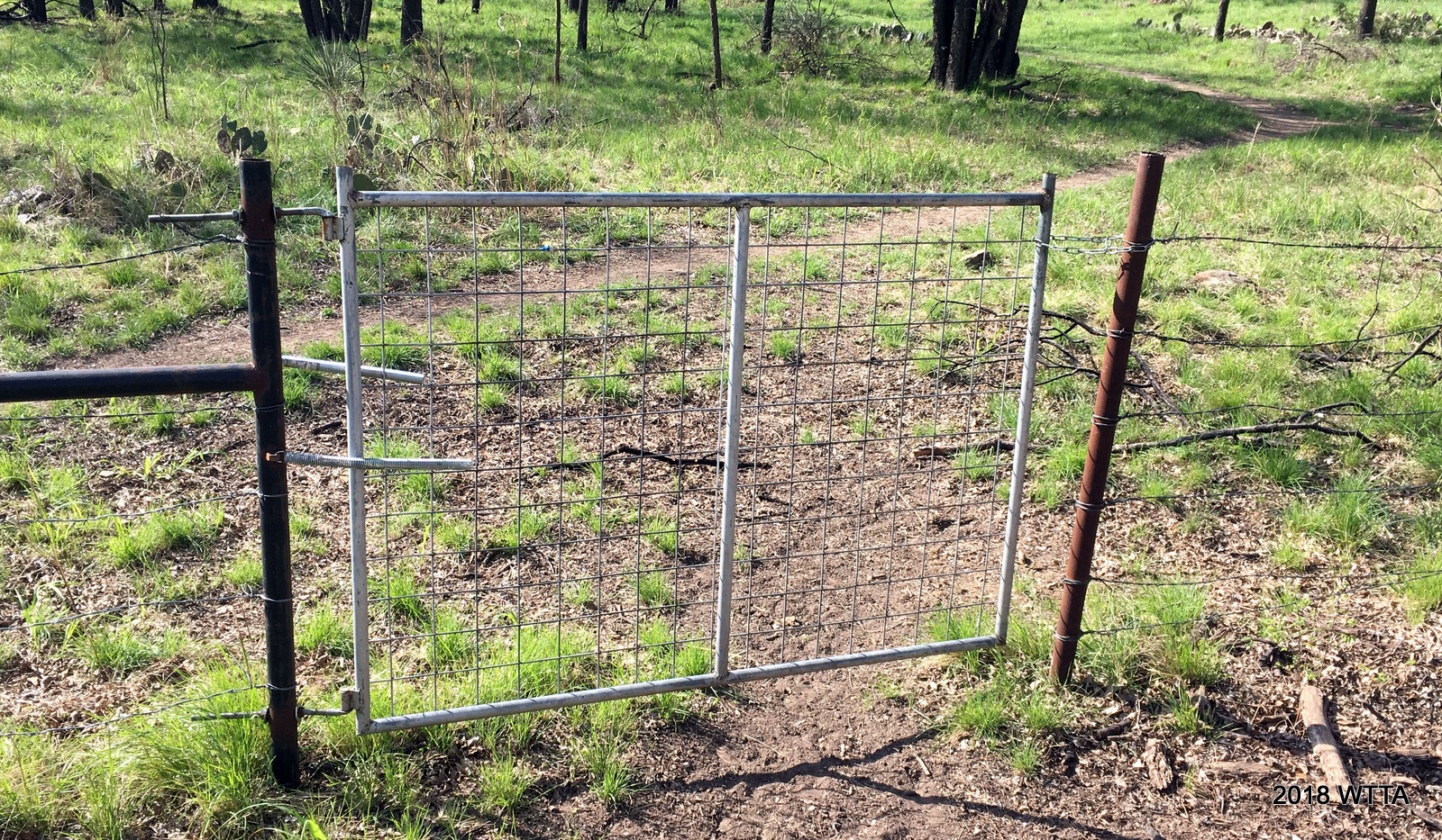
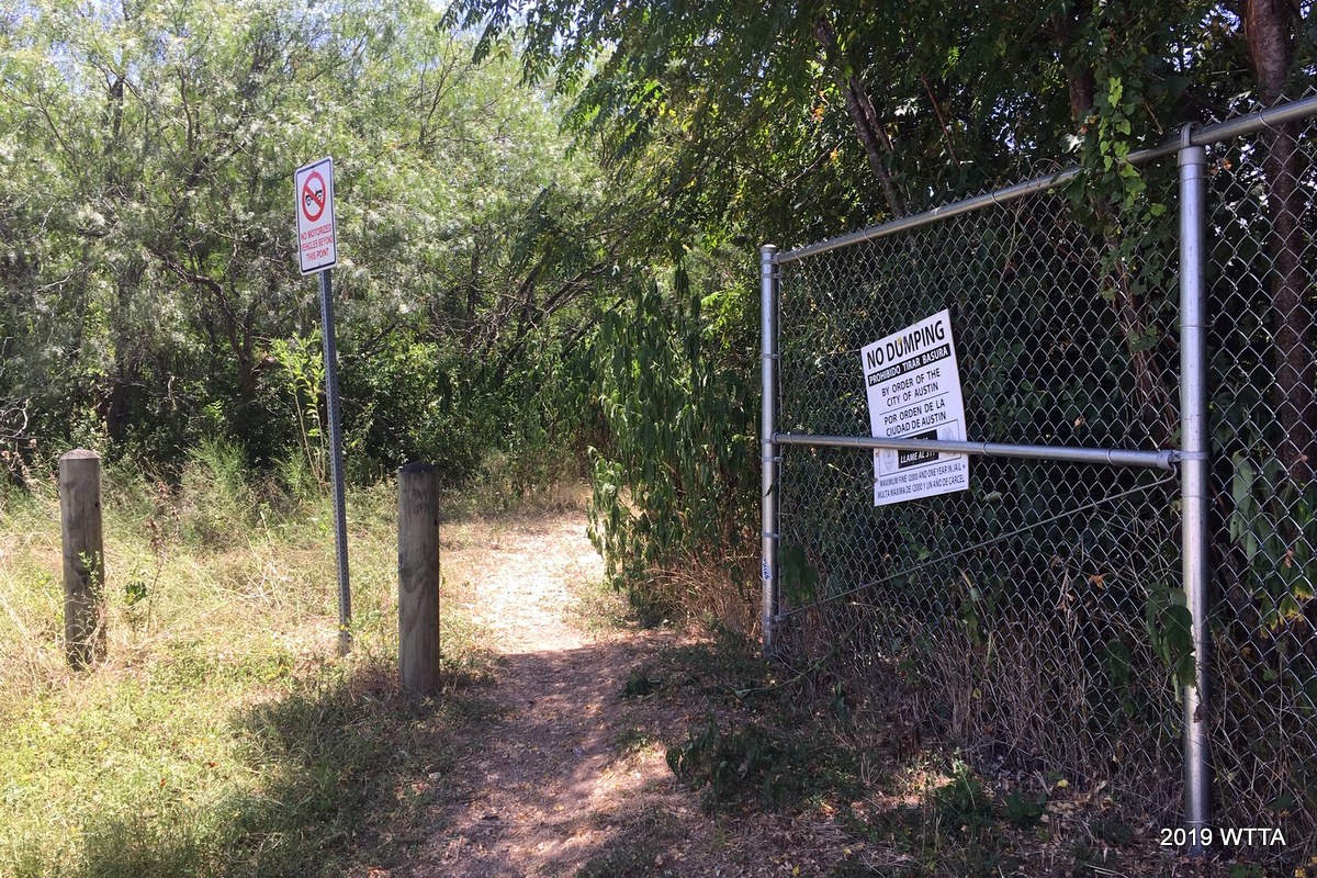
  1. (Best choice) Across the street from the parking is a cable/post fence.  At the end of the fence (near the blue house) is a gap in the fence.  Enter from there.  Follow the edge of the woods back 140 yards to a clump of large trees, look for some ribbons hanging from branches to mark the trail entrance, and you will see a path to the right.  Turn on the path and take the shortcut to Valley Loop Trail (Trailhead #2).  Turn left and follow that trail down to where it connects to the Dog Park Path.  Turn right, go a short distance and you will reach Creek Crossing #2.  Across the creek you will see the trail that leads to the riding area and trails.
  1. (Requires riding in the road) From the parking area, turn right and go back to Pleasant Valley, then turn left towards the dead end.  At the corner of the end of the street you can see the Trailhead #2.  This is Valley Loop Trail.  When following the trail, you will find it very shortly splits at one point…stay to the left of the split. Continue down the trail following the instructions shown in #1 above.


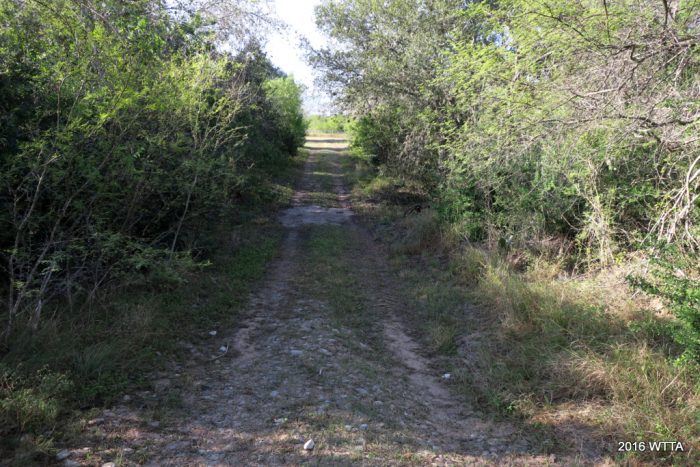
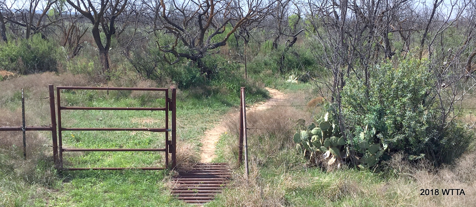
Trail entrance off the road / dead end area.


Mileage: approximately 12 or more miles, 550 acres of riding area.

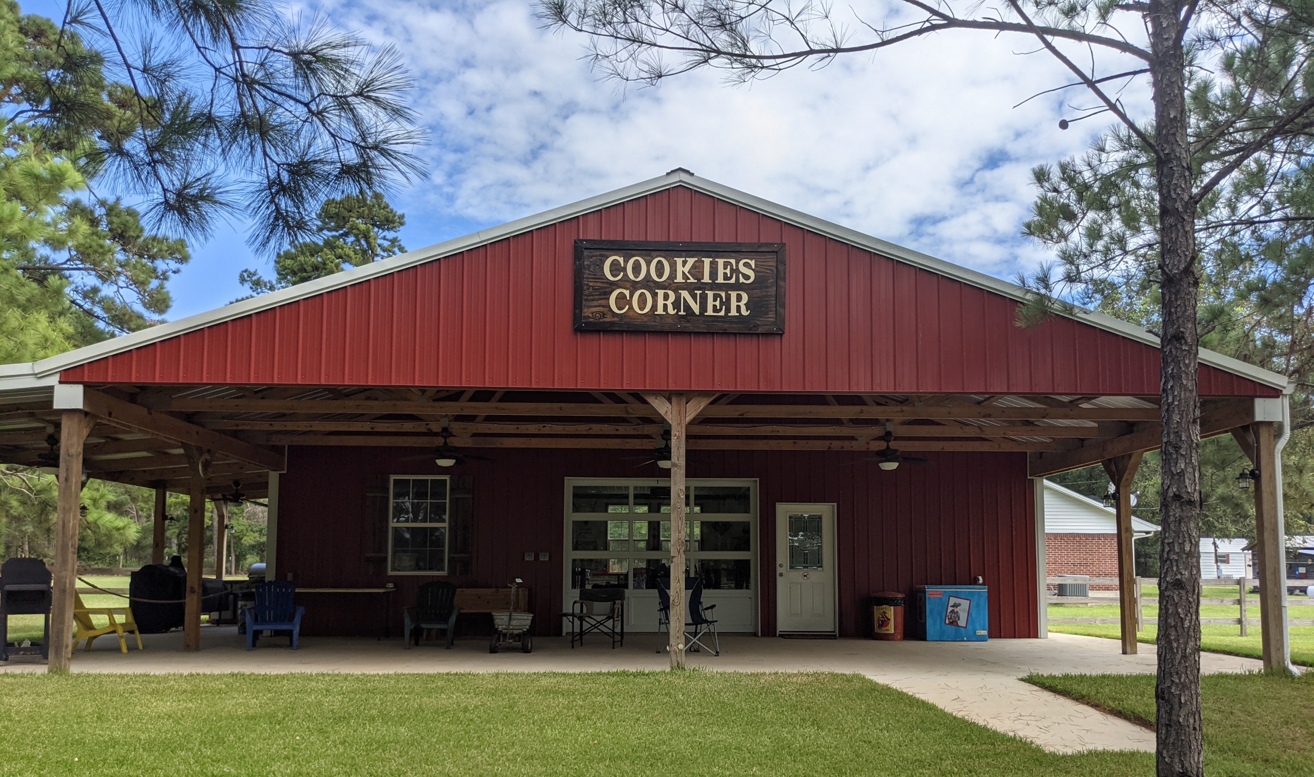
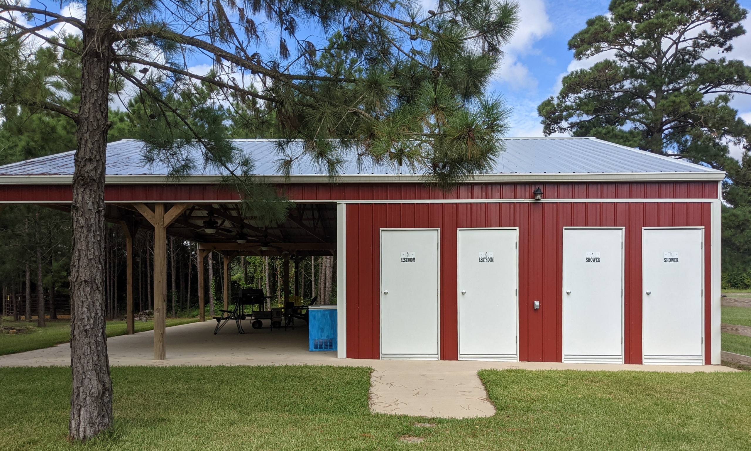
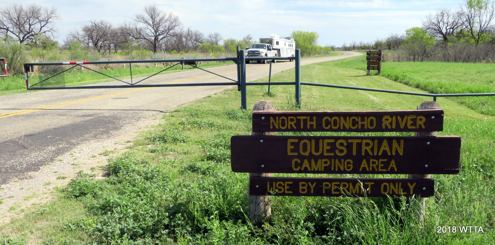
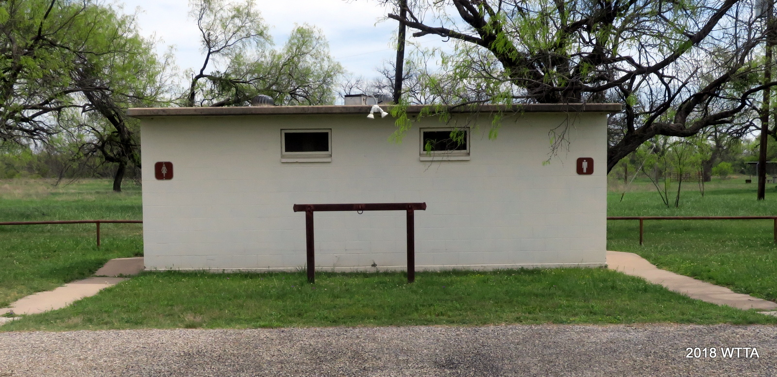
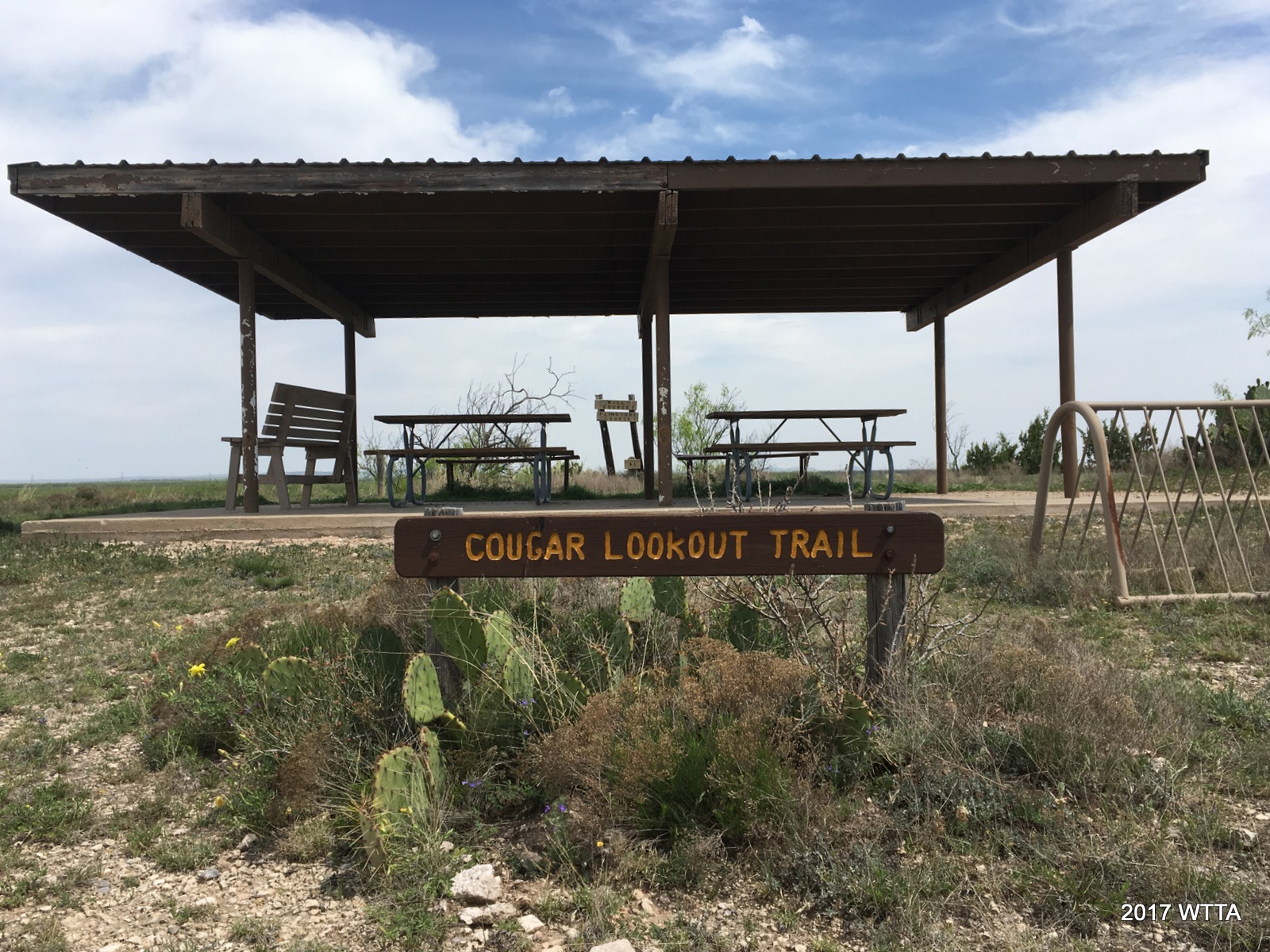
Facilities: None (however, the dog park does have porta potties and picnic tables).

Overnight Camping: None
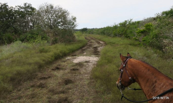
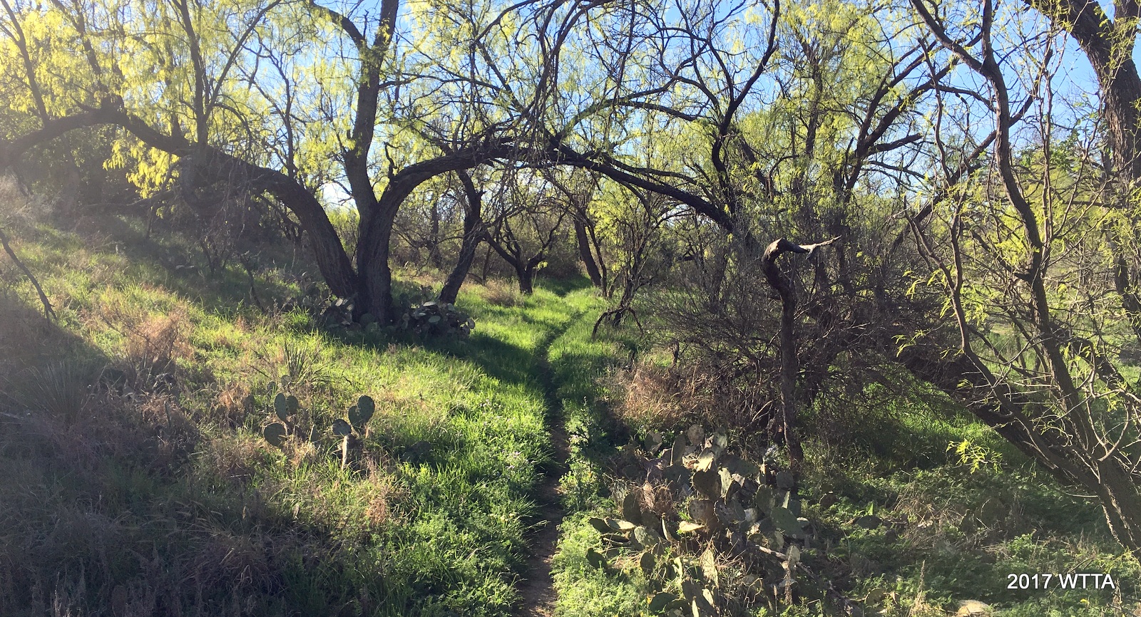
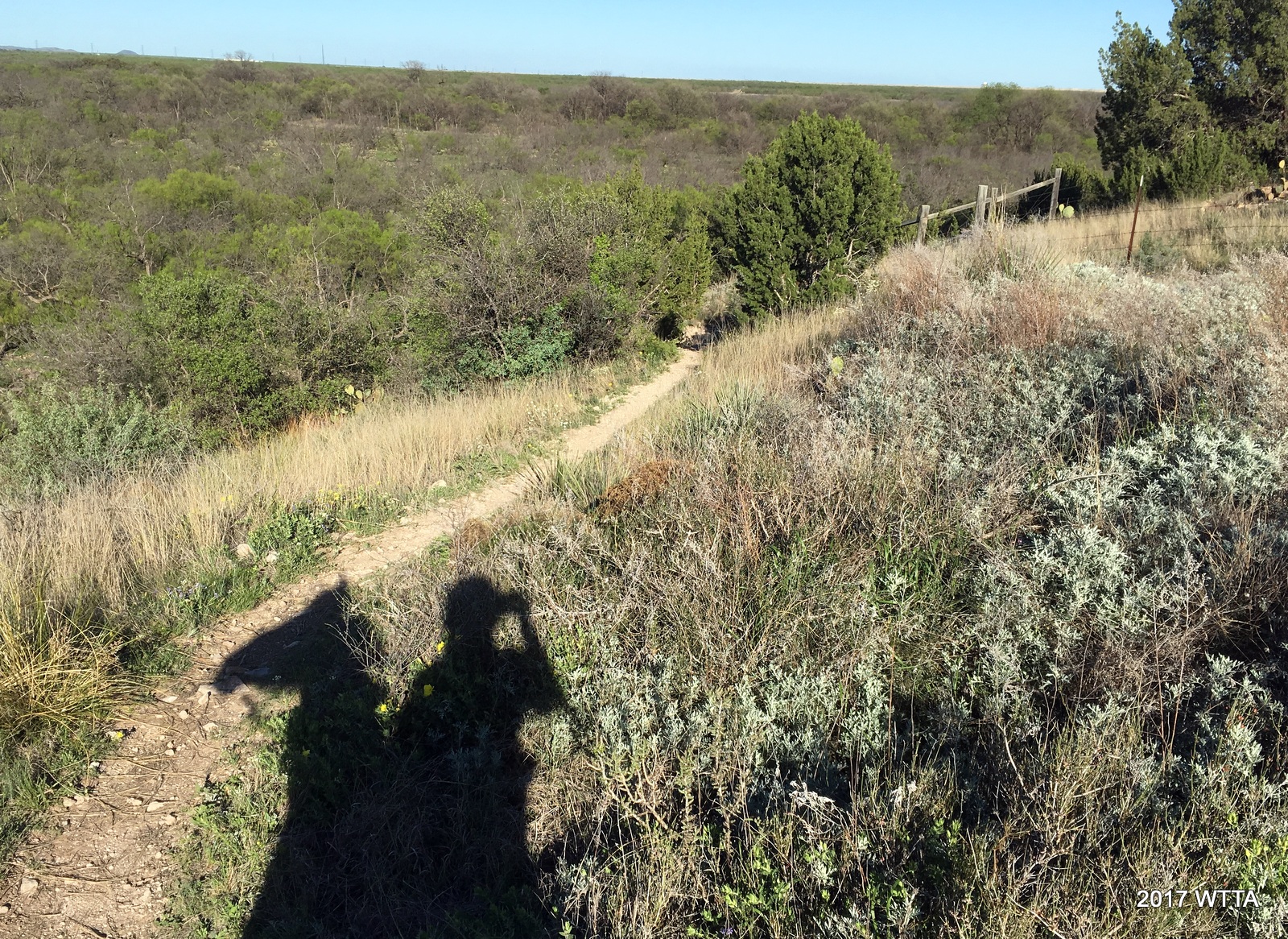
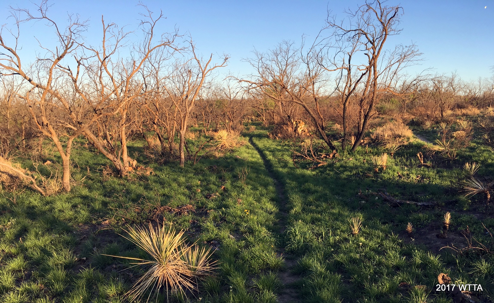
TerrainMostly flat, wooded, with the majority of trails being tree covered and shaded, trails are packed dirt with no rocks other than an occasional patches of small gravel.

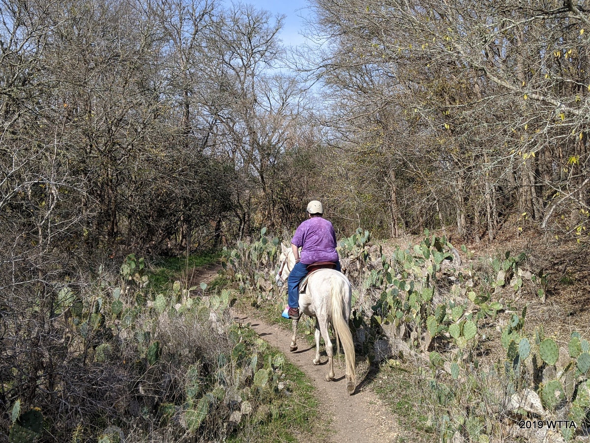
Deb Demers on Maya heading down Jewel Trail.

Cost: None

Trail Users: Hikers, bicyclist, horseback riders.  No motorized vehicles allowed.

Dogs: Allowed on Leash Only.  Dogs can be off leash only in the dog park area north of the creek, not on the trails south of the creek. 

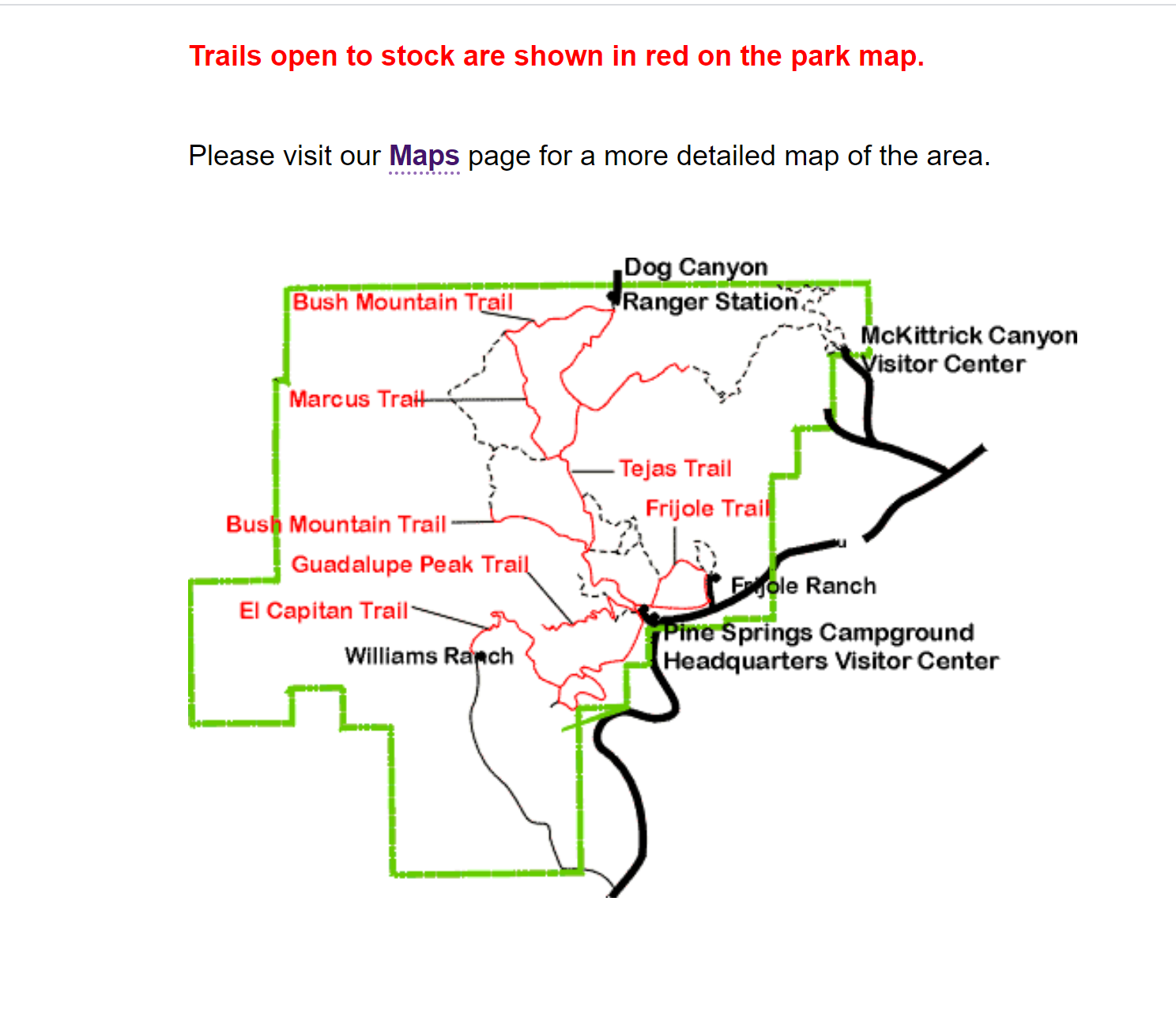
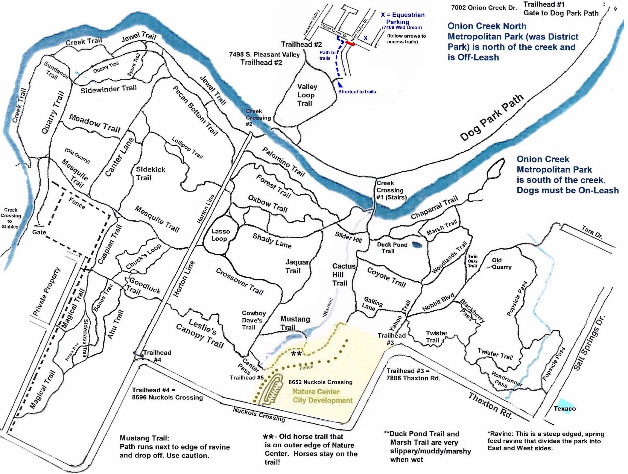
Trail Map:  The trail map is constantly being updated and can be found in the files section of that Friend of Onion Creek Facebook group.

Description:

The park is essentially divided into four sections.  The north section is Onion Creek North Metropolitan  Park and is maintained by the city with pavilions, picnic tables, restrooms, playground, sidewalks, and a Dog Park.  This park is Off-Leash. Although you can ride horses in this area, it’s not recommended because of the number of loose dogs.  Onion Creek divides the north park from the south park. 


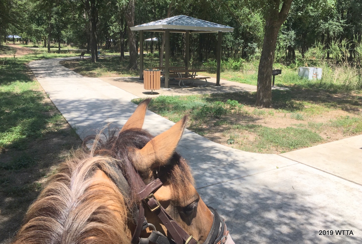
Onion Creek North Metropolitan Park (North of the creek) is the dog park area.   Angel is checking out the new to us covered picnic tables, BBQ grills, and side walks. There are also porta potties in this area of the park. However, dogs can go off leash here and it is not recommended you ride in these areas. Also this is new to us, the amenities have been here for several years now.


The south park is called Onion Creek Metropolitan Park and is home to all the trails for hiking, biking, and horse back riding.  This park is On-Leash Only.  Please be warned that a lot of dog owners let their dogs run loose in the park, however the vast majority of the dog owners are very courteous to bikers and riders.  They will hold their dogs and get off the trail. 


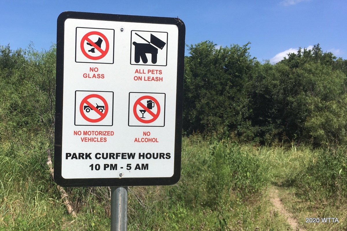
Please abide by trail user rules. Please note standard trail etiquette, everyone always yields to the horses. Please stop and move off the trail to allow the horse(s) to pass. This is standard procedure, but not all persons are always aware of this. Thank You!


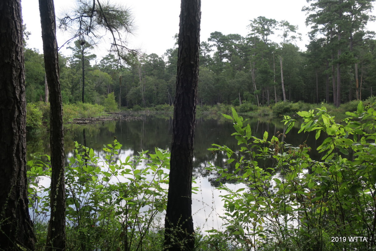
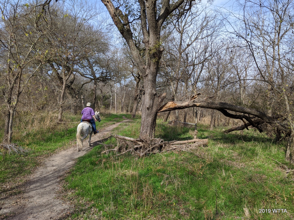
The park is further divided by a spring fed ravine.  It divides the southern park into East and West sides.  The east side is smaller and about half of its trails are open to the sun. The majority of the trails are on the West side. Traveling to and from the East/West sides of the park is only accessible from 4 specific spots: Creek Crossing #1, Slider Hill, Mustang Trail, and Center Pass Trail. 
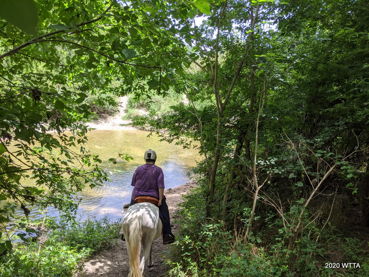
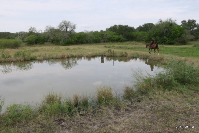
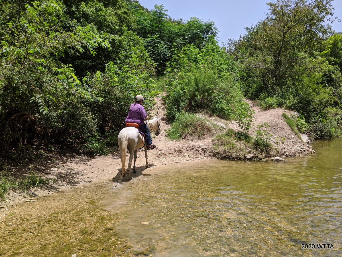
 

Creek crossing #2.


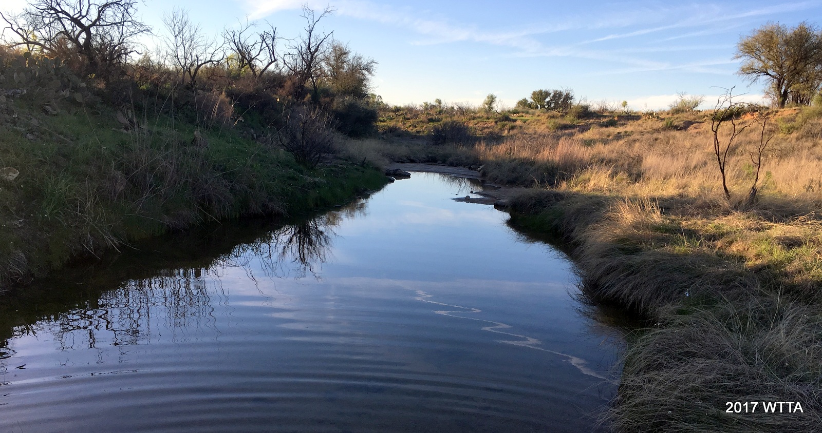
The majority of trails are wooded with thick vegetation. This provides fantastic shade during Texas summer heat. During springtime, the trails are surrounded by a vast array of wildflowers. There are two creek crossings: Creek Crossing #1 & #2.  Creek Crossing #1 is mainly used by hikers coming from the Dog park.  It is a steep descent with wood stairs. 


Creek Crossing #1, mainly used by hikers coming from the Dog park, has a steep descent with wood stairs. These steps were created by a City Youth Team and are made with untreated lumber so that as the wood deteriorates over time, it will not release toxins into the water. They will be replaced as needed.


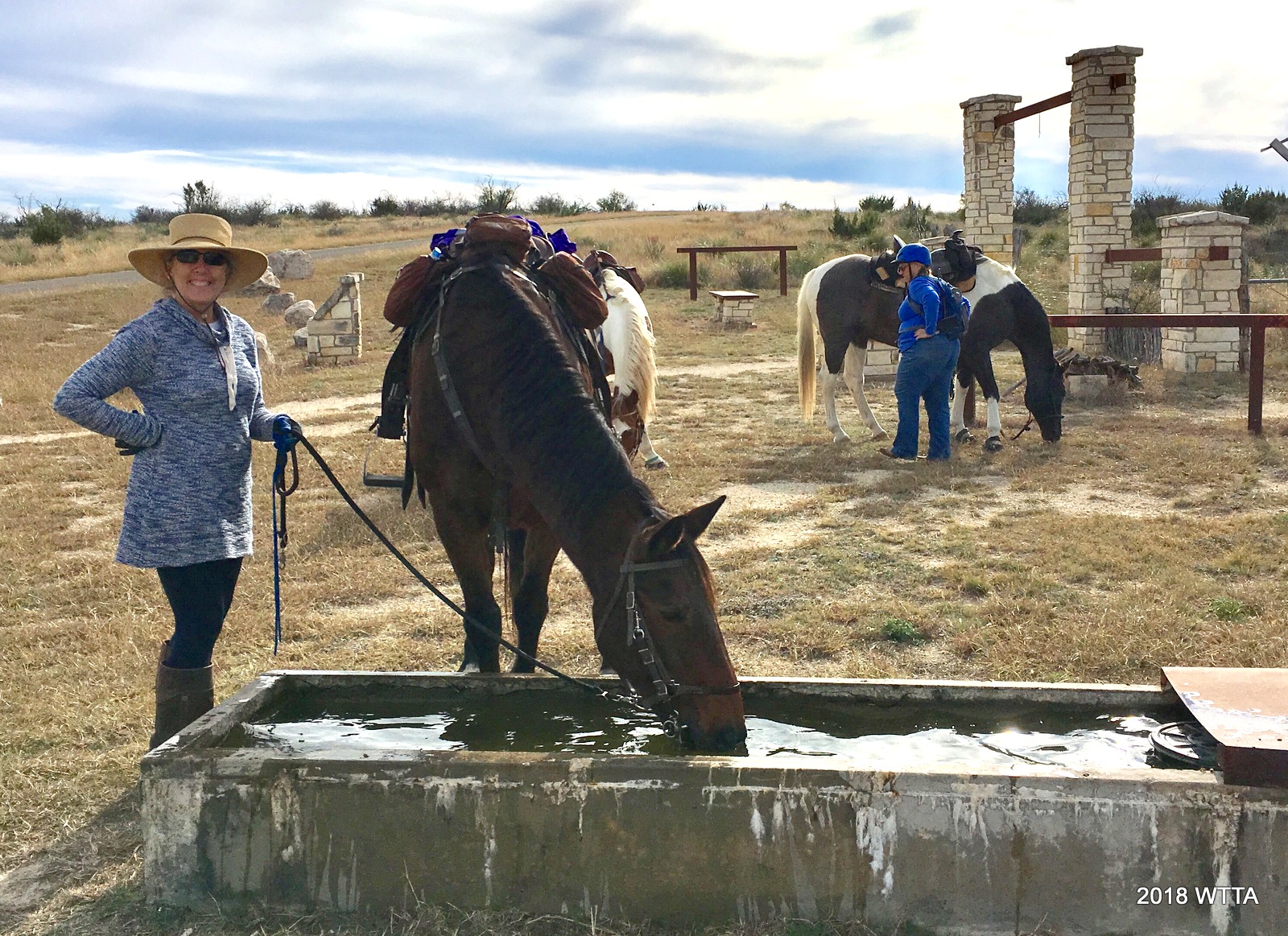
Although it is occasionally used by horses, most horse crossings are done at Creek Crossing #2.   Crossing #1 has the steepest descents/ascents.  Not overly hard but if there has been rain lately, they will be too muddy to attempt.  The crossing’s access must be dry or mostly dry to use them.  Crossing #2 is less steep – any easy incline, but it, too, is too slippery to use if it has rained.  The water at the crossings is four season so there is always water available for horses to drink. 


Creek crossing #2.


The creek bed is small gravel providing good footing. The creek is only 3-5 inches deep at the crossings but does deepen to about thigh deep on either sides.  Both creek crossings are favorite places for dogs to play and swim.  It’s quite common to find families out their with their kids swimming so be aware that floaties maybe used too and may cause some horses to spook.


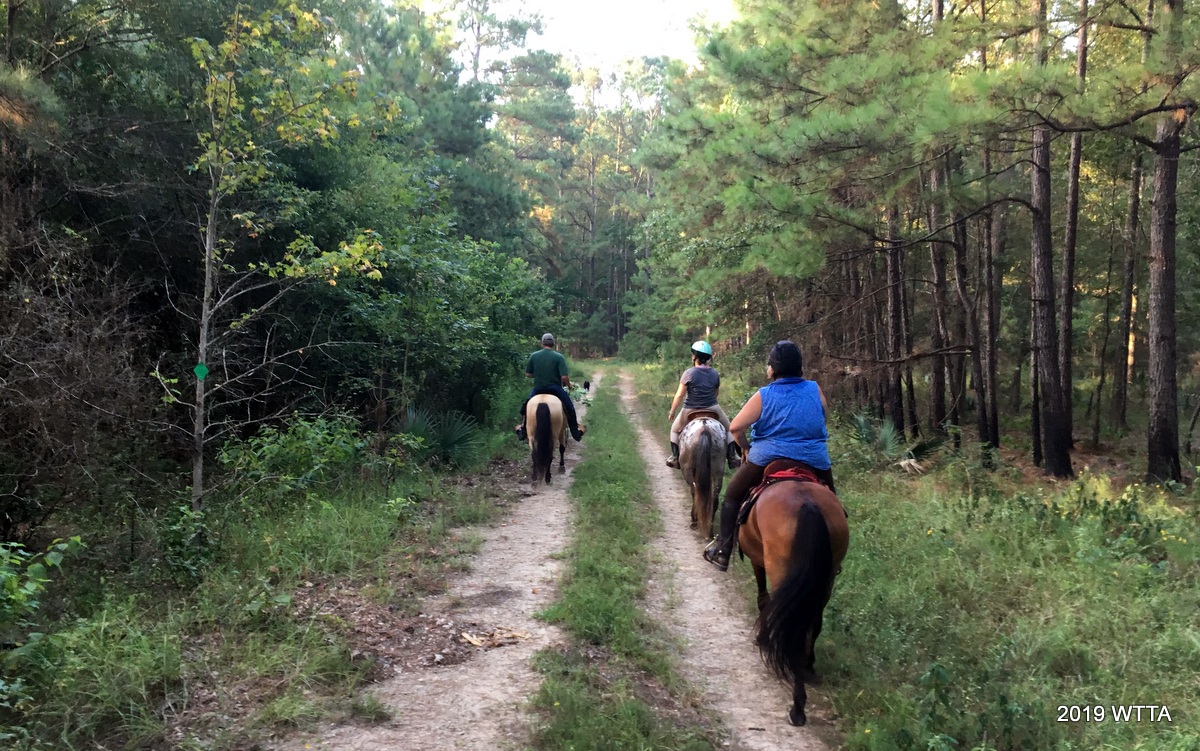
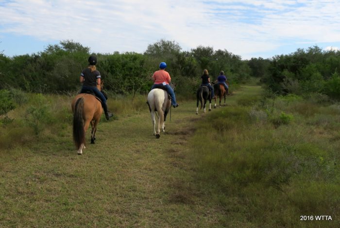
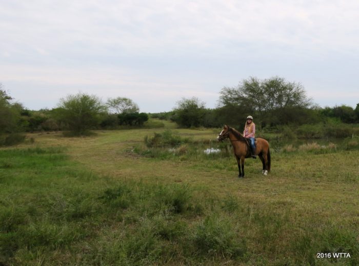
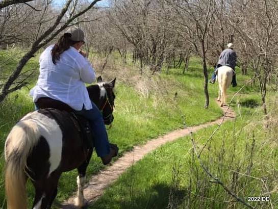
Deb and Caroline riding down Horton Lane.


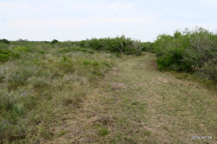
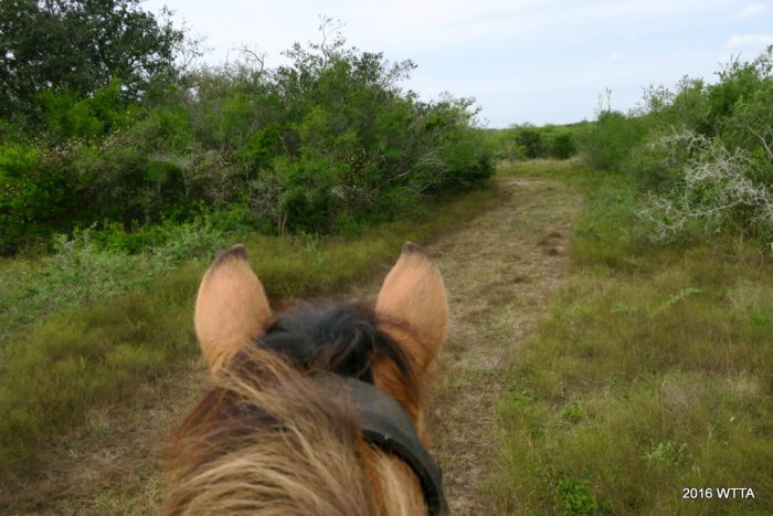
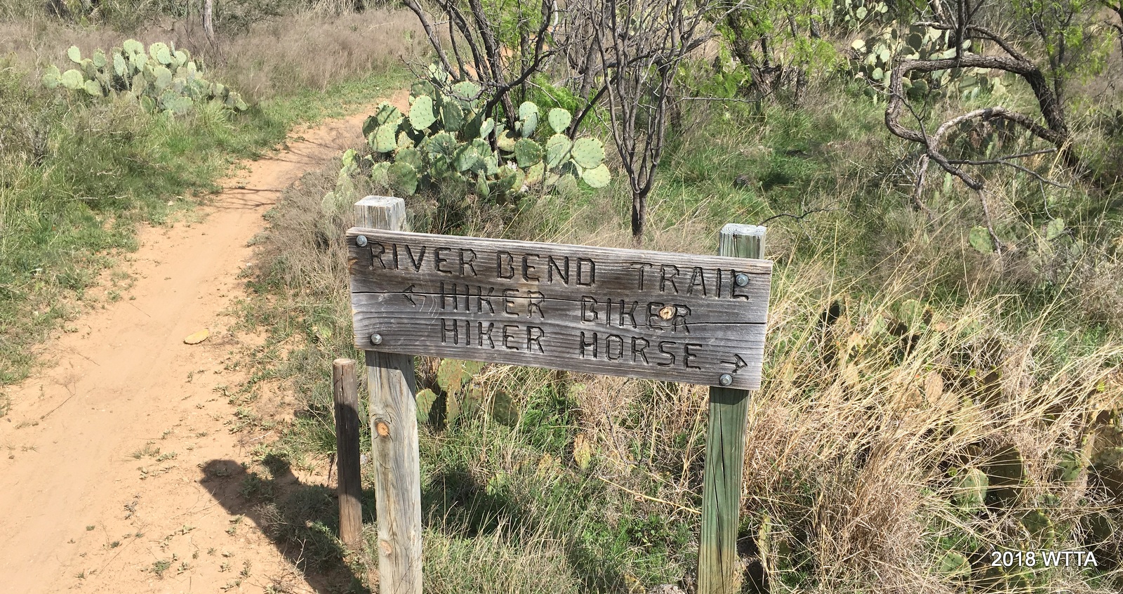
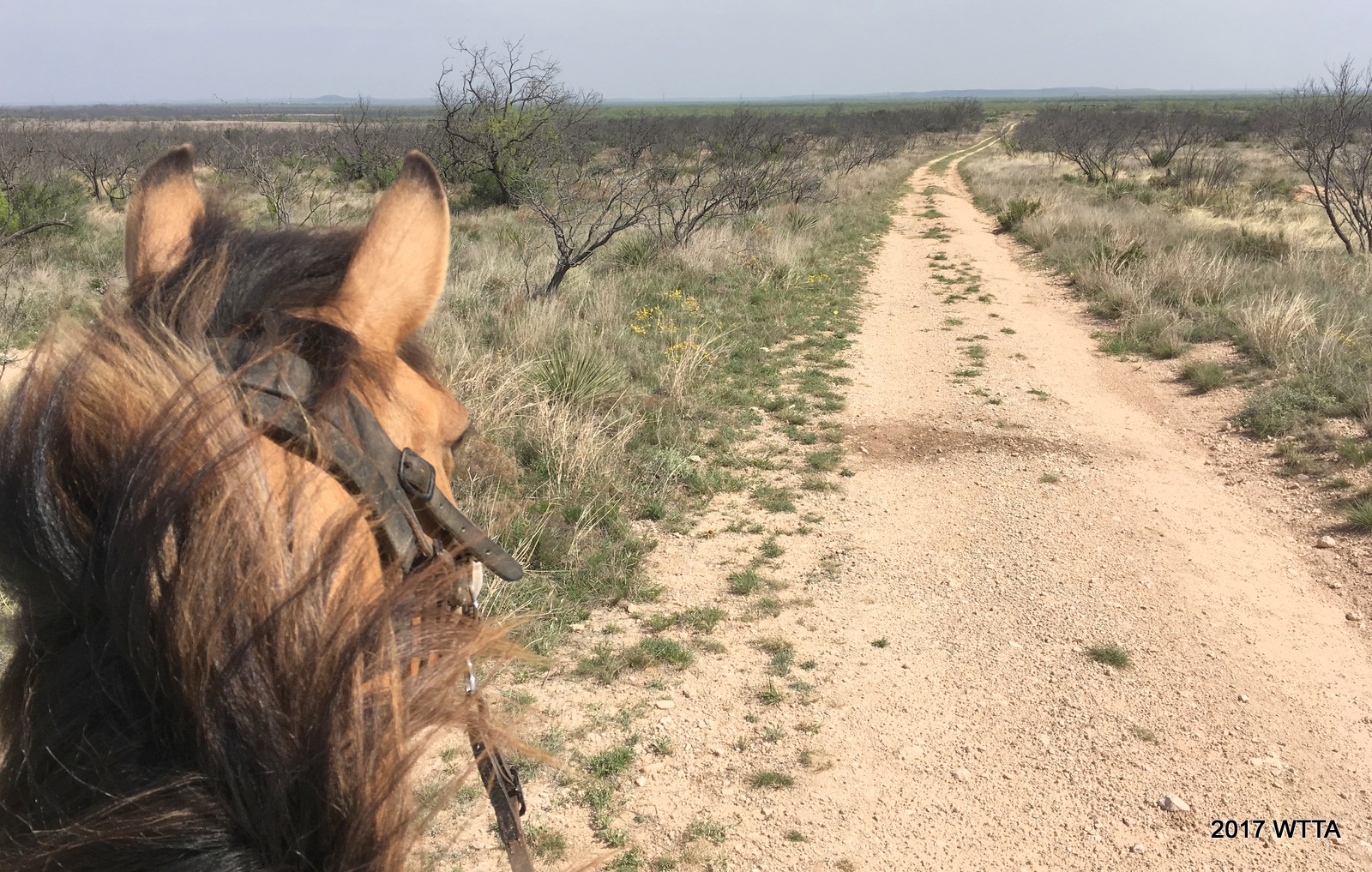
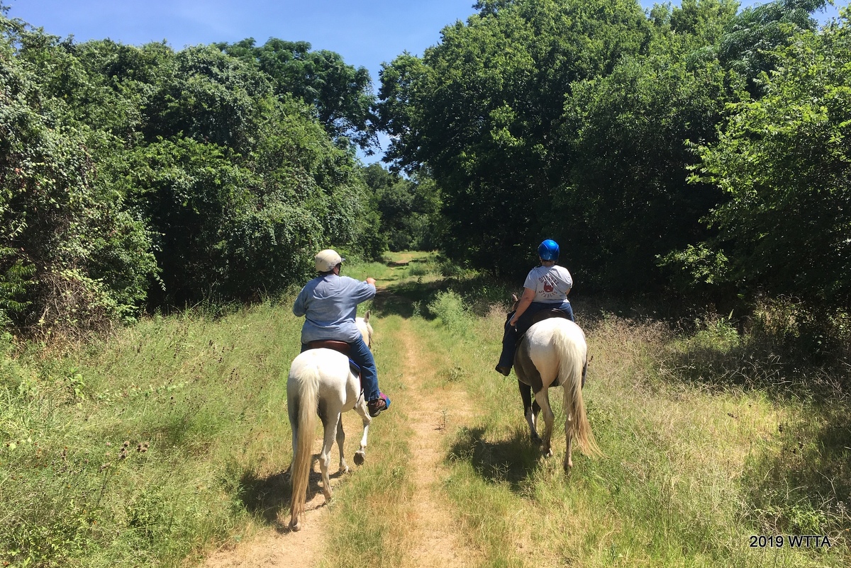
Outside of the creek crossings, most of the land is flat with some mild inclines. The trails are flat, packed dirt with occasional small gravel patches in a few spots. Trails are marked with wood signs giving the names of each trail at the trail junctions. Look up – the signs are in the trees.  Since this is a city park, please stay on the trails – do not wander off the trails.


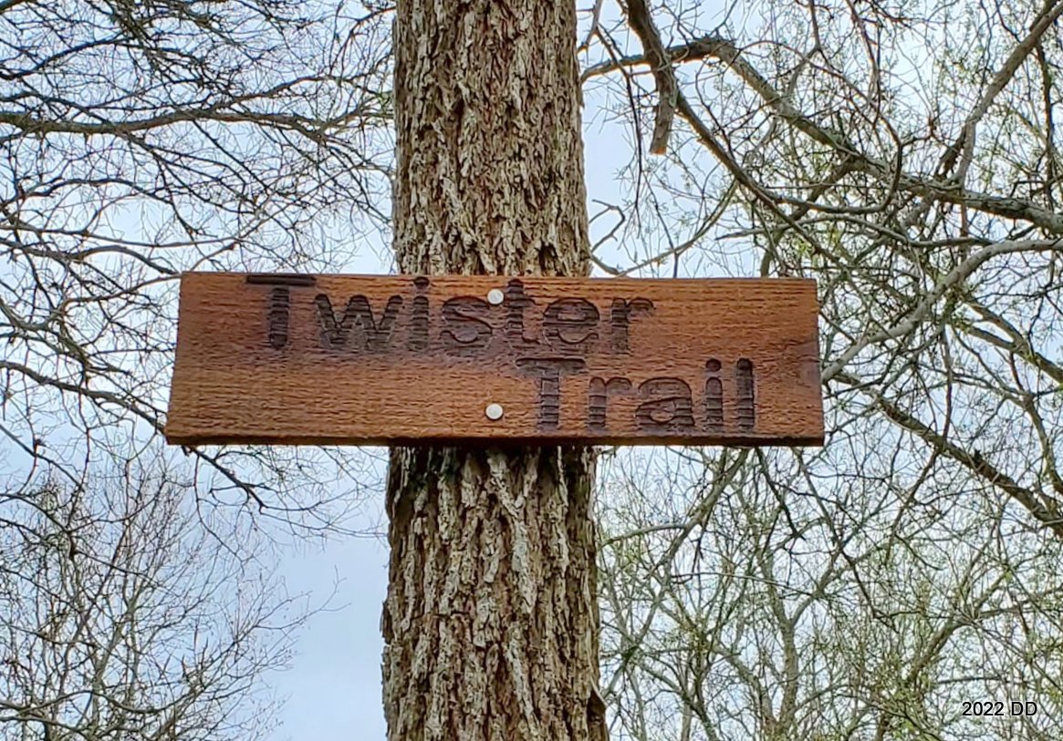
Signs are mounted at trail junctions helping park users navigate through Onion Creek Metropolitan Park.

There are historic relics, homestead ruins, and protected areas within the park.  Do not remove objects,  materials, or plants from the park. Do not dump or leave trash.  The trails were created by and are maintained by local volunteers from the nearby stables and also by fellow hikers.  We do regular trail maintenance such as mowing trails, trimming overgrowth, picking up trash, and clearing out fallen trees/branches.  Help with these volunteer projects are greatly appreciated!


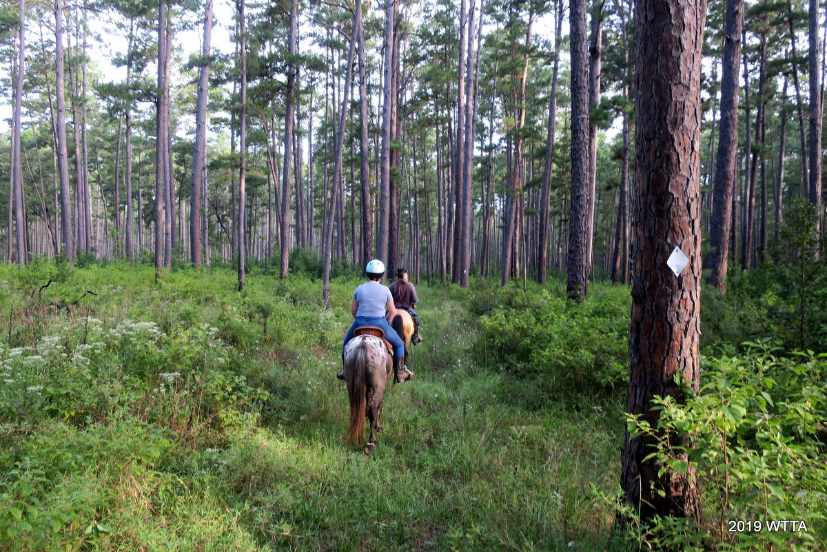
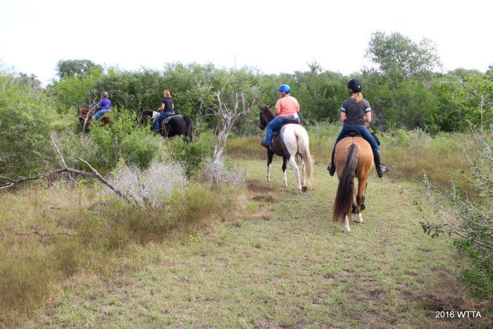
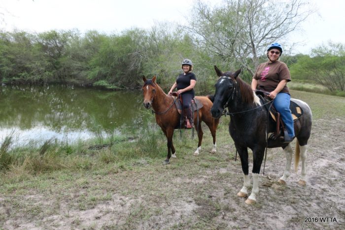
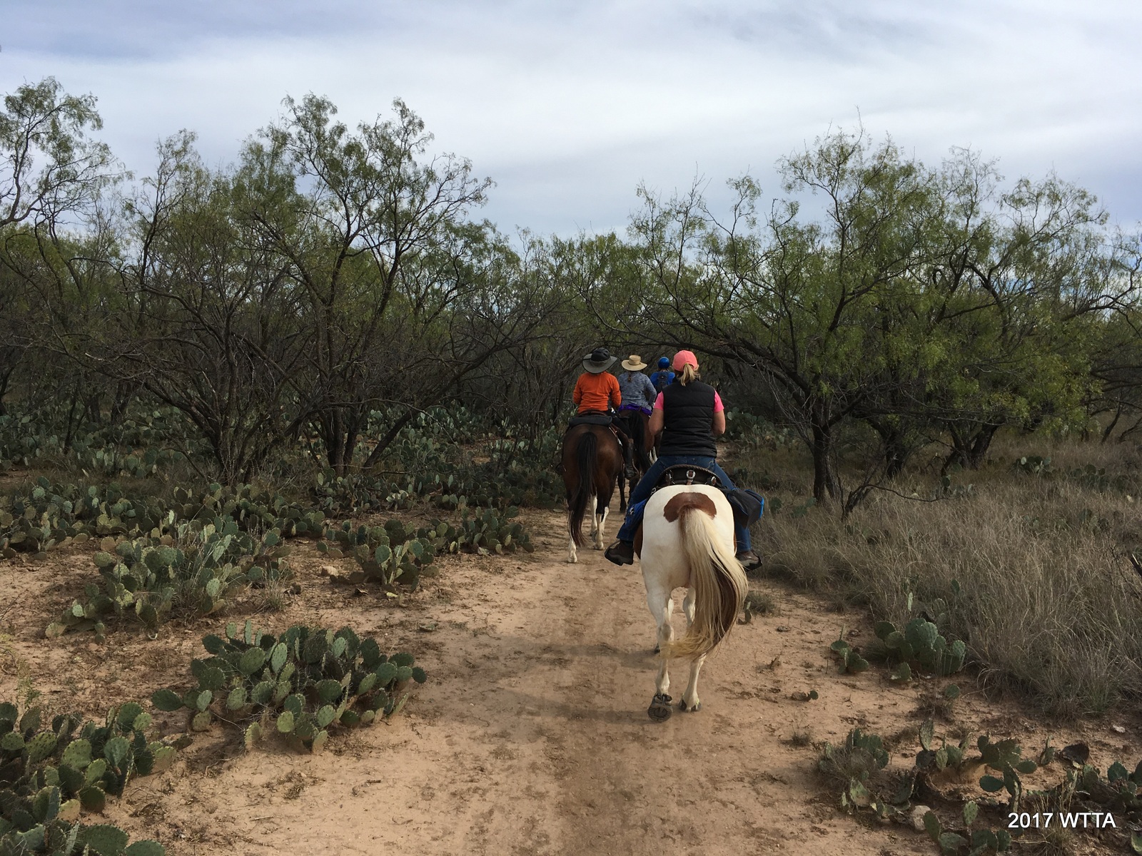
Deb leading a group of riders on Sidewinder Trail.


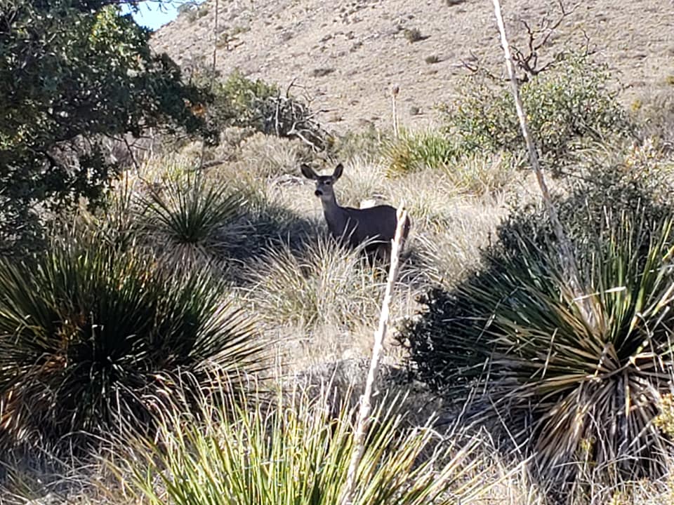
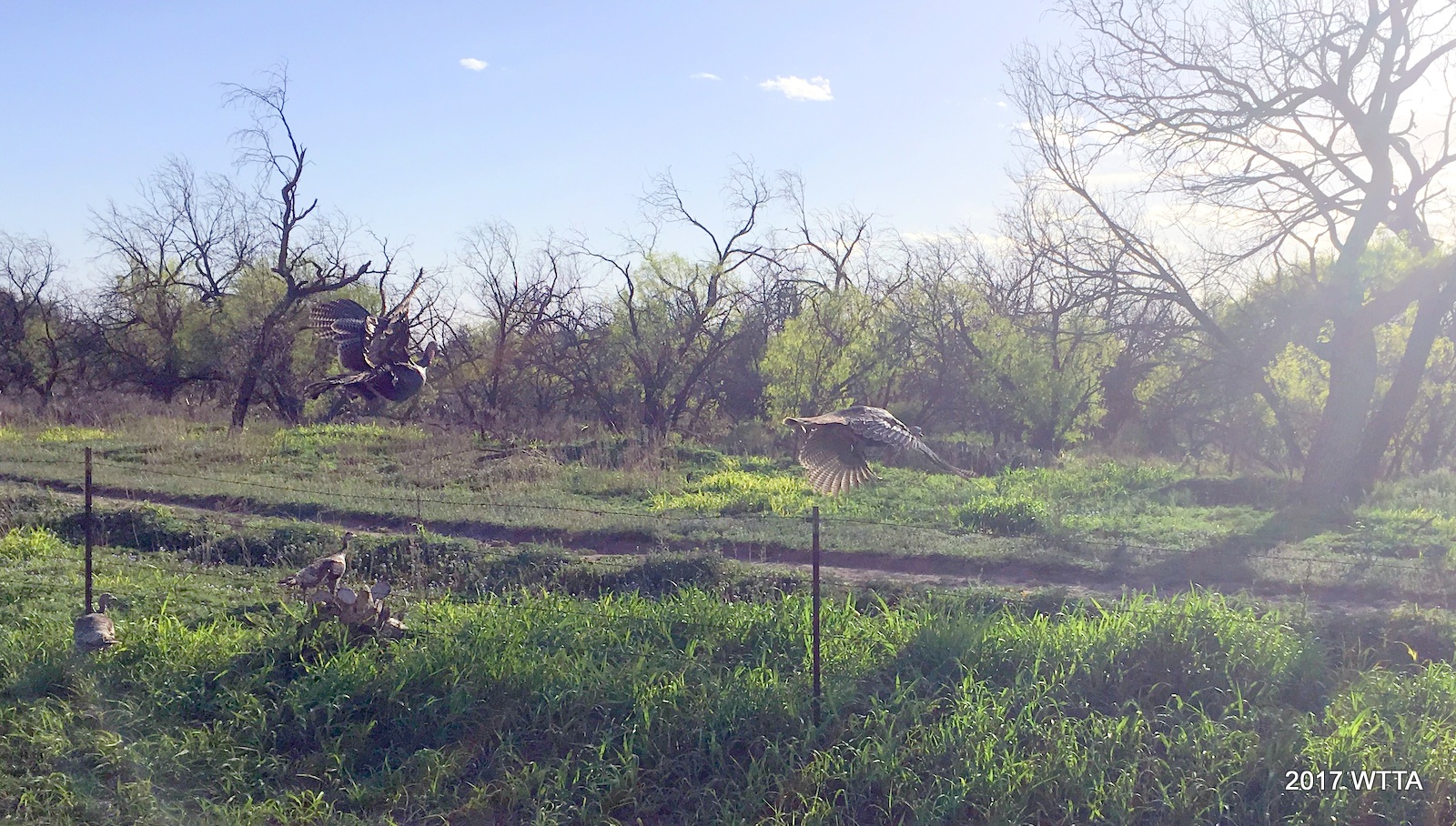
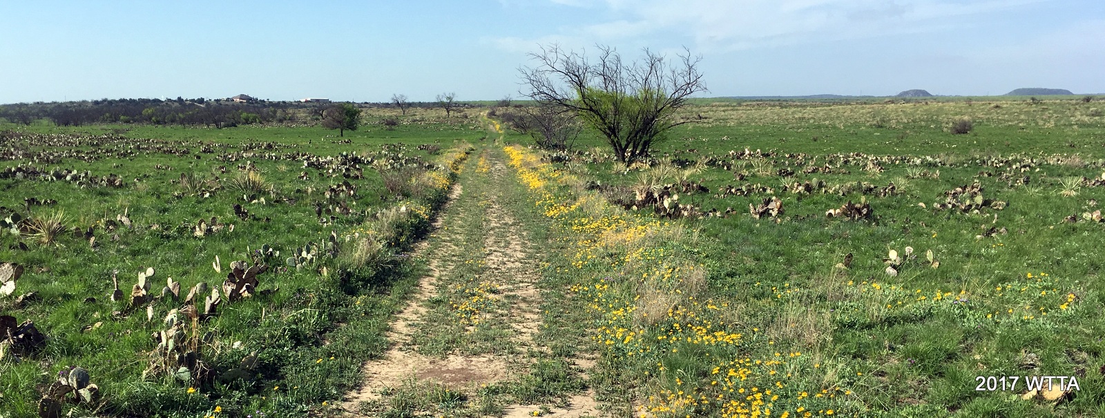
There are miles and miles of trails and you can get in hours of riding without repeating trails.  Since the trails all interconnect and loop around, you can easily get from one area to another. Because of the amount of trails and the dense trees, you can ride there for hours and only occasionally run into another person. Sometimes, you will feel like you have the whole park all by yourself! Quite often you will see wildlife: deer, birds, squirrels plus an occasional armadillo or possum.  Saw a fox one time! 


Old Horse Trail, following along the Nature Center pathway, between Gaiting Lane and Center Pass. Please stay on the trail and off the Nature Center walking path.


This park borders a few boarding facilities, private properties, and some residential neighborhoods so please be aware of the park boundaries and do not go onto private property. Motor vehicles are not allowed in the park.  If you see motorcycles in the park, call 311 and also call to report dumping.  The Facebook group:  “Friends of Onion Creek”  work to help maintain the park for fellow users. 


Cactus Hill trail on the east side of the park.


The trail map is constantly being updated and can be found in the files section of that Facebook group.  In addition, the Trailforks app has been updated to include a map of all the trails. Be aware that most phone mapping apps do NOT show the trails or only show a few of them.  Google Maps and All Trails only show a few, outdated trails.  Until you become familiar with the trails, it’s best to take a copy of the trail map with you or to use Trailforks program.


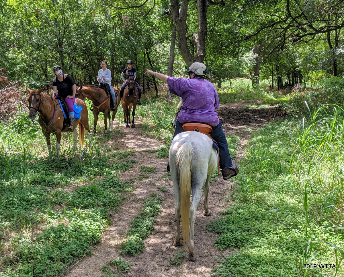
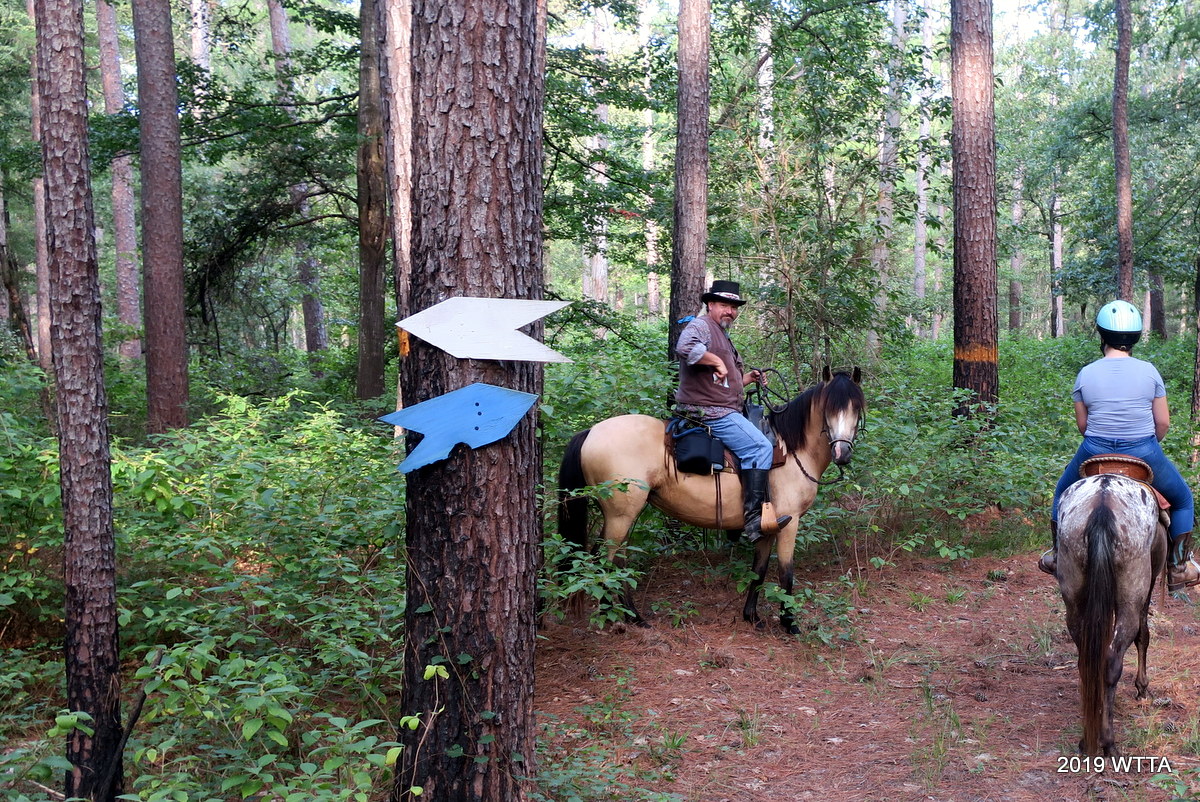
Deb Demers giving fellow riders some directional guidance at Onion Creek.


The Trailforks App is constantly updated with the latest new or changed trails.  For many examples of what the trails look like, go to  “debdemer” on YouTube  and you will find lots of trail ride videos there. This park is a fantastic place to ride! 


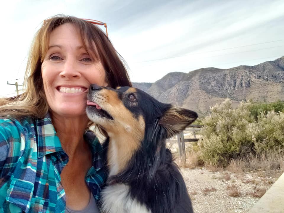
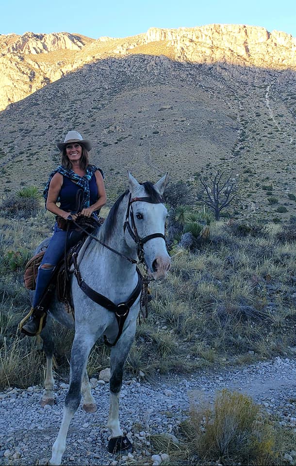
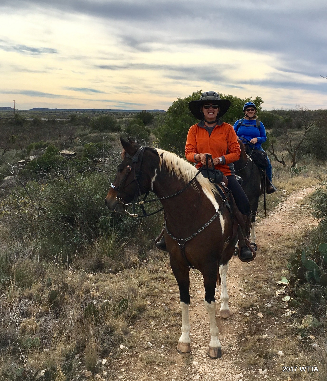
Onion Creek trail update contributor, Deb Demers, enjoying Onion Creek aboard her horse Maya. Deb is very knowledgeable of the parks history and trails. Deb has contributed many many hours volunteering at this park clearing trails, making new trails, updating the map, and putting up trail signs. Thank you Deb! Deb often takes video documentation of her trail rides which can be viewed here: “debdemer” on YouTube


Continue reading

T bar S Horse Camp, Kennard TX

Originally published March 30, 2019 — recently updated September 07, 2021

N.E.T.A.S.A (Northeast Texas and Surrounding Area), an American Indian Horse Registry trail riding group, enjoyed T Bar S for at least their 3rd visit on Aug. 29, 2021. Left to right, Zack on Dragon, Patti on Dakota, and Curtis on Rain Man.

Ride beneath East Texas Woodlands deep in the shade of Davy Crockett National Forest. Discover the Piney Creek Horse Trail system, over 50 miles of sandy, gently rolling, well developed horse trails between Crockett and Lufkin.   If you want to horse around in comfort, skip roughing it for a change and stay at T Bar S… for both you and your horse’s pleasure.

Location:
T bar S Horse Camp in the Davy Crockett National Forest
6387 FM2781
Kennard, TX 75847


Directions: from Huntsville, travel on TX-19 approximately 20 miles to Trinity. In Trinity turn RIGHT on TX-94 (the 2nd traffic signal) towards Groveton. Travel 16 miles and TX-94 ends/merges with Hwy 287, turn LEFT towards Crockett. Go approximately 8 miles to Pennington and turn RIGHT on FM2781, there is a Spitfire Grill/Gas Station at the intersection. In Pennington make the RIGHT (just past the Church) and then a LEFT (just past Avery’s Welding & Feed) to stay on FM2781 towards Kennard. T bar S is then 6 miles ahead, just past Baker Springs, on the RIGHT.

or

From Crockett or Nacogdoches, travel on TX-7 to Kennard, turn SOUTH at the flashing yellow light which is FM2781. Go approximately 6 miles and T bar S is on the LEFT.

If you accidentally pass T bar S, you can continue on to either Kennard or Pennington to get turned back around.


T Bar S is easy to find and right off FM 2781.


Contact:
Tom & Stephanie Hanslik (owners)
Tbarshorsecamp@yahoo.com
(936) 655-3328 office
(832) 928-9584 cell / text


Creative bucket lanterns with the T Bar S logo can be turned on at your campsite.


T Bar S Horse Camp Website: https://tbarshorsecamp.com     This is a great website, user friendly and very informative with a facility map, pictures and details about each campsite, park/trail maps and lastly you can make reservations and a deposit via this website.

T Bar S Facebook Group

Hours: Open daily from 8am to 8pm

Overnight camping:
Equestrian overnight camping is allowed, with parking space available for day riders as well.

Campsite #2 has four covered pens and a lovely Oak tree for shade.


Pens for campsite #2 & #3.


Campsite #4 (picture from 2019) unfortunately has lost a few trees due to the 2021 freeze, however the pens are covered.

Facilities:

  • Enclosed air conditioned pavilion  with a front patio that has chairs, a barbeque grill and a freezer full of of ice bags for purchase
  • Restrooms and showers with AC and vents
  • 16 sites with 30 amp and two 50 amp electric and water hookups – see T Bar S website, as details about each campsite are described well with pictures of each site.
  • Two horse pens per site; several of the pens are covered. Horse pens are 12×12’ Priefert panels; most pens can be opened to 12×24 for those camping with one horse.


Cookies Corner air conditioned pavilion with patio and large garage type doors that can be opened up when the weather is nice. Oh and did I say there is a blue freezer full of bags of ice you can buy!  No more running into town to buy ice – cool.


Inside Cookies Corner.  We enjoyed playing dominos at this table.


Two bathrooms and two showers on the side of Cookies Corner.


One of two bathrooms.


One of two showers.


Angel enjoyed her spacious shady suite at T Bar S.

Rates:
Camp for $35/night with 2 pens included in that price, reservations required. Day Riders are welcome at $10 per trailer. Includes secured parking and access to potable water & facilities. Contact camp in advance. There is no fee to ride the trails.

Policies: listed on website.

  • Proof of Negative Coggins Required.
  • Check-in time is 1pm, check-out time is 12 noon. For later departure check with owners if site is reserved by anyone else. If so, can move to day rider spot or another site if want to ride before heading home.
  • No Stallions.
  • Dogs welcome but MUST be kept on a leash. It is a working farm with cats, chickens, and ducks.
  • Do not tie horses to pens or trees, tie to side of trailer only please.
  • Horse pens must be cleaned of all manure and hay upon departure.
  • Shavings are permitted.
  • Campfires allowed in above-ground rings or community fire ring only.
  • No discharging of any waste or gray water.
  • Quiet hours begin at 10pm.
  • Maximum 4 persons per site
  • Maximum 2 horses per site. If more than 2 horses please contact owners, additional pens (if available) are $10/horse per night.

Manure Management:

A few rakes and muck buckets with carts are provided.  Please put manure in the spreader. Manure is to be cleaned out of the pens and campsites and then deposited in the manure spreader, there are limited muck buckets so if camp is busy be sure to bring your own muck bucket and manure fork to make the job easier.   This is a very clean well maintained facility, thank you in advance for helping to keep it that way.

A few muck buckets, carts and rakes are provided. Manure goes in the spreader please.

Dogs: Are allowed but must remain on leash.  Owners have two very friendly dogs who do roam the facility freely and like to greet the guests.


My pup Eva came along and we did a little hiking in the pines, which you can see she loved! Aug. 2021.

Phone Service:  AT&T is fairly good (mine did not work inside my trailer but did work outside of my trailer).  Straight Talk is said to work well also; while other phone services don’t work as well in this area.

Hunting: Hunting is allowed in the forest, so it is best avoided starting on the first Saturday in November through the end of gun/deer season (approximately mid January).  The forest is commonly too wet to ride in these months anyway.  Riding the trails from T Bar S during hunting season will be closed, but the T Bar S facility will still remain open and is a great rest stop/lay over for any equine travelers.  October is bow season and you may still ride the trails during this time but be sure to wear orange.

Controlled Burns: The U.S. Forest Service conducts controlled burns in the National Forests and Grasslands in Texas from early spring to summer.  Check their website ( https://www.fs.usda.gov/detail/texas/home/?cid=STELPRDB5355005 ) and with T Bar S owners, Stephanie or Tom, for information about any possible burns/fires.

Logging: It is always possible there could be some harvesting/logging going on of the pine trees but I hear the loggers are very courteous to the trail users.

Trail Users: Horse/mule riders, hikers, and hunters.  No motorized vehicles allowed.

Mileage: Over 50 miles of trail.

There are some sections of Piney Horse Trail system where the different trail loops merge, such as here with the White and Blue trails intersecting.  Curtis on his buckskin Wonder Women, aka Diana, is about the check the map.   Which way do we go now?

Maps and trail markers: Maps are online, printed out, and cloth maps on a bandana can be bought at T Bar S for $5.  Trails are color coded and well marked.

T-S Piney Creek Horse Trails May2021


Description:
T Bar S opened in 2019  and has direct access to the 50+ miles of marked and mapped trails in the Davy Crockett National Forest.  Owners, Tom and Stephanie Hanslik, have worked hard adding many additions to this awesome facility to include many nice decorative touches.   Tom and Stephanie check in on their guests and make sure to keep an eye out for everyone’s safety.  It is a good feeling knowing if you don’t come back from trail riding, they will be looking for you and calling the ranger.  Tom and Stephanie are helpful and friendly.  I would feel very safe camping here solo.  Their  newest addition to T Bar S is an air conditioned pavilion named Cookies Corner with bathrooms & showers attached to the side.    Inside Cookies Corner is a large table and chairs, which was great for playing dominoes.  The horse pens are very nice with well secured Priefert panels, soft sand, and several are covered.  I really like if you have just one horse, most of the double pens can be opened up to make one large pen. There are two areas where multiple pens are grouped together, a water spigot and hose is supplied for those. But be sure and bring your own water hose for your campsite. Camp and horse pens are very shady, pens that would otherwise be in full sun are covered.  Some of the sites are pull-through. Camp is located right off a paved farm-to-market road, very easy to find and no rough dirt or gravel roads to negotiate with your trailer.   There is no septic service.  There is a dumpster for your trash.

There are several two track forest service roads to ride on.

Trail Access from T Bar S is practically right in the front yard of Tom and Stephanie’s home.  Just head out the front entrance gate and turn right or head out the side corner gate to the north of the campsite, cross over the yard and you can head left across FM 2781 or through the trail entrance and to the right.  Trails from the camping area to Davy Crockett are yellow and black.

T Bar S gate for trail access, located on the north corner of the camp grounds. A chain latch on top of the post makes it easy to open/close via horseback. Ride straight ahead to the trees and then go right or left across FM 2781 to access the trails.

The Trails:
The Piney Creek Horse Trail system meanders approximately 53 miles through the East Texas piney woods in Davy Crockett National Forest.

Beautiful evergreen towering pines overhead at Davy Crockett National Forest. Sept 2021.

The mostly barefoot friendly trails are primitive. Paths are cleared through the forest which follows Forest Service roads, tram roads, pipeline right-of-ways, game trails, and in some places it was established by clearing brush and trees through the forest. Primarily, it is on National Forest land, but there are crossings on private property and along public road right-of-ways. In general, the route is well cleared.


There are some road crossings along these trails such as FM 2781. Here Patti, aboard her BLM Dakota, showed us how it’s done. Of course look both ways and don’t dilly dally!


Trails are very well marked, and all road crossings are well signed. Different colored triangular markers indicate the route. Trails are easy with gently rolling terrain. It is also very shady, making it a great place for summer riding. There are no motorized vehicles allowed, to include,  atv, utv, and dirt bikes,  in the forest.

I have visited T Bar S twice now and was impressed both times.  I did most of my riding in 2019 as unfortunately my horse was lame during my recent visit in Sept. 2021. Regardless, I still enjoyed hiking the trails with my canine companion, Eva.  I also really enjoyed hanging out at the T Bar S campsite with my friends and critters.

This trail entry is a combination of information from my 2019 and 2021 visits, some information from friends, and information provided by the owners as well.


There are several watering opportunities along the trail.


Another shady trail alongside a beautiful pond.


Most of the trails are soft sand with a few exceptions along some of the roads, such as in this picture provided by Trina Moya. She is enjoying the trails here for the first time and intends to return. – Sept. 2021.


NETASA group enjoying 20 miles of the White trail. On this day we exceeded our plan by riding 22 miles!


There are two trailheads: Piney Creek Trailhead has pit toilets, designated campsites, a self-service pay station and municipal water; White Rock Trailhead (pictured here) has pit toilets. Great to know for when you need to take a pit stop.


White Rock trail head.


Patti and Dakota on the White Trail. This was their longest ride at 22 miles!


A great ride finished and back to the comfort of T Bar S. Look what Curtis has cooking for us!


Guadalupe Mountains National Park, TX

Kona enjoying the view  from Frijole Ranch Road. Photos and Trail Tale provided by Shannon King.

Location: Guadalupe Mountains National Park is located in far West Texas on the north side of U.S. Highway 62/180. The driving distance is 110 miles east of El Paso, Texas, 56 miles southwest of Carlsbad, New Mexico or 62 miles north of Van Horn on Hwy 54.  Follow signs to the park.

Phone: 915-828-3251

Address: Pine Springs Visitor Center, 400 Pine Canyon, Salt Flat, TX 79847

Website: https://www.nps.gov/gumo/planyourvisit/horse.htm

Trail Mileage and Difficulty: Guadalupe Mountains National Park has about 80 miles of trails, just over half of these trails are open to equestrians.  However, Destiny, at the park visitor center phone line reports the trails are extremely difficult. They mostly get mule traffic and very few horse campers.  She said on average they have about 3 equine campers a year.   Definitely plan ahead for this trip, be prepared if you decide to take on the challenging  Guadalupe Mountains of West Texas.

Equestrian Trails at Guadalupe Mountains National Park:

 Gentle grade, easy to follow.

  • Foothills Trail
  • Williams Ranch Road
  • Frijole Trail

Moderate steeper grades; rocky sections; generally easy to follow; may require dismounts; intermediate rider experience; stock conditioned to mountain trails.

  • Bush Mountain Trail – Dog Canyon to Marcus Trail
  • Marcus Trail
  • Tejas Trail – Dog Canyon to Pine Top
  • McKittrick Canyon Trail – Tejas Trail to McKittrick Ridge Campground
  • El Capitan Trail – Pine Springs to Salt Basin Overlook
  • Salt Basin Overlook Trail (lower loop)

Difficult steep grades; narrow sections; rocky; trail may be difficult to follow; requires specific knowledge of trail or experience with similar trail conditions; for experienced riders and stock conditioned for difficult mountain terrain.

  • Tejas Trail – Pine Springs to Pine Top
  • Bush Mountain Trail – Pine Top to Bush Mountain Campground
  • Guadalupe Peak Trail
  • El Capitan Trail – Salt Basin Overlook to Williams Ranch


Guadalupe Mountains National Park Maps Link


Day Use Equine Riding:  Allowed, check in at Pine Springs Visitor Center,  day use parking is at Frijole Ranch or Dog Canyon.

Equine Camping: Allowed at Dog Canyon and Frijole Ranch. No more than 10 equines allowed per group and on one specific trail on any one time.

Frijole Ranch  Corrals (near Pine Springs Visitor Center and Frijole Ranch) is primitive with 4 pens, 2 tent pads, 2 hitching posts, toilets, RV’s  / LQs are allowed but there are no hook ups.

Dog Canyon (remote and on the north side of the park) is also primitive,  has four pens with  designated parking sites near the pens and toilets.

View from Frijole camp. Photo provided by Shannon King.

Reservations can be made for the corrals up to 60 days before arrival. Reservation Instructions Link

Water is available at the corrals by way of a faucet.  Water sources on trail are few and unreliable.

Riding is limited to day trips only. All equines must return to the corrals each night. All riding trips must start and end at the trailheads located at Frijole and Dog Canyon. Horses and/or mules may not be transported by trailer to any other trailheads.

Campfires: No open flame fires allowed.

Fees:

  • $10 Park entrance fee per person applies to all adults, 16 years of age or older, and is good for 7 days. Under 16 is free.
  • $15 a night for use of the corrals.  Reservations for the corrals can be made up to 60 days in advance.  Reservation Instructions Link
  • Free backcountry use permit is required for all equine use. These free permits are issued at the Pine Springs Visitor Center or at the Dog Canyon Ranger Station. Permits must be obtained in person, the day of or the day before a proposed trip.


Mule deer near Pine Springs. Photo provided by Shannon King.

Coggins: Required

Cell Phone Service: Park reports cell phone service is generally usable around Frijole Ranch and Pine Springs, and along some of the major roads.  Expect dead zones along several trails and areas in the park such as the longer trails, canyons, and Salt Basin Dunes.  Free WiFi is available at Pine Springs Visitor Center.

Time Zone: Note this area is right along the central and mountain time zone lines.  Visitor center is in Mountain Time Zone.  Your smart phone might get confused and switch back and forth between the two time zones. This is a great location to lose track of time!

Pets/Dogs: Allowed at campgrounds but not on park trails.  Must be on a leash no more than six feet long and can’t be left unattended.


Shannon King and her Aussie pup Kona. Photos and trail tale provided by Shannon King.

Trail tale and description  contributed by  Confessions of a Saddle Tramp, Shannon King.  Thank you Shannon and keep riding your dreams! 

Guadalupe Mountains National Park, Texas

There’s something about west Texas. The vastness of the land, the roads which seem to go on forever in one direction (without gas stations) … it has always reminded me that there is something bigger in this life than me and my problems. Actually, I’d say the outdoors in general has always had that wonderful effect.


Photo provided by Shannon King.

Out near the west Texas town of El Paso (channel Marty Robbins when you read that), there is a mountain range called the Guadalupe Mountains where what are today mountains used to be the sea – or more specifically a fossil reef. These mountains are one of the finest examples of an ancient fossil marine reef on earth. Geologists visit from around the world to study the Guadalupe Mountains and their perspective.

I visited Guadalupe Mountains National Park hoping to make it to Franklin Mountains State Park as well, but once landed it was hard to leave. There are over 80 miles of trails here and 60% of that is open to horses. To say this area is rocky is an understatement, sometimes there’s nothing but rocks. The horse trails here are divided by difficulty rating and only 3 short trails are rated “easy”… this is not for the uninitiated horse or rider.

Frijole Ranch. Photo provided by Shannon King.

After checking in at the main office, Dex, Kona (my mini Aussie) and I camped at the Frijole Ranch site near Pine Springs. There are both water and corrals there, as well as at Dog Canyon. However, while regular camping is first come first serve these must be reserved in advance. You can find instructions to reserve horse camping using the links above.  Lots of Texas ranching history and beauty is preserved here: Frijole Ranch, built in the late 1800’s, the Butterfield Stagecoach route, Pinery station ruins, McKittrick Canyon and Pratt cabin, plus some.

One of the most accessible Stagecoach station ruins in Texas. Photo provided by Shannon King.

Guadalupe Mountains also boasts the four highest peaks in Texas, of which Guadalupe Peak tops them all at an elevation of 8,749 feet above sea level. For perspective, this makes Guadalupe Peak taller than Aspen Mountain in Colorado and about equivalent to Telluride. The park is also unique in its seclusion as there are no roads inside the 86,000 acre park – only trails, which makes it my kind of place. 

Shannon and Dex enjoying the Foothills trail. Photo provided by Shannon King.

I was working during part of this trip, and it was Daylight Savings so we were limited to shorter rides. Hay, gas and groceries were an hour away in either direction.  Definitely good to stock up before arriving!

Shannon and Dex taking in the landscape views from Frijoles trail. Photo provided by Shannon King.

Our first trail was one of the “easy” ones and even there we had incredible views with paths so narrow in places you could not turn around. Dogs are not allowed on the trails so this time Kona had to stay at camp. Dex was booted on his front feet but still sore after our second time out. So much so that I gave him his head on our return and he walked us straight back into the corral without stopping (and I mean actually into the corral)! His message was clear.

Shannon and Dex riding El Capitan trail. Photo provided by Shannon King.

After a day of recovery, we rode again and this time made it onto part of the El Capitan trail – one worth returning to as it overlooks the salt basin dunes towards trail end. Guadalupe peak trail (advanced trail for experienced riders and stock only) is also available to explore but we were not yet acclimated for the climb. The rolling hill country and one quick trip to Colorado were our only experiences riding real elevation prior to this – and I don’t think the hill country really counts, do you?

Shannon and Dex back at the Frijoles corrals. Photo provided by Shannon King.

So… we have more goals. There is much more to ride at Guadalupe Mountains, we haven’t even touched Franklin Mountains and just a bit down the road (6 hours is a short drive across Texas) are of course Big Bend Ranch and Big Bend National Park.

I’ve heard it said that people either really like West Texas or they really don’t. Well I’m a sucker for it, there’s a beauty here that’s hard to describe. The pace moves just a little slower than the rest of Texas, the perspective goes for miles and you can lose yourself for as long as you like. Just make sure you grab that gas when you can!

Barnhart Ranch, Berclair TX

Wilfred Korth and Claire Barnhart Korth with their herd of Mediterranean miniature donkeys.
  • Location: Berclair, TX (near Goliad, TX)
  • Mailing address: P.O. Box 626, Berclair, TX 78107
  • Physical address: 8212 FM 883, Berclair, TX 78107
  • Website: http://www.barnhartranchretreat.com/index.html
  • Facebook page: https://www.facebook.com/BQ5RANCH/?tn-str=k*F
  • Contact/Reservations: Claire 361.542.0348 or barnhartranchretreat@gmail.com
  • Overnight horse boarding facilities with barn, paddock, and pasture $25 a night per horse
  • Three unique rental cottages ranging from $100 to $350 a night, contact Claire for up to date rates and specials
  • Pets welcome, no more than two dogs per cottage and a $10 cleaning fee per stay
  • Approximately 18 miles of trails sectioned off in several pastures; 706 acres total
  • No trailer/RV hookups yet, but plans are in the works to have them by 2020
Right to left, Doris on my Angel, Carol on Kizy, Caroline on Jack, and Kerri on Savannah. I’m on Midnight and taking the photo.

Five of us visited the family owned and run Barnhart Q5 Ranch and Nature Retreat a few years back. I have been meaning for a while to get a trail info page up on this great little piece of Texas in Goliad County. This is an eco-tourism working ranch and nature preserve. Claire and her family raise Mediterranean Miniature donkeys along with about 30 or so head of cattle and have many other animals and projects underway on their family owned ranch. Saved from demolition and moved to the ranch in 2005, the charming 1877 Maetze-von Dohlen House was our lovely retreat for the weekend. The Maetze home sleeps up to ten with a total capacity of 14. For this trip five was a perfect number! We prepared great meals in the fully equipped kitchen. Enjoyed a wonderful camp fire, which Barnhart set up for us behind the house. Rocked on the back porch enjoying the big and bright Texas stars while savoring Kerri’s homemade goat cheese and sipping wine. The home was so charming and such a happy and relaxing respite was had by all. But, I have not reached the best part yet, we brought our horses with us and hit the trails!

Road between the cottages and the barn.

Getting to the horses from Maetze House was a pleasant walk down to the barn and pasture. There is a covered barn, about a four acre pasture and a paddock closer to the main road, FM 883, where you will enter the ranch if you are traveling with horses. Contact Claire for specific directions. There was more than enough room for our five horses. Our equine friends loved being able to roam freely in the pasture and graze.

A herd of adorable mini donkeys are just behind us.

On trail we got to enjoy seeing the miniature donkeys, cattle, and wildlife. Trails are not marked but easy enough to follow as they kept them well mowed down and wide. Several ponds and tanks to water your horse were easily discovered along the trail. The Ranch is kept in a state of natural beauty. Before we rode out Claire gave us a tour of the ranch from her ATV which was lots of fun, especially when the cattle came barreling through, running past us.

I must apologize for the brief info on this wonderful ranch, as I waited way too long to enter this little gem on WTTA. There are about 18 miles of trails but you will need to be prepared to open and close several gates, great practice if you are wanting to perfect your horseback gate opening/closing skills. There were no mounting blocks when I last visited.

This is a great place to relax; very peaceful and secluded. If you are a Texas History lover then you must also make the short drive to visit Goliad. This is also a very popular birding location.

Lots of Pictures from our visit to Barnhart Ranch and Nature Retreat Q5.

I will have to ask Claire about the history behind the Q5 name/brand for this Ranch.
Maetze House where we stayed and my favorite of the three cottages, it is also the largest.
The room I stayed in.
My favorite room in the Maetze House.
The barn.
Horses enjoying stretching their legs and grazing in the pasture.
Angel enjoying her large paddock.
On the trail.

My favorite activity at Barnhart; donkey loving!

San Angelo State Park, San Angelo TX

Carol Grosvenor on Bug and Caroline Moody on Jack at Cougar Lookout Trail in San Angelo State Park.

San Angelo State Park SASP

Location: Central West Texas
Business Address: 3900-2 Mercedes Road, San Angelo TX 76901

GPS Coordinates (main park entrance – not the equestrian entrance):
Latitude: 31.463922
Longitude: -100.508038

San Angelo State Park, North Shore Entrance. This is where you check in with your horses.

Contact: Park 325.949.4757 Reservations 512.389.8900

Website:
https://tpwd.texas.gov/state-parks/san-angelo

FaceBook page:
https://www.facebook.com/San-Angelo-State-Park-Texas-Parks-and-Wildlife-120216764662169/

Directions to North Shore Gatehouse entrance for Equestrian use: You must go through this gatehouse first to check in, pay fees, and have your Coggins checked. You will get a map, directions to where you are camping or the day use area, and the gate code. There is more than one way to get there; here is one, from US 87 turn south on FM 2288 (also known as Grape Creek Road and near the little town of Grape Creek north of San Angelo, TX). Just before the bridge crossing / river, turn left (see park signs) to the San Angelo State Park North Shore Gatehouse entrance. There is enough room to get your rig turned around easily once you get checked in.

Hours for the North Shore Gatehouse:
Spring/Summer Monday – Thursday 9am – 6pm and Friday – Saturday 9am – 7pm
Fall/Winter Monday – Thursday 9am – 5pm and Friday – Saturday 9am – 6pm

Facilities:
Day Use – First, check in at the North Shore Gatehouse (pay fees, have Coggins check, get the gate code, and be sure to get a map). Turn around and head back out of the gate entrance, go left on FM 2288, cross the river, and take the first left. Pass the North Concho Camping area and continue to the end of the road where there is a large parking lot area. This area is basically a concrete parking lot. At the backside of the parking lot is the main trail access entrance called, Bells’s Trailhead (point #7 on the maps) with a brick metal archway, posted map, hitching rail, and two benches (which can be used as mounting blocks). From here continue straight for a beautifully shaded stroll next to the river on Shady Trail or go right through the gate to get to the main trailhead to trailhead route and/or Dinosaur Trail.

North Concho Camping Area – is the main equestrian camping area. First check in at the North Shore Gatehouse (pay fees, have Coggins check, get the gate code, and be sure to get a map). Turn around and head back out of the gate entrance, go left on FM 2288, cross the river, and take the first left (gated entrance ). When riding to the trails you can just cross over the main park road and go through the gate or you can follow the park road south to Bell’s Trailhead (point #7 on the maps).

At North Concho, there are 23 well maintained camp sites, all are primitive except for sites 1-10. Sites 1-10 have water, electric, a covered picnic table, grill, two metal paneled horse pens that share a center panel and are about 10 by 10, three tethering posts to high tie your horses, a level asphalt parking pad, and large oak trees. Some of the sites are pull through. There are no mounting blocks. The campsites are beautiful and well kept. On my visit in March we had no issues with the electric hookups but in November of 2017 they were working on some of the electric hooks ups and was able to get mine going just in time. However, my microwave did end up shorting out and I was not sure if that was due to it’s age or problems with the electricity. There is lots of shade and grass on the campsites and you can set up your own pens (to include electric) if you want your horse to have more space and grazing time. Park hosts told us we could spread our manure in the field.

I loved the extra option of the tethering posts and used them to high tie my horses to give them a break from the small stalls while I cleaned the stalls, or tied them to tack up. I also high tied my younger mare using the tethering posts when I rode off on her buddy and left her behind. This was the safest way to contain her, as she most likely would have reared up on the stall panels and possibly caught a hoof in between the panels. She does not like being left behind. The stall would not have been safe for her while in a state of emotional abandonment. My husband stayed behind and kept a close watch on her as well.

The primitive sites vary with some (not all) having one larger paneled horse pen and/or three tethering posts, covered picnic tables, grill and/or fire ring, and some had paved parking pads while others are only dirt. There are no mounting blocks.

There is an enclosed men’s/women’s restroom (chemical toilets) but no showers. There are showers in the Bald Eagle Camping Area which is located by way of the North Shore Gatehouse entrance.

Firewood: is provided and located by the restroom area; donations are encouraged.

A dumpster for trash is also located near the restroom area.

An RV dump station is located on the way out of the North Concho Camping Area.

Bald Eagle Camping Area – This area has water/electric sites as well as primitive sites. Horses are sometimes allowed here, with permission from park staff, but there are no pens or tying posts. You are allowed to bring your own portable pens to the park. There is a shower house and restroom located in this area. This area can be reached by going through the North Shore Gatehouse.

Other non-equestrian camping areas are located throughout the park and on the south side of the park. There are also primitive camping areas within the park that you can ride, hike, or bike to.

On our way to SASP!

Pets: Pets are allowed but must be contained or remain on a leash. In addition to our two horses we brought along our two dogs and one cat. Yes, one cat! This was my first time to camp with a cat and it actually went well and saved us $$ on boarding fees!. Itsy Bitsy had her own little pop up cat playpen, harness & leash, and she stayed in the trailer with us at night.

Park residents: When entering SASP we saw a rafter of turkeys taking flight. At our campsite we also saw owls and hawks. Our shady site seemed to also be the social hang out for all the park owls who were enjoying teasing our dog all night long. We received several warnings about rattle snakes but luckily I saw none on our trips there so far. We did see deer, javelina, and a wide variety of birds. Longhorns roam throughout the park. San Angelo State park is the home of the Official Texas State Longhorn Herd. I frequently came across these beautiful residents while on trail and learned that you go around them, not the other way around. It was really exciting when we were on a trail leading to a large water trough and the Longhorns were running from behind us, evidently to get to the water. They were thirsty and we had to get our spooked horses out of their way fast. Quick note on trail etiquette for San Angelo State Park; everyone yields to the Longhorns! After we all settled down one of my riding friends, Kathy, took this great picture (above) of me on Angel with the Longhorns. On the south side of the park there is a herd of buffalo (they have their own section in the park and do not roam on the park multiuse trails). Check with the Park for Buffalo or Longhorn educational tours/events.

Everyone yields to the Longhorns, go around!

Cell Phone Service: My service with AT&T was good at this park.

The bikers at SASP were very polite and quick to yield to our horses.

Trails Users: The trail is shared and divided between equestrians, hikers, and bicyclist. Everyone is to yield for the horse (except for the Longhorns and wildlife of course). No motorized vehicles allowed on trails. I saw several bicyclists on trail during both my visits to SASP in 2017. They were very courteous and careful around the horses.

Mileage: SASP has approximately 50 miles of multiuse trails. Now that’s a lot of riding!

Maps:
The park has two official trail maps (North and South Unit maps) and a facility park map which you can ask for at the gate and which is also listed on their website; see links below:

SASP North Unit Trail Map

SASP South Unit Trail Map

SASP facility park map

The trail maps are not as detailed as the maps posted along the trail. I suggest you take a good look at the map signs on trail as they are much more thorough and often have a “YOU ARE HERE” bullet on the map. I took a picture of one of the maps which is posted above.

Trail Markers: Overall, I found the trail markers (mix of wood and metal markers) to be pretty good. On a few spots there were trail intersections that had no marking but I just stayed on what appeared to be the main trail and had no trouble. It is fairly easy to navigate this park because the trails are all in between the river and FM 2288. If the road is on your right and the river on your left, then you are heading south and away from the North trailhead… and vise versa.

What is awesome about a lot of the trails is that they have separated the bike trails from most of the horse trails with hikers being able to go on either the bike or horse trail. The bike trail often runs alongside parallel to the horse trail. However, there are still some sections of trail that are shared by all users.

Water On Trail: Above is a water trough located at Burkett Trailhead which is marked at point number 2 on the maps. There are a few water troughs located on the trails. A water trough is also located on point 4 on the maps which is called Five Points (not sure why they did not assign it as point five on the map, lol). Another one of the water troughs is off of Dinosaur Trail closer to the equestrian campgrounds. There are also a few streams on some of the trails that are most likely dry during the summer or dry seasons.

This gate is typical of most of the gate at the park and fairly easy to open and close by just lifting the chain off of the post.

Gates: I will say there are several gates to open and close along the trails but most are fairly easy to open/close off the back of your horse while a few are sticky and tricky (being too close to the cattle guard making your horse nervous). So if your horse is not gate trained, ride with someone who can easily open/close gates or be prepared to dismount/mount as needed to get through them.

This type of gate was more difficult to open by horseback. The cattle guard is too close to the narrow gate. You have to be careful of your horse not stepping on the cattle guard. This gate also had a spring instead of a chain so it springs closed on it’s own as soon as you let go of it. I dismounted for this one.

Terrain: San Angelo State Park offers diversity in it’s terrain with four regions converging, Edwards Plateau, Hill Country, Rolling Plains, and the Trans-Pecos desert. Most of the trails are fairly flat and level but there is a little Hill Country in Concho Land. Be ready for a few ups and downs in some areas. You can tell by the name of some of the trails if they will be challenging or not, such as Roller Coaster Trail versus Tasajilla Flats Trail.The ground varies from black dirt, sandy clay type soil, and hilly rock surfaces. My horse got by fine barefoot but there are some rocky and hilly areas in which you may want boots or shoes on your horse. Some of the trails are wide open with miles and miles of catus but no tree coverage, while other trails have short brushy trees, lots of mesquite, and oak groves closer to the North Concho River.

A Short Description:
San Angelo State park is off the banks of the O.C. Fischer Reservoir and the Concho River. Opened in May of 1995, it is approximately 7,500 acres. My first equestrian camping trip to the park was March of 2017 but I was eager to return, going back in Nov. of 2017. I’d love to time my next trip when all of the prickly pair cactus are blooming, because they are everywhere. The park is really interesting and diverse in it’s landscape. The Reservoir water levels have greatly receded leaving behind several abandoned picnic and camping sites now far from the shores and over grown with cactus. While at the park be sure to check out the inviting town of San Angelo and it’s Fort Concho a National Historic Landmark.

Lots of Pictures!

Angel and I at Cougar Outlook.

hitching post and a giant bench at Cougar Outlook.

Bike repair station at Cougar Lookout. Sorry Angel this won’t help you any.

Haley and Jake.

« Older posts