Cooper Lake State Park, South Sulphur Unit – Sulphur Springs, TX
Contributor: Trail review and pictures provided by contributor Ann Sides. Thank you Ann!
Website: http://tpwd.texas.gov/state-
Contacts: Reservations for camping: 512-389-8900. Ranger Station: 903-945-5256 (open 8-5 daily). Reservations can also be made on-line at http://texas.reserveworld.com/
Directions: Two separate units comprise Cooper Lake: South Sulphur Unit and Doctors Creek. The South Sulphur Unit is closer to Sulphur Springs, and has the equestrian campground, Buggy Whip Equestrian Area. The address is 1690 FM 3505, Sulphur Springs, TX 75482. Latitude: 33.28772 Longitude: -95.65792
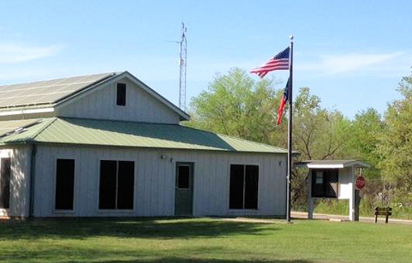
Cooper Lake Ranger Station.
From Greenville, take I30 East toward Sulphur Springs. Take the Hwy 19 exit (Exit 122) and cross over I30 and go north. This is also called Loop 301. You will loop around Sulphur Springs, and will go through several stop signs. When you come to the intersection of Loop 301 and Hwy 19, go to the left (north). At Birthright, turn left on FM 71 and go 4 miles, then turn right on FM 3505. You’ll see signs that say Cooper Lake when you’re back on Hwy 19. After you go past the Rangers’ station, take the first left. This is a long winding road that will take you to Buggy Whip Equestrian Camping Area. The last sign for Buggy Whip Equestrian Camping is on the left side of the road. If you miss it you can keep going straight and easily turn around. The camping area is laid out in a large loop, with camp sites all around the loop. There is day parking along the center of the loop. You can also access the South Sulphur Unit from Commerce but the road is more narrow and twisty.
Equestrian Camping: There are 15 concrete camp sites with water and electricity. Two of the sites are made for double trailers, which is really nice if you’re traveling with someone. The sites are spaced out with trees and bushes between the sites making them feel more private. Each site has a metal post picket system in the shape of an H with 20 ft cable across the top to tether horses. This camp doesn’t appear to be as busy as it was in past years, but reservations for camping are recommended.
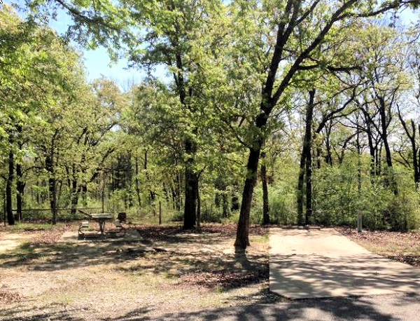
A typical camp site; very shady with nice concrete pads.
Fees: $5.00 for day use. $20 per night plus day use fee for equestrian campsites with water and electricity.
Coggins: You will be asked to present a current Coggins at the Ranger Station prior to entering the park. They will inspect your horse to insure the papers match the horse.
Facilities: The road in camp is asphalt and is in the shape of a long oval. It’s also very flat, which makes it a great place for kid’s to ride bikes. The equestrian camp has a very nice bath house with men’s and women’s facilities with multiple showers, sinks, flushing toilets, and is heated in cold weather. It is always clean and well cared for. There are picnic tables and fire rings at each campsite. The park has many separate camp sites, some with shelters and others for camping or RVs. There are many hiking trails and nature talks are also offered at times. Check with the ranger station for non-horse related activities.
Facility Map Link to the South Sulphur Unit
Dogs: Welcome!
Cell Phone Service: ATT has good service.
Buggy Whip Trail Users: Equines only
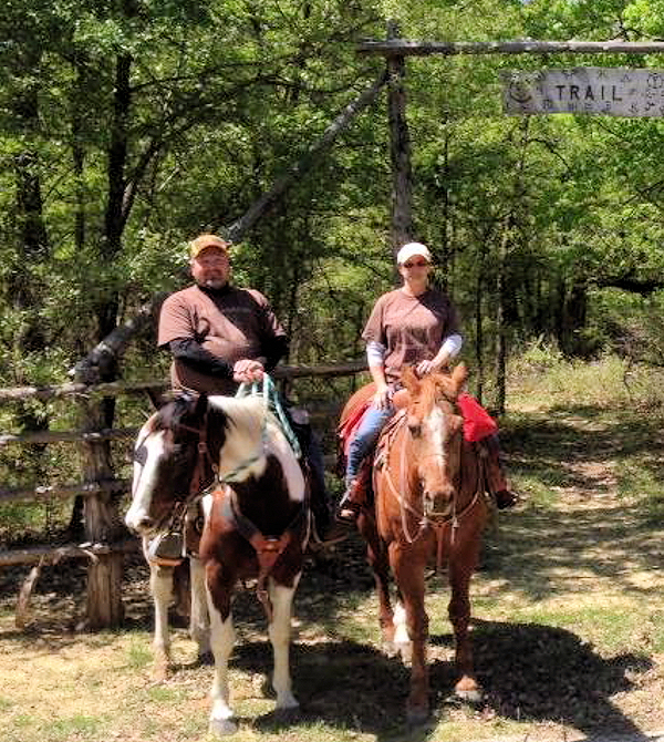
Mileage: The Buggy Whip Equestrian only trail is 10.55 miles.
Trail Map: The current trail map you receive at the front gate doesn’t have trail numbers marked on it. I’ve written them in on the new map using info from a previous map.
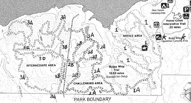
Link to Cooper Lake South Sulphur Unit Park Trail Map
Terrain: Sandy clay with some rocks. Most horses are fine without shoes. The soil erodes very badly so when there is rain the trails are closed. If in doubt, call the ranger station before you haul.
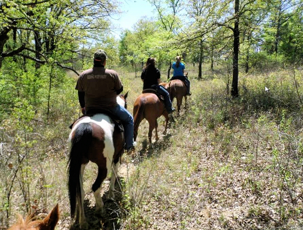
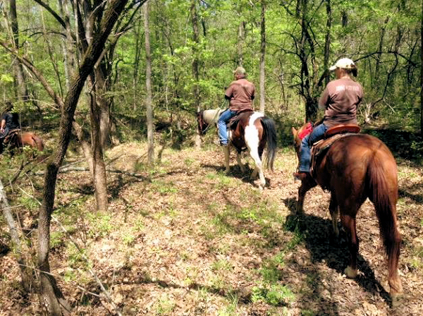
Description: The Buggy Whip Equestrian trail is primarily in hard wood forest with some ups and downs. There is access to the lake on one portion of the trail. Be prepared to see deer and possibly wild hogs. There is no hunting in the park and the deer certainly seem to know that! The park has really worked hard in the recent years to alleviate erosion by rerouting trails and adding supports in the trails.
Buggy Whip Equestrian Trail: There are basically 3 areas of trails. On the new map the area closest to the camp is called “Novice area”. These are easy trails and are comprised of 3 large long loops. From these trails there is a single crossing over into the next area. This crossing is a low bridge in a creek, but it is good footing with mild slopes on either side. Some inexperienced horses/riders may have problems with this crossing. This creek crossing was very dangerous for many years with an open bridge and steep slopes. Hats off to the park for changing this crossing and making it very safe.
The 2nd area is called “Challenging” on the new map. After you cross the bridge the trail will fork and the trail to the right has some steep inclines. If you have small children or inexperienced riders, I’d definitely recommend avoiding this section of trail. On the map the trails that fork are BOTH called 2A so if you want mild riding go to the left. The pond near the north end of Trail 2A is very boggy.
The 3rd area is across a white rock road. The majority of these trails are relatively flat and wind through trees.
Please note, the numbering on the trails can be somewhat confusing. The far trail is called 3A on both the north, west and south loops. If you’re one of those folks who like to know where they are, it’s a good idea to orient yourself with the sun before you take off.
 Ann Sides
Ann Sides, WTTA’s newest contributor, lives near Greenville, TX with husband, J.Paul, who is head of security and composting, 5 horses, and 3 dogs. Ann works at L-3 in Greenville and hopes to retire in a couple of years. But until then she’ll keep riding and camping every weekend she gets the chance. She and J.Paul have one daughter, Lauren, son-in-law Clint, and one adorable grandchild, Ryan Moore, who live close by in Royse City. It doesn’t get any better than this!!!
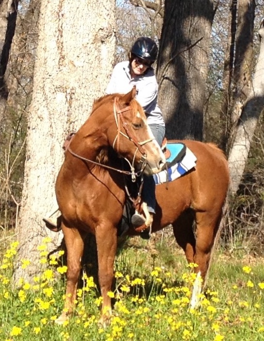
Photo shot by Donna Taker. Ann and Scout, her long time, much loved, trail companion.
Ann has contributed posts on the following locations:
Trace Trails in Athens, TX, Caddo National Grasslands near Telephone, TX, and Cooper Lake State Park in Sulphur Springs, TX.
Leave a Reply
You must be logged in to post a comment.