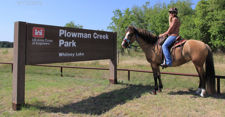
Plowman Creek Park, Hopewell Trail at Lake Whitney
Website:
http://www.recreation.gov/campgroundDetails.do?contractCode=NRSO&parkId=71359
http://www.swf-wc.usace.army.mil/whitney/recreation/parks/corpsparks.asp
GPS Info. (Latitude, Longitude):
32.07, -97.49333
32°4’12″N, 97°29’36″W
 Location: Just south of Kopperl, Texas.
Physical Address: 15188 FM 56, Kopperl, TX 76652 (This is listed as the 911 address, however, when entered into Google Maps, the wrong location is given. It is best to enter Plowman Creek Park at Lake Whitney when searching in Google Maps. See this link under Directions).
Office Address: US Army Corps of Engineers, 285 CR 3602, Clifton, TX 76634
Contact: 254/622-3332 or 254/694-3189
Email: whitneylaketx@usace.army.mil
Directions: Plowman Creek Park Google Maps Link
Plowman Creek Park is just outside of Kopperl off of HWY 56 between TX 174 and Farm Road 927. From Meridan take TX 174 north and go through Morgan. Continue on TX 174. Pass FM 56 on your left and take the second FM 56 on your right, heading east towards Kopperl. (If coming 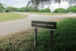 from Cleburne on TX 174 then take the first FM 56 on your left). Go through the small town of Kopperl and pass a large berm/water spill way. Look for the park signs and turn left on Plowman Creek Park Road.
From Whitney take TX 22 heading west and turn right on FM 56. Pass Farm Road 927 and continue. Look for the park sign and turn right on Plowman Park Road. If you go into the town of Kopperl you have gone too far.
Once in the park and through the gatehouse, continue forward. At the fork you will see the lake to your right and a small sign on the right which points left and states “Equestrian Area”, turn left onto the gravel road which takes you behind the bathroom/shower house and into the equestrian trailhead.
Camping: Overnight equestrian camping is allowed.
 Hours of operation: The front gate for the park is opened at 6am and closes at 10pm.
Cost: $16.00 for overnight camping with electric and water hookups, $12 camping with no hookups, and $1 to ride just for the day. (Please call because rates may be subject to change).
Reservations for Camping: At this time the equestrian hookups cannot be reserved on line or by phone. The hookups and pens are on a first come first serve basis. However, once the trailhead renovations are completed this may change. Horses are not allowed outside of the Equestrian Area or trail. Campsites outside of the Equestrian area can be reserved at: http://www.recreation.gov/campgroundDetails.do?contractCode=NRSO&parkId=71359.
Dogs: Dogs are are allowed but must be kept on a leash no longer than six feet.
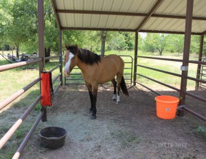
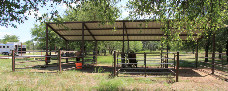
The Plowman Creek Park Equestrian area has great facilities which the Texas Equestrian Trail Rider Association (TETRA) is currently in the process of completing. There are ten 30 amp electric and water hookups. The parking is gravel but when backing up to the hookups you can get the back of your trailer on a small patch of grass which is nice because if you tie your horse to the trailer to saddle up he/she does not have to stand on the gravel. There is not much shade for trailer parking at the hookup sites, however, just a few feet away are several trees. TETRA just built five concrete pads located directly behind the electric/water hookups. It appears the plan is to attach awnings to these pads (as of 7/4/12 the support beams were in place) and put picnic tables under them. Currently two picnic tables are located under some shade trees. Newly built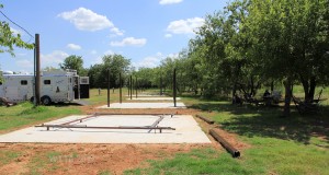 pipe pens are also available for the horses. All of the pens are adjacent to each other and share pipe dividers. There are a total of four large pens, however, the large pens can be divided into smaller pens, making a total of eight small pens, except for the one on the end due to the center divider being removed. A shed is located over the pens and covers half of them, so if the pens are divided then four of the smaller pens will not have cover. The campsite also has two fire rings. Just a short walk from the equestrian camping area is a mens and womens restroom and shower facility as well. There is also a dumpster at the back of the parking area away from the pens and hookups.
Hunting: Hunting is permitted on areas adjacent to the Hopewell Trail; it is advised you wear bright colors when riding.
AT&T Cell Phone Service: I did have cell phone connection for my AT&T iPhone but it was spotty in some areas and not always reliable.
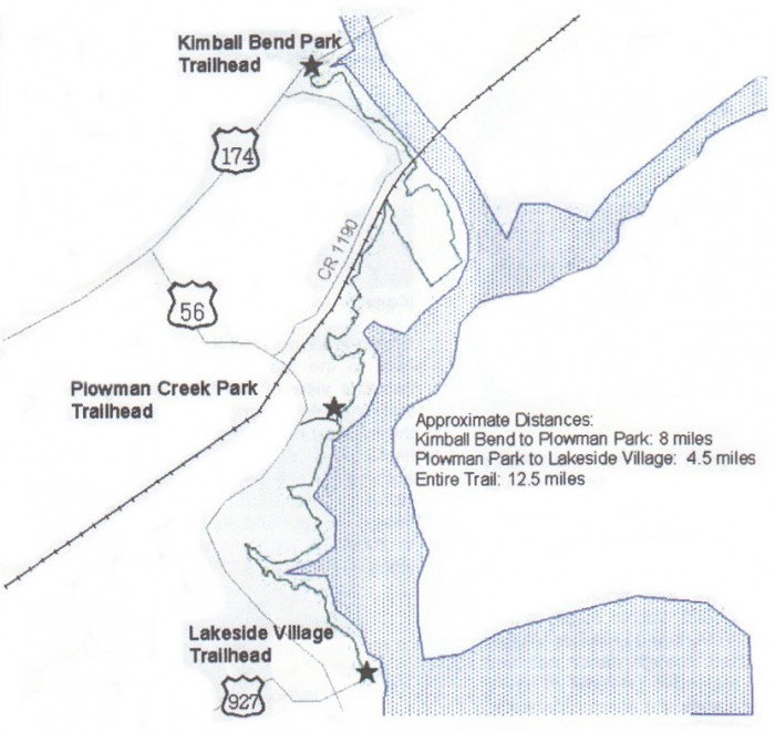
Mileage: Hopewell Trail is approximately twelve and a half miles long.
Map: I have not found a detailed map, but listed below is what the park provides.
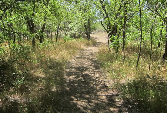
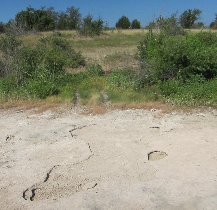
Terrain: The ground ranges from sandy, but not deep sand, to gravely surfaces. Due to the gravely areas I would recommend shoes or boots for your horse. The land is mostly flat and rolling in some areas. There are several dry creek crossings which most likely have water when there is lots of rain. Most of the trails are in open pastures and fields but there are also several forest trails as well. Overall the terrain is not difficult to manage as it is mostly flat. However, I did not get to cover all of the trails available.
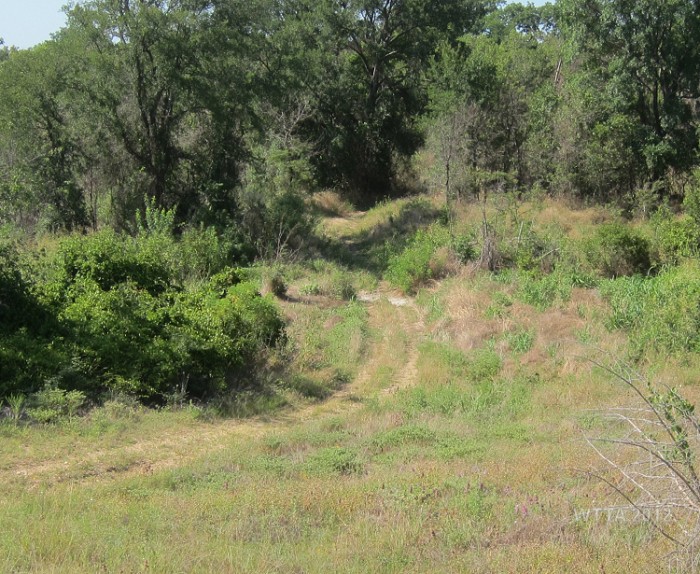
Trail Markers: The trails are not marked. The one way 4.5 mile trail from Plowman Creek equestrian trailhead south to Lakeside Village trailhead was especially difficult to follow as it would disappear in tall fields of grass and was difficult to pick up again. The trails were so overgrown here that it was hard to tell the difference from the deer trails and the main trail in spots. On a few occasions a pink ribbon marked the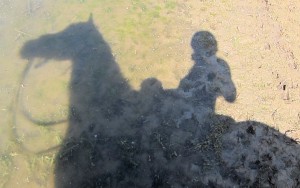 trail. This information was shared with the park ranger who said they may mow down the trails and at some point hopefully work on putting up trail markers. The northern half of the trail leaving from Plowman Creek equestrian trailhead to the Kimball Bend trailhead is more defined but also not marked.
Equestrian Lake Access: There is no lake access from the equestrian trailhead at Plowman Creek Park. The equestrian area is away from the shoreline and horses are not allowed outside of this area or outside of the Hopewell Trail. There are a few places along the trail where riders have access to the lake, but you must be careful and make sure that the ground will support your horse because you definitely don’t want to get bogged down. This is not a park I would feel comfortable swimming my horse. Just be sure to use caution when deciding if you are going to take your horse on the lake shoreline.
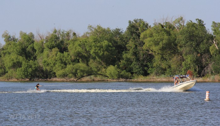
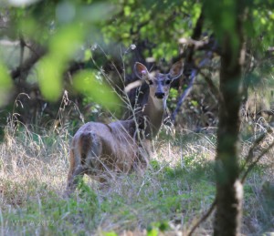
Plowman Creek Park is managed by the US Army Corps of Engineers and is located off the western shoreline of Lake Whitney. The equestrian trailhead in this park is located away from the shoreline of the lake and offers access to the Hopewell Trail. This multi-use trail was opened for equestrians, hikers, and bicyclists in 2002. Currently the Texas Equestrian Trail Riding Association is in the process of improving this trailhead, which appears to be close to completion. This is a very nice trailhead /equestrian area for camping which we had all to ourselves. This area is popular with the deer and we often caught them checking us out. My horse Angel would alert to them every time, showing us which way to point the camera or binoculars so we could check them out too.
The Hopewell Trail runs from Lakeside Village Park trailhead north on along the western shore of Lake Whitney to where the lake begins to merge back into the Brazos River at Kimball Bend trailhead. The Plowman Creek Park equestrian trailhead is located in between the Lakeside Village and Kimball Bend trailheads.
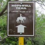
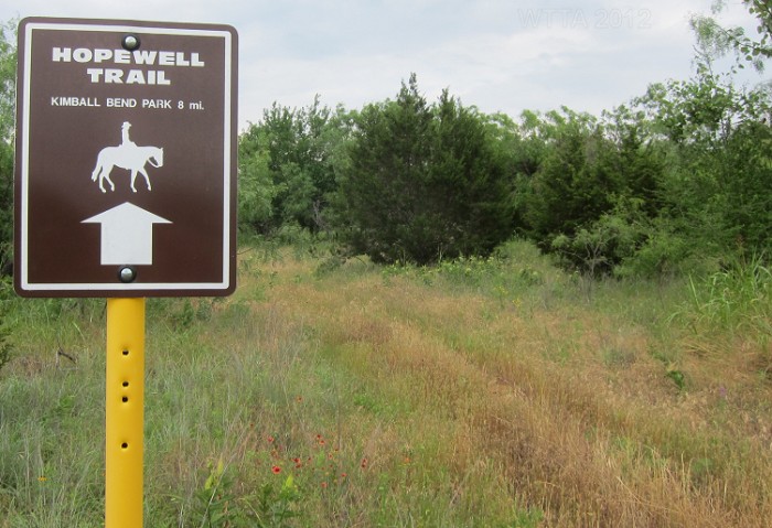
From the equestrian trailhead at Plowman you need to decide if you want to take the one-way 4.5 mile trail south to Lakeside Village trailhead and then return back to Plowman making your total mileage nine miles, or take the one-way eight mile trail to the Kimball Bend trailhead and return, making your total mileage 16 miles. There are two signs at each end (north and south) of the Plowman trailhead marking these routes of the Hopewell Trail. You really have to look for these signs as the grass is tall and they can be difficult to see from the center of the equestrian area. 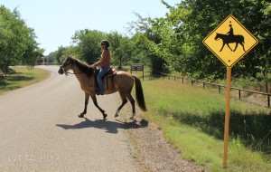 Having visited this park twice but only riding here during one of my two visits, it was interesting to see how much things change over time with the vegetation growth. If you happen to get to the park just after they mow then you are in luck but after a long period of not mowing then it is harder to locate the trail and/or signs. There is lots of wildlife, especially deer along these trails.
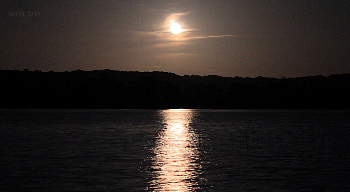
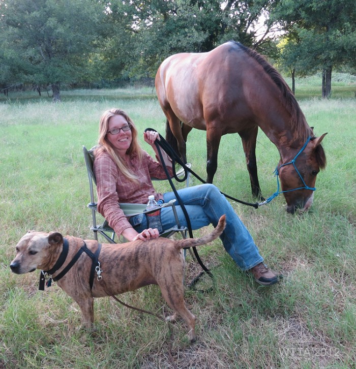
Chris and I arrived at Plowman on the late afternoon of the 4th of July, 2012. We had the whole equestrian area to ourselves. We could hear fireworks in the distance and walked our dog LB down to the lake. A few people were popping off small fireworks in the lake. However, they did not compare to the beauty of a full golden moon rising up and reflecting into the lake’s waters. We camped out at the equestrian area for two nights. Our AC broke down the first night, yikes. We will be getting that repaired soon I hope.
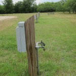
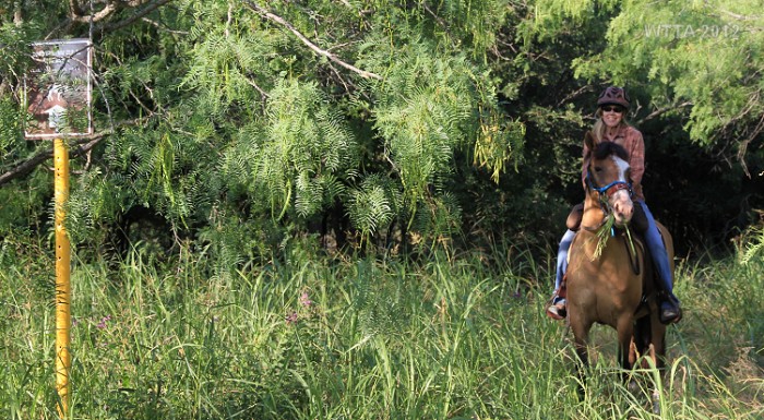
On the morning of 7/5/12 I was able to ride the Hopewell trail heading south towards Lakeside Village trailhead. I followed the electric and water hookups south to the tree line where I was able to see the sign marking this 4.5 one way trail. I figured it would be easy to follow the trail since it is one-way (no loops, etc.). This trail starts out going through some woods and then to a road crossing at Plowman Creek Park Road. The park boundary is marked by about a three foot tall brown pipe fence. At the road crossings the pipe fence is dropped down to about 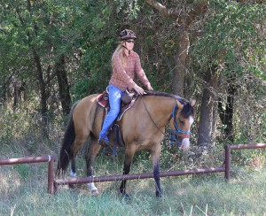 a foot in height so your horse just steps over the lower fence, crosses the road, and then steps over the lowered pipe fence on the other side of the road to get back on the trail. The trail took me to the park RV dump station which was bit confusing as I did not know where to pick it back up again. I eventually found where the trail picked back up at the back southern side of the dump station. The trail went down a slope and back up along a fence line and led to an open brown gate. From here the trail was shaded for a while and well defined. I could see the lake on my left on and off along this trail. In some areas the trail would follow a fence line. However, the grass was so tall in spots and the trail so undefined I was not sure if I was on the main trail or a deer trail. I thought as long as I kept the lake to my left I’d be fine and I’d make it to the Lakeside Village trailhead. There are some areas where the main trail was obvious, especially when I came to a brown opened gate or on a few occasions when I saw a pink ribbon. However, due to being unsure of the trail at several spots I decided to head back to avoid forgetting how to return, something that is not uncommon for me. This was a fairly nice area to ride and I did find two safe looking places where the ground wasn’t too boggy to water my horse from the lake. Next time hopefully the trails will be mowed down a little and marked, or maybe I’ll use GPS tracking.
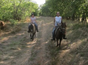
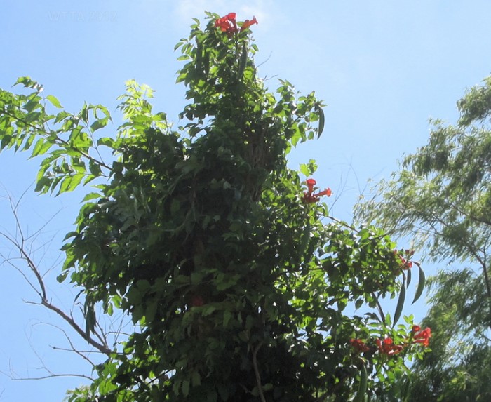
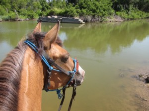 The late afternoon of 7/5/12 my brother and his girlfriend joined me and we rode the Hopewell Trail heading north towards Kimball Bend trailhead. From the center of the Plowman equestrian trailhead you go north away from the pens and maps posting sign towards the tree line. The grass was so tall here that you could not see the trail sign from the horse pen area. This part of Hopewell Trail is much more defined but not marked. The beginning of the trail is sandy and winds through the trees. You will pass another bathroom/shower house on your right where the trail takes a sharp left. Then you come to an open gate and can go right or left. If you go left you remain on the main trail. Going to the right takes you to the lake shoreline and a spot to water your horse. In this spot it looks like there is a small island in the lake that has an old concrete landing with steps leading down into the water. This way eventually dead ends back into the park’s boundaries (the three foot pipe fence). I also saw some beautiful blooming trumpet vines in this area.
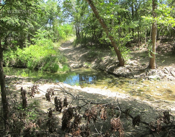
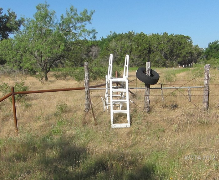
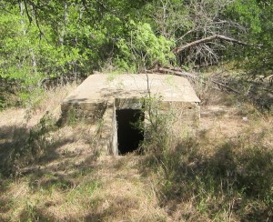 Back on the main trail and heading left from the gate you will eventually see a brown gate ahead which is closed and locked. The trail curves to the right just before you get to this gate. On this trail you will pass two storm shelters or root cellar type of buildings. Park staff said most likely these are root cellars from old farm houses that use to be on the land. They plan on having them filled in at some point. Just a ways after the second root cellar the trail splits again. If you turn right you remain on the main trail and come to a creek crossing. This is also a nice place to water your horses. If you go left at this fork then you head to an opening through a barb wire fence which leads to a steep hill that looks like the backside of a dam, but it is actually a tall berm with a road along the top of it. Once you’re up on this berm you can see part of the little town of Kopperl. From the opening in the fence a two-track dirt road follows along the bottom of the berm. I did not take this too far, as I believe it was off of the park’s property. Be careful going this way as the opening in the fence line is a barb wire gate and the wire sits on the ground close to the posts. You would not want to have your horse step in that.
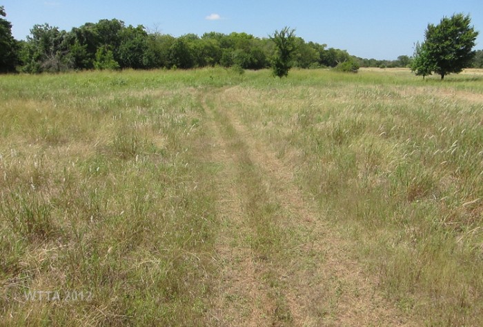
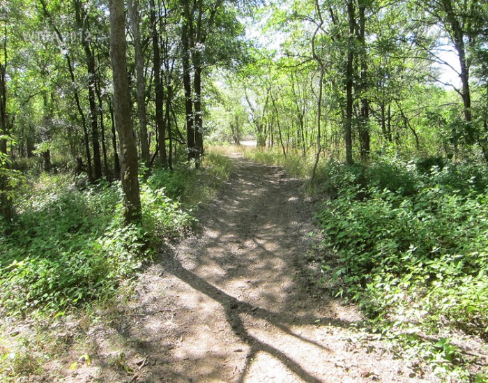
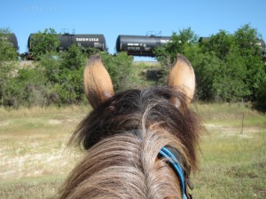 Back to the main trail and turning right at the fork takes you to the creek. Just a ways after the creek the trail forks again but the main trail continues to the right. If you go to the left then you eventually dead end at the railroad tracks, so stay to the right. After a ways I crossed another creek, this one was dry and I noticed the main trail goes to the right again, but a small trail forks off to the left. Going to the left just takes you to the railroad tracks again. Staying right keeps you on the main trail which is mostly a two-track trail that winds through open grass fields and through some wooded areas. This trail is very nice in spots where there are no rocks and invites a nice gallop or long trot. Another confusing spot is when you come to a brown gate that is open. After going through the gate the trail splits. A smaller forest trail is to the left and the main trail is to the right and goes by another smaller brown gate. Take the trail to the right that goes by the second gate, it eventually curves to the left as well. The other trail to the left before the second gate dead ends into the park boundary pipe fence.
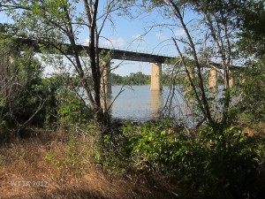 For the most part this portion of the trail continues to be a two-track on fairly nice ground most of the time, and it is flat. The trail here meanders around and follows a fence line for a bit and goes in and out of the woods. I think at some point the trail was supposed to curve right and take a big loop towards the lake, but we seemed to miss this section and somehow skipped the loop (I think). We came to another split in the trail underneath a railroad track bridge by the lake. At this spot there is a brown gate, which was a good sign that the main trail went to the right under the bridge, and it looks this way on the map too. However, we wanted to check out the gravely trail to the left which went up hill a bit. Of course this trail eventually dead ended into a fence. We decided to go ahead and return back as it was hot and the horses had not had a water break in a while. The ground by the lake under the railroad bridge did not look safe to water a horse because the shore appeared boggy. So we missed out on getting to see this section of the trail running north from under the railroad track bridge and on to the Kimball Bend trailhead. Next time I’ll make it a point to ride this part of the trail, as I think this might have been a pretty neat section that goes by the Indian Lodge Resort. On this ride I had my GPS MotionX app for my iPhone turned on. Upon completing our ride, MotionX documented that our round trip was ten and a half miles.
My horse Angel and I enjoyed one more short ride the next morning on the same trail. I did not want to ride as far since we would be doing a five hour trailer ride home in the heat, so we went about six miles and explored some of the trails that ended up being dead ends. I was not able to find the loop. Lots of deer are out in the morning here and while working in a nice extended trot on one of the smooth two-track trails, a little fawn ran up right next to us. She was almost under my right stirrup. The fawn followed us for a few seconds, went on ahead, and then disappeared into the trees on the left. A few moments later her mother jumped out in front of us, also crossing over to the left. What a sight they were! The deer here are not little but very large and healthy looking. There is a lot of solitude on these trails as we never saw anyone else using them.
My folks who live near by were able to join me and my husband Chris for the day at Plowman and enjoy a meal together, and since my brother and his girlfriend were there too it was really a nice time. Despite the heat we had a very shady spot and 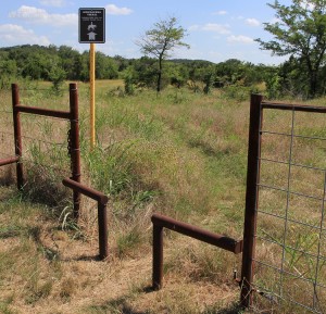 it was not bad. My folks got a bit turned around on their way over and accidentally ended up at Lakeside Village Park. They said the park was closed. So I have no idea what the Lakeside Village trailhead is like, however, I did call the Corps of Engineers and they told me the park is closed but the trailhead itself is open. There is nothing at the trailhead other than a flat area where you can park a vehicle. There are no bathrooms or running water at this trailhead.
We decided to drive to Kimball Bend Park to see what that trailhead is like, since we did not get to ride to it. It is off of TX 174. The equestrian area, or the area where Hopewell Trail ends, is fairly sparse. There is a bathroom, which looks like it is locked but it is actually open. There is also a sign with the maps posted on it. There is no running water at this trailhead. On the gate is a warning stating “Caution: ground near shoreline may not support your horse, stay on established trails.” I have not seen this warning anywhere else in the park, but it is a good one. I have heard of horses sinking in the mud or sand close to the shores of different lakes. So be very cautious, especially when lake levels are low. There is no staff at this trailhead and I don’t think there is a fee to ride from this point. There is enough space to park a few horse trailers at this spot. Across TX 174 from this trailhead is Kimball Bend Park. You definitely would not want to cross this road via horseback as I think the highway speed limit is 60 mph or higher. Besides, horses are not allowed in Kimball Bend Park anyway. There is a gatehouse at this park as well.
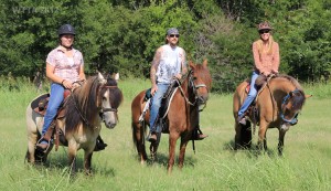 Overall I liked Plowman Creek Park. The equestrian camping area is nice and has a lot of potential. I was able to enjoy some solitude here, as we did not see anyone else on the trail or in the equestrian area. However, it would be great if the trails were marked and were more defined. That is just me, I know some people like to use their GPS or just find their own way. I did see a few hazards; small shards of glass on one section of the trail and barb wire on the ground off the trail and next to posts. Personally I would not ride anywhere the ground can’t be seen due to tall grass and weeds. Also be cautious about riding on the lake shoreline, as the ground could bog your horse down in some areas. Lastly, remember hunting is allowed in areas adjacent to the trail so be sure to wear bright colors to be safe.
Additional Pictures, Enjoy:
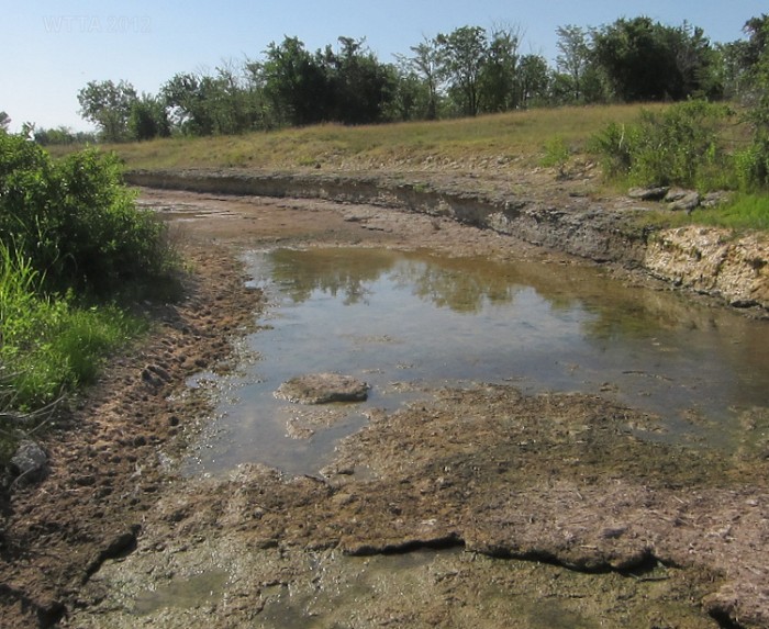
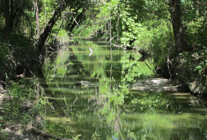
This is the same creek crossing in a section that is not completely dry from a different point of view.
Leave a Reply
You must be logged in to post a comment.