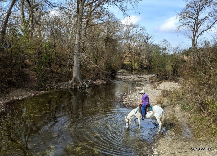
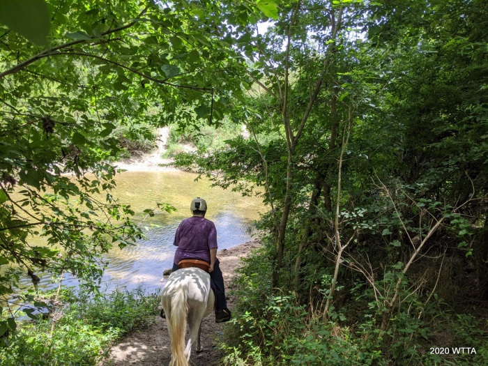
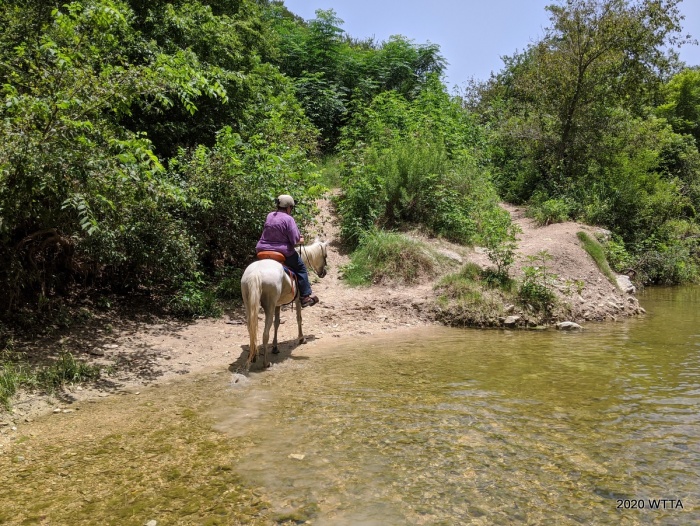
Deb Demers, contributor of this Onion Creek update is riding Maya at creek crossing #2. Maya is enjoying a nice drink of water from the creek.
Updated Review Provided by contributor Deb Demers. Thank you Deb!
Location: Location: Onion Creek Metropolitan Park, 7409 Wild Onion Dr., Austin, TX
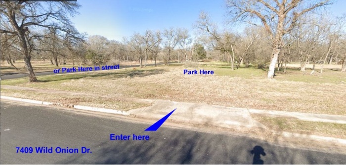
Directions: Do not follow GPS directions to Onion Creek Metropolitan Park. Doing that will either take you to Trailhead #1 (Dog Park) or to the other side of the park which has no equestrian entrances. To get the Equestrian access to the park, exit IH-35 onto William Cannon Dr. and head east passing the HEB on your right. Turn right on Pleasant Valley (you will see a Citco gas station on the corner). Do not turn at the first left onto Onion Creek Drive (GPS will tell you to go there). That is Onion Creek North Metropolitan Park and has the Dog Park and Dog Park Path. Continue down Pleasant Valley almost to the end. You will see a dead end ahead of you. Turn left at the last street junction onto Onion Creek Drive. Proceed two blocks to Wild Onion Dr. The grassy area on the left between Wild Onion Dr. And Ladybug St. is where horse trailers park. Pull into the grass area using the driveway cutouts. This parking area is the “unofficial” equestrian parking area. You can also park curbside on Wild Onion and Ladybug to unload horses there.
Trail Head #2:
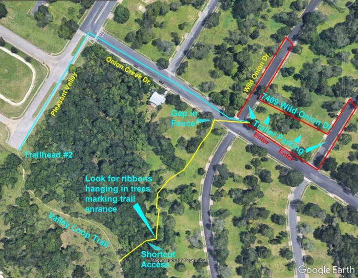
Trail Head #2 From the Equestrian Parking area: 7409 Wild Onion Dr. (See Parking and Trail Access Photo):
There are two ways to access the horse trails:
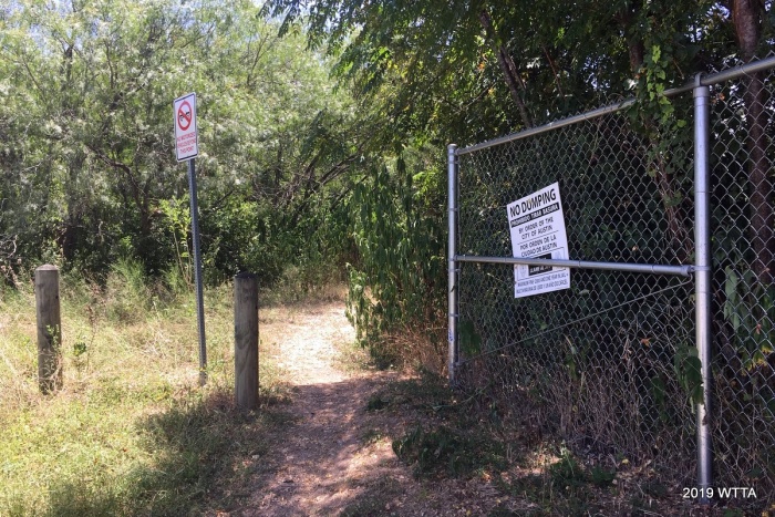
- (Best choice) Across the street from the parking is a cable/post fence. At the end of the fence (near the blue house) is a gap in the fence. Enter from there. Follow the edge of the woods back 140 yards to a clump of large trees, look for some ribbons hanging from branches to mark the trail entrance, and you will see a path to the right. Turn on the path and take the shortcut to Valley Loop Trail (Trailhead #2). Turn left and follow that trail down to where it connects to the Dog Park Path. Turn right, go a short distance and you will reach Creek Crossing #2. Across the creek you will see the trail that leads to the riding area and trails.
- (Requires riding in the road) From the parking area, turn right and go back to Pleasant Valley, then turn left towards the dead end. At the corner of the end of the street you can see the Trailhead #2. This is Valley Loop Trail. When following the trail, you will find it very shortly splits at one point…stay to the left of the split. Continue down the trail following the instructions shown in #1 above.
Mileage: approximately 12 or more miles, 550 acres of riding area.
Facilities: None (however, the dog park does have porta potties and picnic tables).
Overnight Camping: None
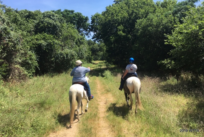
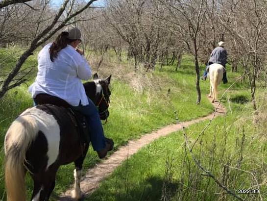
Terrain: Mostly flat, wooded, with the majority of trails being tree covered and shaded, trails are packed dirt with no rocks other than an occasional patches of small gravel.
Cost: None
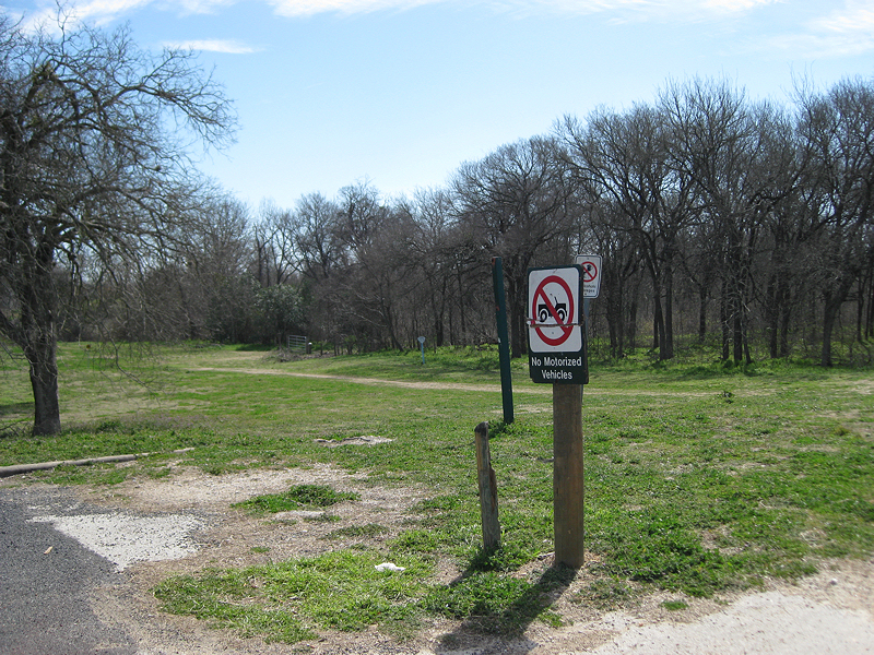
Trail Users: Hikers, bicyclist, horseback riders. No motorized vehicles allowed.
Dogs: Allowed on Leash Only. Dogs can be off leash only in the dog park area north of the creek, not on the trails south of the creek.
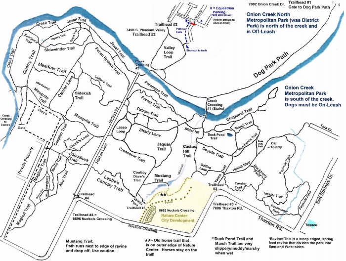
Trail Map: The trail map is constantly being updated and can be found in the files section of that Friend of Onion Creek Facebook group.
Description:
The park is essentially divided into four sections. The north section is Onion Creek North Metropolitan Park and is maintained by the city with pavilions, picnic tables, restrooms, playground, sidewalks, and a Dog Park. This park is Off-Leash. Although you can ride horses in this area, it’s not recommended because of the number of loose dogs. Onion Creek divides the north park from the south park.
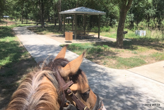
Onion Creek North Metropolitan Park (North of the creek) is the dog park area. Angel is checking out the new to us covered picnic tables, BBQ grills, and side walks. There are also porta potties in this area of the park. However, dogs can go off leash here and it is not recommended you ride in these areas. Also this is new to us, the amenities have been here for several years now.
The south park is called Onion Creek Metropolitan Park and is home to all the trails for hiking, biking, and horse back riding. This park is On-Leash Only. Please be warned that a lot of dog owners let their dogs run loose in the park, however the vast majority of the dog owners are very courteous to bikers and riders. They will hold their dogs and get off the trail.
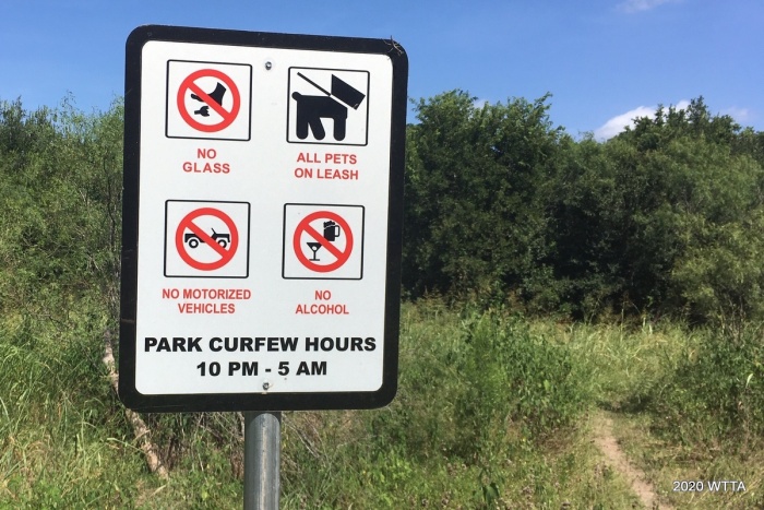
Please abide by trail user rules. Please note standard trail etiquette, everyone always yields to the horses. Please stop and move off the trail to allow the horse(s) to pass. This is standard procedure, but not all persons are always aware of this. Thank You!
The park is further divided by a spring fed ravine. It divides the southern park into East and West sides. The east side is smaller and about half of its trails are open to the sun. The majority of the trails are on the West side. Traveling to and from the East/West sides of the park is only accessible from 4 specific spots: Creek Crossing #1, Slider Hill, Mustang Trail, and Center Pass Trail.
The majority of trails are wooded with thick vegetation. This provides fantastic shade during Texas summer heat. During springtime, the trails are surrounded by a vast array of wildflowers. There are two creek crossings: Creek Crossing #1 & #2. Creek Crossing #1 is mainly used by hikers coming from the Dog park. It is a steep descent with wood stairs.
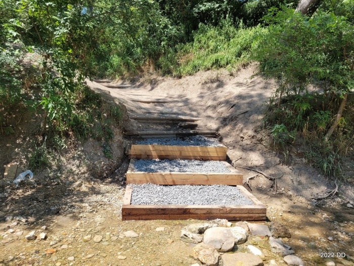
Creek Crossing #1, mainly used by hikers coming from the Dog park, has a steep descent with wood stairs. These steps were created by a City Youth Team and are made with untreated lumber so that as the wood deteriorates over time, it will not release toxins into the water. They will be replaced as needed.
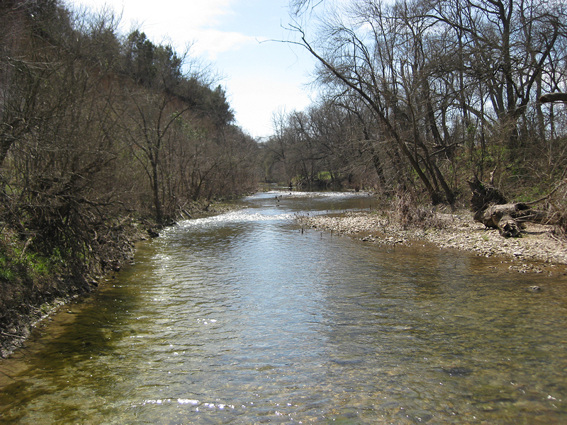
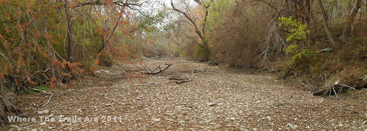
Although it is occasionally used by horses, most horse crossings are done at Creek Crossing #2. Crossing #1 has the steepest descents/ascents. Not overly hard but if there has been rain lately, they will be too muddy to attempt. The crossing’s access must be dry or mostly dry to use them. Crossing #2 is less steep – any easy incline, but it, too, is too slippery to use if it has rained. The water at the crossings is four season so there is always water available for horses to drink.
The creek bed is small gravel providing good footing. The creek is only 3-5 inches deep at the crossings but does deepen to about thigh deep on either sides. Both creek crossings are favorite places for dogs to play and swim. It’s quite common to find families out their with their kids swimming so be aware that floaties maybe used too and may cause some horses to spook.
Outside of the creek crossings, most of the land is flat with some mild inclines. The trails are flat, packed dirt with occasional small gravel patches in a few spots. Trails are marked with wood signs giving the names of each trail at the trail junctions. Look up – the signs are in the trees. Since this is a city park, please stay on the trails – do not wander off the trails.
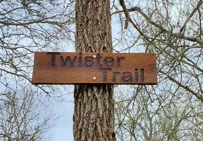
Signs are mounted at trail junctions helping park users navigate through Onion Creek Metropolitan Park.
There are historic relics, homestead ruins, and protected areas within the park. Do not remove objects, materials, or plants from the park. Do not dump or leave trash. The trails were created by and are maintained by local volunteers from the nearby stables and also by fellow hikers. We do regular trail maintenance such as mowing trails, trimming overgrowth, picking up trash, and clearing out fallen trees/branches. Help with these volunteer projects are greatly appreciated!
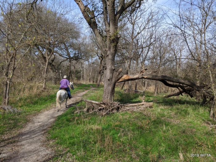
There are miles and miles of trails and you can get in hours of riding without repeating trails. Since the trails all interconnect and loop around, you can easily get from one area to another. Because of the amount of trails and the dense trees, you can ride there for hours and only occasionally run into another person. Sometimes, you will feel like you have the whole park all by yourself! Quite often you will see wildlife: deer, birds, squirrels plus an occasional armadillo or possum. Saw a fox one time!
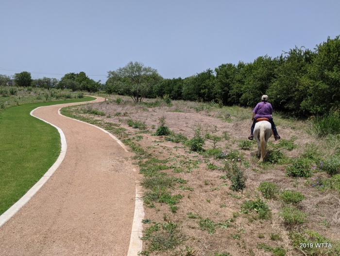
Old Horse Trail, following along the Nature Center pathway, between Gaiting Lane and Center Pass. Please stay on the trail and off the Nature Center walking path.
This park borders a few boarding facilities, private properties, and some residential neighborhoods so please be aware of the park boundaries and do not go onto private property. Motor vehicles are not allowed in the park. If you see motorcycles in the park, call 311 and also call to report dumping. The Facebook group: “Friends of Onion Creek” work to help maintain the park for fellow users.
The trail map is constantly being updated and can be found in the files section of that Facebook group. In addition, the Trailforks app has been updated to include a map of all the trails. Be aware that most phone mapping apps do NOT show the trails or only show a few of them. Google Maps and All Trails only show a few, outdated trails. Until you become familiar with the trails, it’s best to take a copy of the trail map with you or to use Trailforks program.
The Trailforks App is constantly updated with the latest new or changed trails. For many examples of what the trails look like, go to “debdemer” on YouTube and you will find lots of trail ride videos there. This park is a fantastic place to ride!
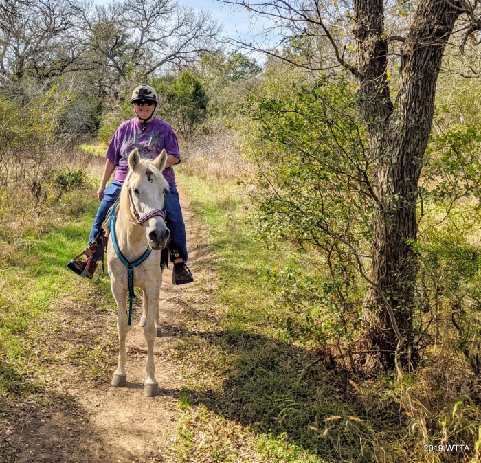
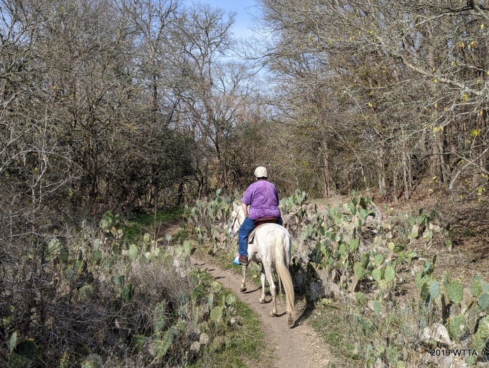
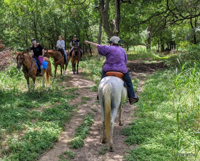
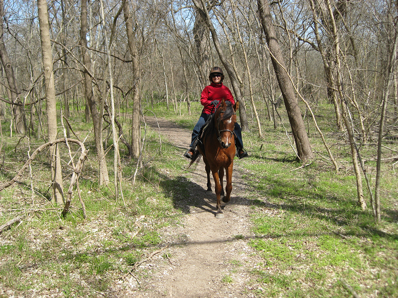
Onion Creek trail update contributor, Deb Demers, enjoying Onion Creek aboard her horse Maya. Deb is very knowledgeable of the parks history and trails. Deb has contributed many many hours volunteering at this park clearing trails, making new trails, updating the map, and putting up trail signs. Thank you Deb! Deb often takes video documentation of her trail rides which can be viewed here: “debdemer” on YouTube
Leave a Reply
You must be logged in to post a comment.